Old Maps of Macopin, West Milford for Genealogy
Trace your family roots with 18 historic maps of Macopin. These high-res maps reveal old neighborhoods, homesites, landmarks, and streets — helping you uncover where your ancestors lived and how the area evolved over time.
- Explore historic neighborhoods: Identify where your relatives may have lived in the 1800s or 1900s.
- Compare maps over time: Trace the changes in streets, buildings, and landmarks for multi-generational research.
- Perfect for genealogy & ancestry research: Used by family historians and researchers to map out lineage and migration.
These maps are an incredible resource for exploring your personal connection to Macopin's past.
Macopin, West Milford maps
(18)- 1891 Map of Greenwood Lake
 1891 Greenwood Lake1891 Print · USGSThe Highlands of New York and New Jersey are captured here in the late nineteenth century during a peak era of iron mining and rail expansion. Researchers can trace the industrial footprint of the Sterling Furnace, locate family-named mines like Carey Mine, and follow the historic routes of the New York Susquehanna and Western Railroad.
 - 1893 Map of Greenwood Lake
 1893 Greenwood Lake1893 Print · USGSThe iron-rich highlands of the New York-New Jersey border come to life in this late-century survey of the lakes and ridges between Passaic and Orange counties. Genealogists and industrial historians can trace the paths of the Sterling Mountain Railroad and find long-established sites like Sterling Furnace or the Layton Mines.6 unique versions available
 - 1903 Map of Greenwood Lake, 1909 Print
 1903 Greenwood Lake1909 Print · USGSThe Highlands of New York and New Jersey are captured here at the height of their industrial era, showing a landscape of iron mines and mountain railroads. Genealogists and historians can locate heritage sites like Sterling Furnace, Dayton Mines, and the rural community of New Newfoundland.
 - 1910 Map of Greenwood Lake
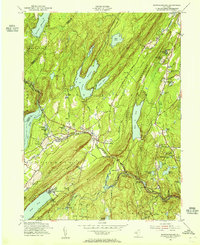
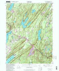
 1910 Greenwood Lake1910 Print · USGSThe Highlands of northern New Jersey and southern New York are shown here during a peak era of iron mining and rail expansion. Genealogists and industrial historians can trace the foundations of Sterling Furnace, Charlotteburg Mine, and the New Milford Sta. along the Erie Railroad.9 unique versions available
 - 1943 Map of Newfoundland
 1943 Newfoundland1943 Print · USGSThe Pequannock River valley and its surrounding ridges are captured here during the Second World War. Researchers can trace the New York Susquehanna and Western rail line through Newfoundland or locate landmarks like the Fire House and West Milford School.
 - 1950 Map of Scranton, 1952 Print
 1950 Scranton1952 Print · USGSMid-century Northeast Pennsylvania and the Hudson Valley come alive in this survey of the tri-state region. Genealogists and historians can trace the dense rail networks of the Erie RR and DL&W RR between industrial hubs like Scranton and Wilkes-Barre.
 - 1953 Map of Scranton
 1953 Scranton1953 Print · USGSNortheastern Pennsylvania and the Catskills are shown in great detail during the early fifties, a time when rail lines and river valleys dictated the region's growth. Genealogists and historians can trace the industrial hearts of Scranton and Wilkes-Barre or locate remote landmarks like High Point and Lake Wallenpaupack.
 - 1954 Map of Newfoundland, 1955 Print
 1954 Newfoundland1955 Print · USGSThe Highlands of northern New Jersey appear here in the mid-fifties, dominated by the massive reservoirs and ridge-lines of the Pequannock watershed. Genealogists and local historians can trace the New York Susquehanna and Western RR through Newfoundland and locate landmarks like Vreeland Cem and Postville.6 unique versions available
 - 1959 Map of Scranton
 1959 Scranton1959 Print · USGSThe northern coalfields and the Hudson Valley meet in this mid-century survey of the Pennsylvania and New York borderlands. Genealogists and historians can trace the intricate rail networks of the Erie Railroad and the vast waters of Lake Wallenpaupack.2 unique versions available
 - 1962 Map of Scranton, 1977 Print
 1962 Scranton1977 Print · USGSThe industrial heart of eastern Pennsylvania and the New York Catskills are captured here in the early sixties. Genealogists and historians can trace the dense valley settlements from Scranton to Wilkes-Barre and the rail lines of the Erie Lackawanna Railroad.2 unique versions available
 - 1965 Map of Scranton
 1965 Scranton1965 Print · USGSThe tri-state highlands of Pennsylvania, New York, and New Jersey come alive in the mid-sixties as industry and recreation converge. Trace the intricate rail lines of the Erie Lackawanna RR or locate landmarks like the U S Military Academy.2 unique versions available
 - 1986 Map of Middletown
 1986 Middletown1986 Print · USGSThe Tri-State region comes alive in the mid-1980s, documenting the corridor from the Hudson River to the Delaware Water Gap. Researchers can trace the sprawling grounds of West Point, the extensive Conrail rail network, and early suburban growth around Middletown and Suffern.2 unique versions available
 - 1997 Map of Newfoundland, 1998 Print
 1997 Newfoundland1998 Print · USGSNorthern New Jersey's Highlands were a critical water and transit corridor in the late twentieth century. You can trace the NEW YORK SUSQUEHANNA AND WESTERN railroad past Newfoundland and locate the Vreeland Cem and Turner Cem.
 - 2011 Map of Newfoundland, 2011 Print
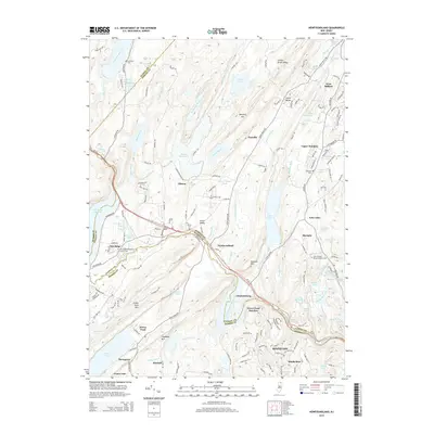
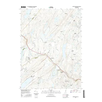
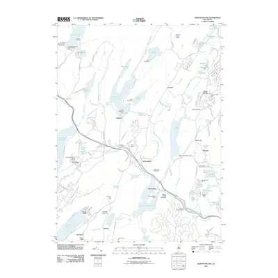 2011 Newfoundland2011 Print · USGSCovers Macopin, including West Milford, Vernon Township, and other nearby areas
 - 2014 Map of Newfoundland, 2014 Print
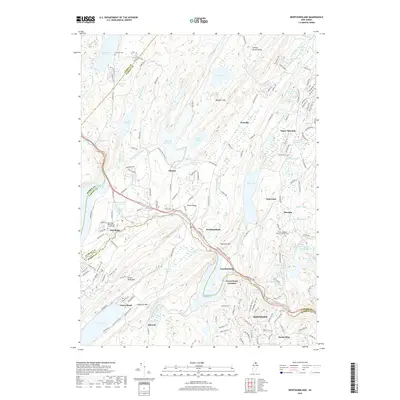
 2014 Newfoundland2014 Print · USGSCovers Macopin, including West Milford, Vernon Township, and other nearby areas
 - 2016 Map of Newfoundland, 2016 Print
 2016 Newfoundland2016 Print · USGSCovers Macopin, including West Milford, Vernon Township, and other nearby areas
 - 2019 Map of Newfoundland, 2019 Print
 2019 Newfoundland2019 Print · USGSCovers Macopin, including West Milford, Vernon Township, and other nearby areas
 - 2023 Map of Newfoundland, 2023 Print
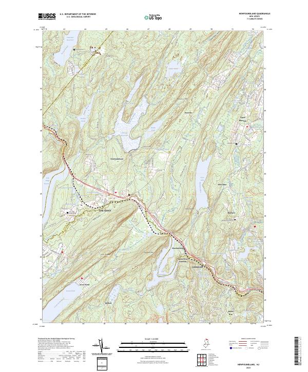 2023 Newfoundland2023 Print · USGSThe Highlands of Passaic and Morris Counties are shown here in the 2020s, a landscape shaped by massive reservoirs and deep-rooted mountain settlements. Researchers can trace the heritage of local families at Vreeland Cem or the Oak Ridge Presbyterian Church, and locate the site of Green Pond Junction.
End of results
Showing maps 1-18 of 18
Frequently asked questions
- What are the different types of historical maps available for Macopin?
- What is the oldest map of Macopin?
- Where can I purchase historical maps of Macopin for my home or office?
- Where can I download high-res historical maps of Macopin?
- Are there historical topographic maps available for Macopin?
- Is there historical aerial imagery available for Macopin?
- Where are historical maps of Macopin sourced from?