Old Maps of Sparta Township, New Jersey for Academic Research
Study the evolution of Sparta Township with 54 high-resolution historic maps. Whether you're teaching, researching, or modeling changes in land use, these maps provide essential visual documentation of urban, environmental, and geographic change.
- Analyze long-term change: Track patterns in development, transportation, and natural features.
- Ideal for environmental or urban studies: Support academic projects with primary historical map data.
- Use in the classroom or lab: Educators and researchers rely on these maps to bring historical context to life.
These maps are a powerful tool for teaching, research, and visualizing how Sparta Township has changed over the decades.
Sparta Township, NJ maps
(54)- 1888 Map of Franklin
 1888 Franklin1888 Print · USGSSussex County was a thriving hub of iron mining and rail commerce in the late nineteenth century. Genealogists and historians can trace the early industrial layout of Franklin Furnace, the remote Ogden Mine, and rural junctions like Branchville Junction.
 - 1888 Map of Lake Hopatcong
 1888 Lake Hopatcong1888 Print · USGSThe iron and water-power corridors of northern New Jersey are captured here in the late nineteenth century. Trace the industrial footprint of the Morris Canal and major rail lines through early centers like Port Oram, Stanhope, and Dover.
 - 1894 Map of Lake Hopatcong
 1894 Lake Hopatcong1894 Print · USGSThe New Jersey Highlands are captured here in the 1890s, when the iron-rich hills were still crisscrossed by canal boats and steam locomotives. Researchers can trace the early layout of Lake Hopatcong or locate lost industrial sites near Shippenport and Hacklebarney.
 - 1894 Map of Franklin
 1894 Franklin1894 Print · USGSSussex County was a thriving industrial hub in the late nineteenth century, driven by the iron and zinc deposits of the Highlands. Genealogists and historians can trace the rail-to-mine connections between Franklin Furnace, Ogden Mine, and Deckertown.
 - 1897 Map of Franklin
 1897 Franklin1897 Print · USGSSussex County’s industrial and agricultural heartlands are captured in the late 1890s, centered on the vital mining district and its complex rail network. Genealogists and historians can trace the footprint of early iron and zinc works at Franklin Furnace or locate family homesteads near Branchville and Papakating.
 - 1898 Map of Lake Hopatcong
 1898 Lake Hopatcong1898 Print · USGSNorthwest New Jersey's highland lake country is captured here during a period of intense industrial and resort development. Researchers can trace the path of the Morris Canal, locate historical mining operations at Mine Hill, and explore early lakeside settlements like Mt. Arlington and Landing.2 unique versions available
 - 1900 Map of Raritan
 1900 Raritan1900 Print · USGSNorth Jersey in the late nineteenth century was a complex web of mountain ridges and vital rail corridors. Researchers can trace ancestral routes through old junctions like High Bridge, industrial sites at Mine Hill, and the shores of Lake Hopatcong.
 - 1903 Map of Franklin Furnace
 1903 Franklin Furnace1903 Print · USGSSussex County at the turn of the century is a landscape shaped by iron mining and a bustling rail network. Genealogists and historians can trace the early industrial roots of Franklin Furnace, locate rural landmarks like North Church, and follow the path of the Lehigh and Hudson River Railroad.4 unique versions available
 - 1905 Map of Lake Hopatcong
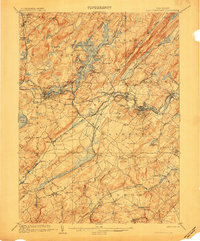 1905 Lake Hopatcong1905 Print · USGSNorthern New Jersey during the early twentieth century shows a landscape shaped by iron mining, railroads, and the growing resort culture around Lake Hopatcong. Genealogists and historians can trace family roots through old settlements like Succasunna, the industrial sites at Mine Hill, and the U.S. Navy Powder Depot.3 unique versions available
 - 1905 Map of Raritan
 1905 Raritan1905 Print · USGSNorthern New Jersey's ridges and valleys are meticulously detailed here at the turn of the century. You can trace the complex rail networks of the Lehigh Valley R.R. and locate family landmarks from Swayze Mills to the Powder Depot near Picatinny Peak.2 unique versions available
 - 1943 Map of Stanhope
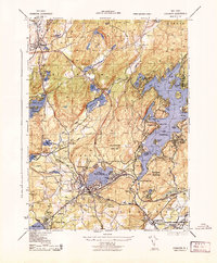 1943 Stanhope1943 Print · USGSMid-century Sussex and Morris County life is centered here on the busy rail and water corridors of the highlands. Researchers can trace the path of the Morris Canal, locate the Hercules Powder Co works, and explore lakefront landmarks like Bertrand Island.
 - 1943 Map of Franklin Furnace
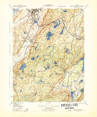 1943 Franklin Furnace1943 Print · USGSMid-century Sussex County is defined here by its deep mining roots and mountain reservoirs. Trace the industrial landscape of Franklin and Ogdensburg through landmarks like the N J Zinc Co, the Stockholm School, and the Lehigh and Hudson River.
 - 1943 Map of Newton East
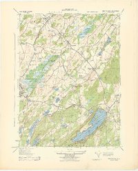 1943 Newton East1943 Print · USGSSussex County was a hub of dairy production and rail transport during the early war years. Genealogists and historians can trace local family land at Ideal Farms or locate industrial sites like the Slate Quarry and Mulford Station.
 - 1944 Map of Newark, 1971 Print
 1944 Newark1971 Print · USGSThe industrial corridor from Philadelphia to New York was in a period of massive transition during the mid-forties. Genealogists and researchers can trace the rail lines of the Lehigh Valley RR, locate military installations like Picatinny Arsenal, and explore the early sprawl near Levittown.5 unique versions available
 - 1947 Map of Dover
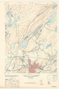 1947 Dover1947 Print · USGSDover and the Rockaway River valley are captured in the late 1940s, showing a landscape defined by industrial centers and lakeside retreats. Trace local history along the Morris Canal or find landmarks like the Star of the Sea Church and Wharton.
 - 1949 Map of Newark
 1949 Newark1949 Print · USGSThe industrial corridor between Philadelphia and New York comes alive in this post-war survey. Genealogists and historians can trace the massive rail networks of the Reading Railroad and locate major installations like Fort Dix or Picatinny Arsenal.2 unique versions available
 - 1950 Map of Scranton, 1952 Print
 1950 Scranton1952 Print · USGSMid-century Northeast Pennsylvania and the Hudson Valley come alive in this survey of the tri-state region. Genealogists and historians can trace the dense rail networks of the Erie RR and DL&W RR between industrial hubs like Scranton and Wilkes-Barre.
 - 1953 Map of Scranton
 1953 Scranton1953 Print · USGSNortheastern Pennsylvania and the Catskills are shown in great detail during the early fifties, a time when rail lines and river valleys dictated the region's growth. Genealogists and historians can trace the industrial hearts of Scranton and Wilkes-Barre or locate remote landmarks like High Point and Lake Wallenpaupack.
 - 1954 Map of Dover
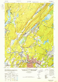 1954 Dover1954 Print · USGSNorthern New Jersey's Morris County is documented here at a time of significant industrial and recreational growth. Genealogists and historians can trace the paths of the Morris Canal, locate the Star of the Sea Church, and explore old tracts in Wharton and Dover.5 unique versions available
 - 1954 Map of Newton East, 1955 Print
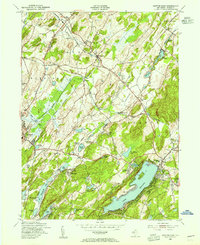 1954 Newton East1955 Print · USGSSussex County emerges in the mid-fifties as a landscape of established rail hubs and growing lakeside communities. Trace the vanished industrial footprints of Sussex Mills and Mulford Station or locate family roots near Vaughn Cem and Township Sch.6 unique versions available
 - 1954 Map of Franklin, 1956 Print
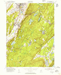 1954 Franklin1956 Print · USGSNorthern New Jersey during the mid-fifties reveals a landscape shaped by mining and mountain retreats. Genealogists and historians can trace rail lines and early settlements like Edison, Milton, and the St Thomas Cem.6 unique versions available
 - 1954 Map of Stanhope, 1957 Print
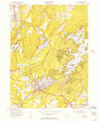 1954 Stanhope1957 Print · USGSStanhope and the Lake Hopatcong region are shown here in the mid-1950s as the area balanced its rail-industrial roots with growing lakeside recreation. Genealogists and local researchers can locate the Stanhope Union Cem, the Budd Lake Sch, and the winding tracks of the Central RR of New Jersey.5 unique versions available
 - 1956 Map of Newark
 1956 Newark1956 Print · USGSThe industrial heart of the Mid-Atlantic is captured here at the dawn of the highway era, tracing the dense corridors between Newark and Philadelphia. Genealogists and local historians can map the rail networks of the Reading RR or locate mid-century military life at Fort Dix Military Reservation.2 unique versions available
 - 1957 Map of Newark
 1957 Newark1957 Print · USGSThe industrial and military heart of the Mid-Atlantic is mapped during its post-war suburban boom. Genealogists and historians can trace the intricate rail corridors of the Reading Railroad and locate key landmarks from Princeton University to Fort Hancock.
 - 1959 Map of Scranton
 1959 Scranton1959 Print · USGSThe northern coalfields and the Hudson Valley meet in this mid-century survey of the Pennsylvania and New York borderlands. Genealogists and historians can trace the intricate rail networks of the Erie Railroad and the vast waters of Lake Wallenpaupack.2 unique versions available
Showing maps 1-25 of 54
Top cities near Sparta Township
- Parsippany-Troy Hills historical maps
- Warwick historical maps
- Mount Olive historical maps
- West Milford historical maps
- Vernon Township historical maps
- Rockaway Township historical maps
See more
Top neighborhoods of Sparta Township
- Woodruffs Gap historical maps
- Ackerson historical maps
- Edison historical maps
- Houses Corner historical maps
- Mahola historical maps
- Monroe historical maps
See more
Frequently asked questions
- What are the different types of historical maps available for Sparta Township?
- What is the oldest map of Sparta Township?
- Where can I purchase historical maps of Sparta Township for my home or office?
- Where can I download high-res historical maps of Sparta Township?
- Are there historical topographic maps available for Sparta Township?
- Is there historical aerial imagery available for Sparta Township?
- Where are historical maps of Sparta Township sourced from?