Old Maps of Warren County, New Jersey for Academic Research
Study the evolution of Warren County with 166 high-resolution historic maps. Whether you're teaching, researching, or modeling changes in land use, these maps provide essential visual documentation of urban, environmental, and geographic change.
- Analyze long-term change: Track patterns in development, transportation, and natural features.
- Ideal for environmental or urban studies: Support academic projects with primary historical map data.
- Use in the classroom or lab: Educators and researchers rely on these maps to bring historical context to life.
These maps are a powerful tool for teaching, research, and visualizing how Warren County has changed over the decades.
Warren County, NJ maps
(166)- 1888 Map of Hackettstown
 1888 Hackettstown1888 Print · USGSNorthwestern New Jersey in the late nineteenth century was a hub of transit and industry defined by the Morris Canal and competing rail lines. Genealogists and historians can trace old homesteads and industrial sites near Oxford Furnace, Waterloo, and Hackettstown.
 - 1890 Map of Easton
 1890 Easton1890 Print · USGSThe Delaware River valley thrived as a transport hub during the 1890s, where three major canals and multiple railroads met at the Pennsylvania-New Jersey border. Genealogists and industrial historians can trace the paths of the Morris Canal, the works at Durham Furnace, and the strategic Musconetcong Tunnel.
 - 1890 Map of High Bridge
 1890 High Bridge1890 Print · USGSHunterdon and Morris counties at the close of the nineteenth century are defined by their complex rail networks and dramatic ridges. Genealogists and historians can trace the early layouts of High Bridge, Clinton, and the settlements surrounding the distinct curve of Cushetunk Mountain.2 unique versions available
 - 1891 Map of Easton
 1891 Easton1891 Print · USGSThe Delaware River valley thrived as a corridor of heavy industry and transit in the 1890s. Trace the path of historic waterways and early rail lines, including the Morris Canal, the ironworks at Durham Furnace, and rural crossroads like Still Valley.8 unique versions available
 - 1891 Map of Wallpack
 1891 Wallpack1891 Print · USGSThe Delaware River valley and Kittatinny Mountain ridges define this late nineteenth-century borderland between Pennsylvania and New Jersey. Genealogists can locate historic river crossings like Dingmans Ferry and trace early rail lines including the Paulins Kill Railroad.
 - 1891 Map of Delaware Water Gap
 1891 Delaware Water Gap1891 Print · USGSThe Delaware River corridor was a bustling industrial and transport hub in the late nineteenth century. Genealogists and historians can trace the region's slate mining roots at the Old Bangor Slate Quarry or locate historic river crossings like Myeres Ferry and Hartzells Ferry.
 - 1893 Map of Delaware Water Gap
 1893 Delaware Water Gap1893 Print · USGSThe Delaware River borderlands between Pennsylvania and New Jersey are captured here in the late nineteenth century as the slate industry and railroads transformed the valley. Researchers can locate the Old Bangor Slate Quarry, trace the river crossings at Myeres Ferry, and explore old stops like Stone Church P. O.12 unique versions available
 - 1893 Map of Wallpack
 1893 Wallpack1893 Print · USGSThe Delaware River valley and Kittatinny Mountain are captured here during the late nineteenth century, showing a landscape defined by ferries and early rail. You can trace old river crossings like Smiths Ferry or locate the rural post office at Peters Valley Bevans P.O. and the rail stop at Emmons Station.8 unique versions available
 - 1894 Map of Hackettstown
 1894 Hackettstown1894 Print · USGSNorthwestern New Jersey is captured here in the late nineteenth century as a hub of iron production and mountain railroading. Researchers can pinpoint early industrial sites like Oxford Furnace or trace the routes of the Morris and Essex Railroad and Lehigh and Hudson River Railroad.
 - 1898 Map of Hackettstown
 1898 Hackettstown1898 Print · USGSNorthwest New Jersey at the turn of the century is defined by its deep river valleys and the early railroads that pierced its ridge lines. Genealogists and historians can trace the foundations of Hackettstown or locate long-standing landmarks like Swayze Mills and Saxton Falls.2 unique versions available
 - 1898 Map of High Bridge
 1898 High Bridge1898 Print · USGSHunterdon County is mapped in the late nineteenth century as a vital transportation corridor defined by the Cushetunk Mountain range. Genealogists and historians can trace the exact rail routes and rural hamlets of the era, from High Bridge and Glen Gardner to the Lehigh Valley Railroad.2 unique versions available
 - 1900 Map of Raritan
 1900 Raritan1900 Print · USGSNorth Jersey in the late nineteenth century was a complex web of mountain ridges and vital rail corridors. Researchers can trace ancestral routes through old junctions like High Bridge, industrial sites at Mine Hill, and the shores of Lake Hopatcong.
 - 1905 Map of Raritan
 1905 Raritan1905 Print · USGSNorthern New Jersey's ridges and valleys are meticulously detailed here at the turn of the century. You can trace the complex rail networks of the Lehigh Valley R.R. and locate family landmarks from Swayze Mills to the Powder Depot near Picatinny Peak.2 unique versions available
 - 1905 Map of High Bridge
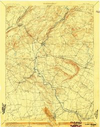 1905 High Bridge1905 Print · USGSHunterdon County at the opening of the twentieth century was a vital junction for New Jersey’s industrial rail lines and river-powered settlements. Researchers can trace the legacy tracks of the Central Railroad of New Jersey and locate early communities like High Bridge, Clinton, and Annandale.4 unique versions available
 - 1905 Map of Hackettstown
 1905 Hackettstown1905 Print · USGSWarren and Morris Counties at the turn of the century show a landscape defined by industrial transport and river valleys. Researchers can trace the historic Morris Canal and the complex rail networks serving towns like Hackettstown, Vienna, and Oxford.5 unique versions available
 - 1924 Map of Bushkill
 1924 Bushkill1924 Print · USGSThe Pennsylvania and New Jersey borderlands come to life in the mid-twenties, showing a landscape of small school districts and traditional river crossings. Researchers can locate family landmarks like Marshall Falls, trace the Delaware Lackawanna and Western rail line, and find old sites like Smoky Hill School.
 - 1932 Map of Easton
 1932 Easton1932 Print · USGSThe Delaware River valley thrived as a corridor of industry and transport in the early 1930s, bridging Pennsylvania and New Jersey. Genealogists and historians can trace the legacy of early industry along the Morris Canal or locate local landmarks like St Josephs Ch and Mine Hill.5 unique versions available
 - 1936 Map of Delaware Water Gap
 1936 Delaware Water Gap1936 Print · USGSThe Delaware River valley thrived in the mid-thirties as a critical junction for coal-hauling railroads and mountain tourism. Local historians can trace family roots through numerous rural landmarks like Spoke Factory Sch, Ross Cem, and Slateford Junction.4 unique versions available
 - 1941 Map of Delaware Water Gap
 1941 Delaware Water Gap1941 Print · USGSThe Delaware River valley is captured here in the early 1940s, showing the borderlands of Pennsylvania and New Jersey. Genealogists can trace family names through dozens of rural landmarks like Three Church Hill, Brass Castle, and the Stone Church PO.
 - 1942 Map of Delaware Water Gap
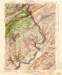 1942 Delaware Water Gap1942 Print · USGSThe Delaware River gorge and its surrounding ridges come into focus during the early war years, highlighting a critical rail and river junction. Trace local history through family-named landmarks like Miller Ch, rural Quaker Plain Sch, and the unique name of Manunka Chunk.3 unique versions available
 - 1943 Map of Bushkill
 1943 Bushkill1943 Print · USGSMonroe County and the Delaware River valley are captured in the early 1940s during a time of rural persistence and local industry. Genealogists and historians can locate family landmarks like Dimicks Ferry, St Thomas Chapel, and the vanished sites of Craig Meadows.2 unique versions available
 - 1943 Map of High Bridge
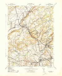 1943 High Bridge1943 Print · USGSWestern New Jersey industrial and institutional corridors are meticulously mapped here during the early war years. Genealogists and historians can trace family locations near the NJ State Hospital or the Grobelis Farm, and identify vanished local landmarks like the Air Raid Station and Asbury Graphite Refinery.
 - 1943 Map of Blairstown
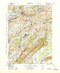 1943 Blairstown1943 Print · USGSWarren County in the early 1940s shows a landscape of ridge-top forests and valley hamlets connected by the Delaware Lackawanna and Western. Researchers can locate the Hematite Mine, trace the historic campus of Blair Academy, or find local family sites near Swayzes Mills.
 - 1943 Map of Bangor
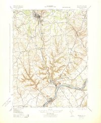 1943 Bangor1943 Print · USGSThe slate and cement industries of the Pennsylvania-New Jersey border are captured in high detail at the height of wartime production. Genealogists and industrial historians can trace rail spurs to the Old Bangor Slate Quarry, locate the Middaghs PO, and find rural landmarks like Three Church Hill.
 - 1943 Map of Portland
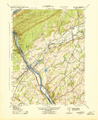 1943 Portland1943 Print · USGSThe Delaware River valley was a bustling corridor of rail and river transit during the early years of the Second World War. Researchers can trace the paths of several major railroads, locate family sites like the Fairview Cemetery, and find old infrastructure such as the Myers Ferry and Hainesburg RR Sta.2 unique versions available
Showing maps 1-25 of 166
Top cities of Warren County
- Phillipsburg historical maps
- Hackettstown historical maps
- Lopatcong Township historical maps
- Washington historical maps
- Blairstown historical maps
- Allamuchy Township historical maps
See more
Frequently asked questions
- What are the different types of historical maps available for Warren County?
- What is the oldest map of Warren County?
- Where can I purchase historical maps of Warren County for my home or office?
- Where can I download high-res historical maps of Warren County?
- Are there historical topographic maps available for Warren County?
- Is there historical aerial imagery available for Warren County?
- Where are historical maps of Warren County sourced from?