Old Maps of Reserve, New Mexico for Genealogy
Trace your family roots with 14 historic maps of Reserve. These high-res maps reveal old neighborhoods, homesites, landmarks, and streets — helping you uncover where your ancestors lived and how the area evolved over time.
- Explore historic neighborhoods: Identify where your relatives may have lived in the 1800s or 1900s.
- Compare maps over time: Trace the changes in streets, buildings, and landmarks for multi-generational research.
- Perfect for genealogy & ancestry research: Used by family historians and researchers to map out lineage and migration.
These maps are an incredible resource for exploring your personal connection to Reserve's past.
Reserve, NM maps
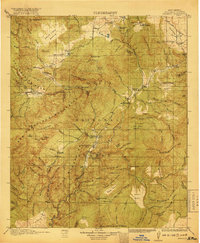
(14)- 1915 Map of Reserve, 1960 Print
 1915 Reserve1960 Print · USGSSocorro County and the Gila National Forest wilderness are documented here in the early twentieth century during the height of the ranger station era. Genealogists and researchers can trace the early plazas at San Francisco Plaza or locate Steven's Sawmill and the Tularosa School.
 - 1918 Map of Reserve
 1918 Reserve1918 Print · USGSUpper Gila country in the years following the Great War reveals a landscape of isolated mountain plazas and early forest service outposts. Researchers can trace the lineage of remote homesteads at Kiehne Ranch, Stevens Sawmill, and the Tularosa School.2 unique versions available
 - 1954 Map of Clifton, 1968 Print
 1954 Clifton1968 Print · USGSThe high timber and copper country of the Arizona-New Mexico border is captured here during the mid-fifties. Genealogists and historians can trace family holdings like the Double Circle Ranch or study the industrial footprint of the Smelting Plant at Clifton.3 unique versions available
 - 1957 Map of Clifton
 1957 Clifton1957 Print · USGSThe copper-mining district around Clifton and Morenci meets the high timberlands of the Mogollon Rim during the mid-1950s. Genealogists and researchers can trace family-named outposts and remote mountain settlements like Reserve, Stargo, and Fort Thomas.
 - 1958 Map of Clifton
 1958 Clifton1958 Print · USGSThe rugged high country of the Arizona-New Mexico border comes into focus in the mid-fifties, showing a landscape of mining camps and forest outposts. Genealogists and researchers can trace old settlements and remote sites like Mogollon, East Fork Mission, and the Tidwell Mine.
 - 1962 Map of Clifton
 1962 Clifton1962 Print · USGSThe copper-rich Arizona-New Mexico borderlands come into focus in the early sixties, centered on the mining complexes of Morenci and Clifton. Researchers can trace the Southern Pacific rail lines and locate remote outposts like Honeymoon and the Double Circle Ranch.
 - 1965 Map of Reserve, 1968 Print
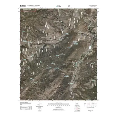
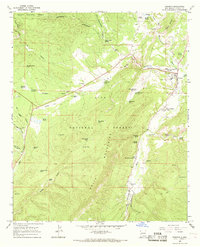 1965 Reserve1968 Print · USGSCatron County settlement centered on the river forks in the mid-1960s. Genealogists and local historians can trace family-named sites such as Hudson Ranch, locate the community High Sch, and explore the old settlements of San Francisco Plaza and Reserve.2 unique versions available
 - 1983 Map of Tularosa Mountains
 1983 Tularosa Mountains1983 Print · USGSCatron County in the early eighties is a landscape of high timber and remote river valleys shaped by the Apache and Gila National Forests. Local historians can trace the foundations of settlements like San Francisco Plaza and Old Horse Springs, or locate remote landmarks like the Negrito Airstrip.2 unique versions available
 - 1999 Map of Reserve, 2002 Print
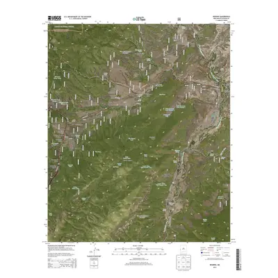
 1999 Reserve2002 Print · USGSThe high mountain valley of the San Francisco River comes alive in the late twentieth century, showing a landscape of remote ranching and forest service outposts. Genealogists and historians can trace family holdings and local landmarks like Hudson Ranch, the Cibola Scout Camp, and San Francisco Plaza.
 - 2011 Map of Reserve, 2011 Print
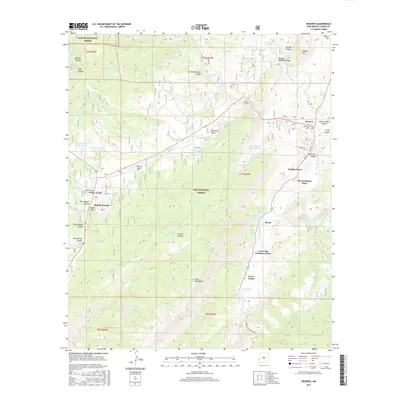
 2011 Reserve2011 Print · USGSCovers Reserve, including San Francisco Plaza, Rancho Grande Estates, and other nearby areas
 - 2013 Map of Reserve, 2013 Print
 2013 Reserve2013 Print · USGSCovers Reserve, including San Francisco Plaza, Rancho Grande Estates, and other nearby areas
 - 2017 Map of Reserve, 2017 Print
 2017 Reserve2017 Print · USGSCovers Reserve, including San Francisco Plaza, Rancho Grande Estates, and other nearby areas
 - 2020 Map of Reserve, 2020 Print
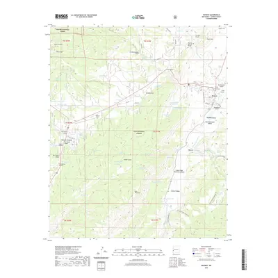 2020 Reserve2020 Print · USGSCovers Reserve, including San Francisco Plaza, Rancho Grande Estates, and other nearby areas
 - 2023 Map of Reserve, 2023 Print
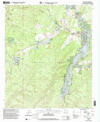
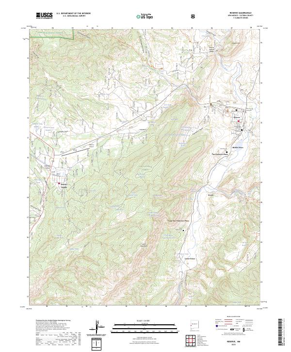 2023 Reserve2023 Print · USGSCatron County settlement patterns are clearly visible along the San Francisco River valley in this detailed 2023 survey. Genealogists and local historians can trace the foundations of Reserve, find the Catron County Courthouse, and locate several burial grounds including Saint Francis Cem and Reserve Cem.
End of results
Showing maps 1-14 of 14
Frequently asked questions
- What are the different types of historical maps available for Reserve?
- What is the oldest map of Reserve?
- Where can I purchase historical maps of Reserve for my home or office?
- Where can I download high-res historical maps of Reserve?
- Are there historical topographic maps available for Reserve?
- Is there historical aerial imagery available for Reserve?
- Where are historical maps of Reserve sourced from?