Old Maps of Old Longbotbam Place, New Mexico
Explore 10 old maps of Old Longbotbam Place, spanning from 1954 to today. These high-resolution historic maps reveal how streets, neighborhoods, landmarks, and natural features evolved over time — perfect for genealogy, metal detecting, research, and local history exploration.
What you can do with these maps:
- See how Old Longbotbam Place changed over time: Compare historical maps to modern-day views to trace roads, homesites, rail lines & more.
- View detailed metadata: Each map includes creators, publishers, year, scale, and archive source.
- Overlay maps with satellite & LiDAR: Visualize the past alongside modern tools to explore terrain & human change.
- Trusted historical sources: Maps sourced from the USGS, Library of Congress, and other archives.
- Access maps your way: View online, download high-res files, or order prints for personal or research use.
Start exploring old maps of Old Longbotbam Place to uncover forgotten places, hidden landmarks, and the deep history beneath your feet.
Old Longbotbam Place, NM maps
(10)- 1954 Map of Carlsbad, 1963 Print
 1954 Carlsbad1963 Print · USGSSoutheastern New Mexico's desert peaks and river valleys appear in this mid-century study of the borderlands. Researchers can locate vanished sites like Sacramento City, trace the Pecos River reservoirs, and explore Carlsbad Caverns.3 unique versions available
 - 1958 Map of Carlsbad
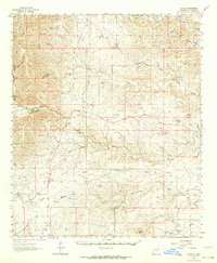
 1958 Carlsbad1958 Print · USGSSoutheastern New Mexico in the mid-1950s shows a landscape of deep desert basins and high forest ranges during a period of steady ranching and early tourism. Researchers can trace the path of the Atchison Topeka and Santa Fe railroad or find vanished locales like Sacramento City (abandoned) and Whites City.2 unique versions available
 - 1962 Map of Dunken, 1964 Print
 1962 Dunken1964 Print · USGSDunken and the surrounding Chaves County ranchlands are captured here in the early sixties, as the Rio Peñasco sustained a network of remote family homesteads. Genealogists can trace property roots at the Old Higginbotham Ranch or find the community heart at Peñasco Sch and the Dunken PO.3 unique versions available
 - 1979 Map of Alamogordo
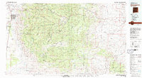 1979 Alamogordo1979 Print · USGSThe high Sacramento Mountains and the Tularosa Valley floor meet in the late seventies, showing the region's unique mix of scientific research and military land use. Genealogists and historians can trace routes to Cloudcroft, the Solar Observatory, and the McGregor Range.
 - 1989 Map of Thimble Canyon
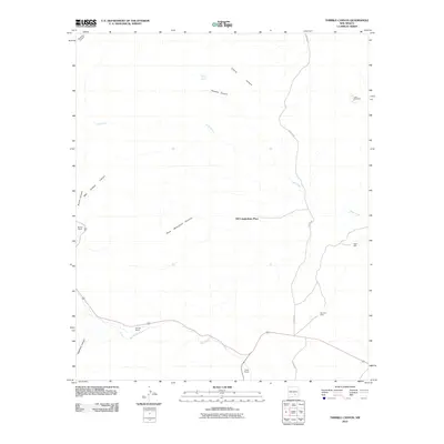
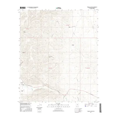
 1989 Thimble Canyon1989 Print · USGSChaves County ranchlands are detailed in the late eighties as this survey reveals the vital water network of the high desert. Researchers can trace the drainage of Rio Peñasco and locate specific improvements like Watts Tank, Eagle Well, and Lake Windmill.
 - 2010 Map of Thimble Canyon, 2010 Print
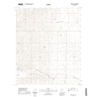
 2010 Thimble Canyon2010 Print · USGSCovers Old Longbotbam Place, including Chaves County, United States, and other nearby areas
 - 2013 Map of Thimble Canyon, 2013 Print
 2013 Thimble Canyon2013 Print · USGSCovers Old Longbotbam Place, including Chaves County, United States, and other nearby areas
 - 2017 Map of Thimble Canyon, 2017 Print
 2017 Thimble Canyon2017 Print · USGSCovers Old Longbotbam Place, including Chaves County, United States, and other nearby areas
 - 2020 Map of Thimble Canyon, 2020 Print
 2020 Thimble Canyon2020 Print · USGSCovers Old Longbotbam Place, including Chaves County, United States, and other nearby areas
 - 2023 Map of Thimble Canyon, 2023 Print
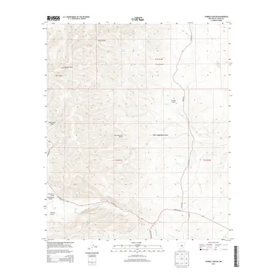
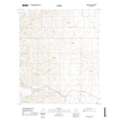 2023 Thimble Canyon2023 Print · USGSThe high desert canyons of Chaves County are shown here in the 2020s as a landscape defined by ranching and seasonal waters. Researchers can trace historical routes like Old School House Rd and find landmarks such as Watts Tank and Rio Peñasco.
End of results
Showing maps 1-10 of 10
Frequently asked questions
- What are the different types of historical maps available for Old Longbotbam Place?
- What is the oldest map of Old Longbotbam Place?
- Where can I purchase historical maps of Old Longbotbam Place for my home or office?
- Where can I download high-res historical maps of Old Longbotbam Place?
- Are there historical topographic maps available for Old Longbotbam Place?
- Is there historical aerial imagery available for Old Longbotbam Place?
- Where are historical maps of Old Longbotbam Place sourced from?