
1954 Map of Carlsbad
USGS Topo · Published 1963About this map
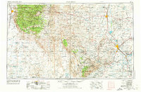
The Sacramento Mountains and Guadalupe Mountains dominate this mid-century view of southeastern New Mexico, where the high desert meets a network of managed water systems. The landscape is defined by the contrast between the timbered slopes of the Lincoln National Forest and the irrigated corridor of the Pecos River. Along the river, vital reservoirs like Lake McMillan and Lake Avalon support a string of settlements from Artesia down to Carlsbad and Loving.
Find a feature on this map
86 named features on this map. Tap any name to fly to it.
Don’t see what you’re looking for? This feature index may not catch every label — zoom into the map to look around manually.
Map Details
Editions of this 1954 Carlsbad Map
3 editions found
Other maps of this area

1896 · El Paso
USGS Topo · 1:125,000

1903 · Cerro Alto
USGS Topo · 1:125,000

1908 · El Paso
USGS Topo · 1:125,000

1916 · Tularosa
USGS Topo · 1:125,000

1916 · Point Of Sands
USGS Topo · 1:125,000

1925 · Orla 2-b
USGS Topo · 1:48,000

1931 · Orla
USGS Topo · 1:62,500

1933 · Guadalupe Peak
USGS Topo · 1:48,000

1935 · El Paso Gap
USGS Topo · 1:62,500

1936 · El Paso Gap
USGS Topo · 1:48,000