
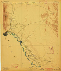
1896 Map of El Paso
USGS Topo · Published 1896About this map
The Rio Grande defines the international border in this late nineteenth-century survey, anchoring a landscape where the United States Mexico Boundary Line follows the river's meandering course. On the American side, the city of El Paso serves as a critical junction for the Southern Pacific Railroad, the White Oaks R.R., and the Mexican Central R.R. which crosses into Juarez. To the north, the Franklin Mountains and a substantial Military Reservation at Fort Bliss overlook the growing settlement.
Find a feature on this map
30 named features on this map. Tap any name to fly to it.
Don’t see what you’re looking for? This feature index may not catch every label — zoom into the map to look around manually.
Map Details
Editions of this 1896 El Paso Map
2 editions found
Other maps of this area

1891 · Las Cruces
USGS Topo · 1:125,000

1893 · Las Cruces
USGS Topo · 1:125,000

1894 · Fort Hancock
USGS Topo · 1:125,000

1896 · Rio Grande
USGS Topo · 1:125,000

1903 · Cerro Alto
USGS Topo · 1:125,000

1908 · El Paso
USGS Topo · 1:125,000

1917 · Canutillo
USGS Topo · 1:62,500

1919 · Canutillo
USGS Topo · 1:62,500

1939 · Ysleta
USGS Topo · 1:62,500

1939 · Heuco Tanks
USGS Topo · 1:62,500