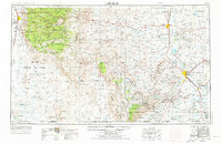
1954 Map of Carlsbad
USGS Topo · Published 1976About this map
Carlsbad and the surrounding high desert of southeastern New Mexico are documented here during a period of significant military and agricultural transition. The Pecos River serves as the lifeblood of the region, feeding major reservoirs like Lake McMillan and Lake Avalon, which supported the irrigation districts near Artesia and Loving. To the west, the massive MC Gregor Range Expansion and Fort Bliss occupy the Tularosa Valley, illustrating the Cold War-era expansion of military testing grounds.
Find a feature on this map
64 named features on this map. Tap any name to fly to it.
Don’t see what you’re looking for? This feature index may not catch every label — zoom into the map to look around manually.
Map Details
Editions of this 1954 Carlsbad Map
3 editions found

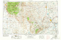
Other maps of this area

1896 · El Paso
USGS Topo · 1:125,000

1903 · Cerro Alto
USGS Topo · 1:125,000

1908 · El Paso
USGS Topo · 1:125,000

1916 · Tularosa
USGS Topo · 1:125,000

1916 · Point Of Sands
USGS Topo · 1:125,000

1925 · Orla 2-b
USGS Topo · 1:48,000

1931 · Orla
USGS Topo · 1:62,500

1933 · Guadalupe Peak
USGS Topo · 1:48,000

1935 · El Paso Gap
USGS Topo · 1:62,500

1936 · El Paso Gap
USGS Topo · 1:48,000