Old Maps of Fromer Val Verde Ski Area, New Mexico for Hiking & Exploration
Hike through history with 10 historic maps of Fromer Val Verde Ski Area. Explore old trails, ghost towns, and forgotten backroads — perfect for outdoor adventurers and local explorers.
- Rediscover forgotten places: Map out old mining camps, roads, and footpaths that no longer exist on modern maps.
- Layer with modern tools: Combine with LiDAR or satellite views to plan hikes through historical terrain.
- Made for exploration: Popular among hikers, overlanders, and local history lovers.
Use these maps to find adventure and explore the hidden past of Fromer Val Verde Ski Area.
Fromer Val Verde Ski Area, NM maps
(10)- 1954 Map of Raton, 1963 Print
 1954 Raton1963 Print · USGSNorthern New Mexico's high-country and plains are documented here in the early sixties, showing the region's ranching and mining infrastructure. Trace the legacy of the Maxwell Land Grant, locate remote rural sites like Tafoya School, and follow the Atchison Topeka and Santa Fe Railway through the heart of Raton.3 unique versions available
 - 1958 Map of Raton
 1958 Raton1958 Print · USGSNorthern New Mexico and the Colorado borderlands are mapped here in the late fifties, showcasing a landscape of high peaks and historic land grants. Genealogists and historians can trace families across Picuris Pueblo, find old schoolhouses like Piedra Lumbre School, or follow the Atchison Topeka and Santa Fe rail line.3 unique versions available
 - 1965 Map of Palo Flechado Pass, 1968 Print
 1965 Palo Flechado Pass1968 Print · USGSThe high mountain passes and historic land grants of the Sangre de Cristo range are frozen in time during the mid-1960s. Genealogists and researchers can trace the old Kit Carson Trail and identify property boundaries within the Maxwell Land Grant Boundary near Agua Fria.
 - 1983 Map of Taos
 1983 Taos1983 Print · USGSNorthern New Mexico's high-country heritage is on full display in the early eighties, from the deep river canyons to the highest alpine peaks. Genealogists and historians can trace traditional land-grant settlements like Las Trampas, Truchas, and the historic Taos Pueblo.2 unique versions available
 - 1995 Map of Palo Flechado Pass, 1997 Print
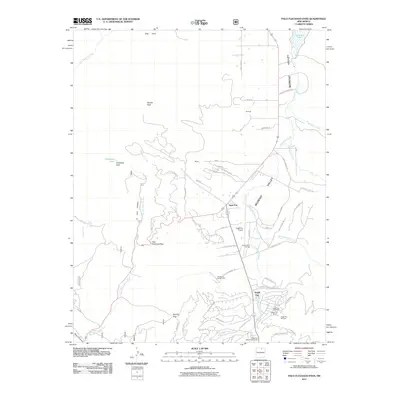
 1995 Palo Flechado Pass1997 Print · USGSHigh-altitude mountain passes and historical land grants define this corner of the Sangre de Cristo range in the mid-1990s. Researchers can trace the borders of the Pueblo de Taos Indian Reservation or locate the Angel Fire Ski Area and Agua Fria.2 unique versions available
 - 2011 Map of Palo Flechado Pass, 2011 Print
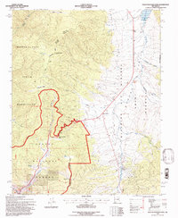
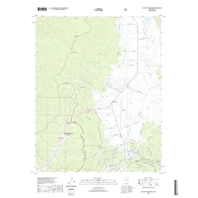
 2011 Palo Flechado Pass2011 Print · USGSCovers Fromer Val Verde Ski Area, including Angel Fire, Agua Fria, and other nearby areas
 - 2013 Map of Palo Flechado Pass, 2013 Print
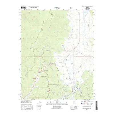
 2013 Palo Flechado Pass2013 Print · USGSCovers Fromer Val Verde Ski Area, including Angel Fire, Agua Fria, and other nearby areas
 - 2017 Map of Palo Flechado Pass, 2017 Print
 2017 Palo Flechado Pass2017 Print · USGSCovers Fromer Val Verde Ski Area, including Angel Fire, Agua Fria, and other nearby areas
 - 2020 Map of Palo Flechado Pass, 2020 Print
 2020 Palo Flechado Pass2020 Print · USGSCovers Fromer Val Verde Ski Area, including Angel Fire, Agua Fria, and other nearby areas
 - 2023 Map of Palo Flechado Pass, 2023 Print
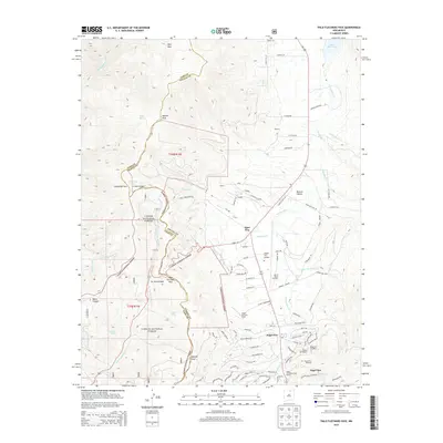
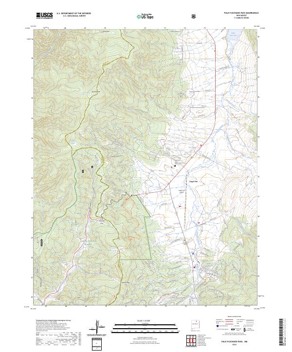 2023 Palo Flechado Pass2023 Print · USGSThe Moreno Valley region near the Taos and Colfax county line is shown here in the 2020s. Researchers can trace high-altitude routes like Palo Flechado Pass and find landmarks such as Angel Fire and the Angel Fire State Veteran Cem.
End of results
Showing maps 1-10 of 10
Top cities near Fromer Val Verde Ski Area
Frequently asked questions
- What are the different types of historical maps available for Fromer Val Verde Ski Area?
- What is the oldest map of Fromer Val Verde Ski Area?
- Where can I purchase historical maps of Fromer Val Verde Ski Area for my home or office?
- Where can I download high-res historical maps of Fromer Val Verde Ski Area?
- Are there historical topographic maps available for Fromer Val Verde Ski Area?
- Is there historical aerial imagery available for Fromer Val Verde Ski Area?
- Where are historical maps of Fromer Val Verde Ski Area sourced from?