Old Maps of Eagle Nest, New Mexico for Hiking & Exploration
Hike through history with 16 historic maps of Eagle Nest. Explore old trails, ghost towns, and forgotten backroads — perfect for outdoor adventurers and local explorers.
- Rediscover forgotten places: Map out old mining camps, roads, and footpaths that no longer exist on modern maps.
- Layer with modern tools: Combine with LiDAR or satellite views to plan hikes through historical terrain.
- Made for exploration: Popular among hikers, overlanders, and local history lovers.
Use these maps to find adventure and explore the hidden past of Eagle Nest.
Eagle Nest, NM maps
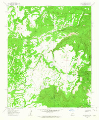
(16)- 1883 Map of Mt. Taylor
 1883 Mt. Taylor1883 Print · USGSThe high-desert frontier of New Mexico comes to life in the 1880s, centered on the towering Mt Taylor. Researchers can trace the early path of the Atlantic and Pacific Railroad and locate settlements like Old Fort Wingate and Laguna.
 - 1886 Map of Mt. Taylor
 1886 Mt. Taylor1886 Print · USGSNorthwestern New Mexico in the mid-1880s reveals a high-desert territory where early rail commerce meets long-standing mountain settlements. Researchers can trace the path of the Atlantic and Pacific Railroad past Old Fort Wingate and the historic villages of Laguna and Cebolletta.
 - 1892 Map of Mt. Taylor, 1896 Print
 1892 Mt. Taylor1896 Print · USGSNorthwestern New Mexico in the late nineteenth century was a territory of rail expansion and ancient volcanic landmarks. Researchers can trace the path of the Atlantic and Pacific Railroad past Old Fort Wingate and the pueblo at Laguna.
 - 1899 Map of Mt. Taylor
 1899 Mt. Taylor1899 Print · USGSNorthwestern New Mexico in the late nineteenth century is a landscape of vast mesas and early rail stops before modern highways arrived. Genealogists and historians can trace the foundations of Grant, San Mateo, and Old Fort Wingate along the Santa Fe Pacific Railroad.5 unique versions available
 - 1958 Map of Albuquerque
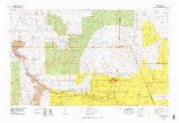
 1958 Albuquerque1958 Print · USGSAlbuquerque and the surrounding high desert are captured here during a period of massive federal expansion and postwar growth. Researchers can trace the development of Kirtland Air Force Base, find ancestral homes in Pueblo de Santa Ana, or locate industrial sites like the Jackpile Mine.
 - 1961 Map of Laguna Seca, 1963 Print
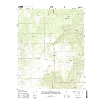
 1961 Laguna Seca1963 Print · USGSHigh canyons and mesas mark the McKinley and Sandoval county border in the early sixties. Genealogists and historians can trace old land divisions and remote locales like Eagle Nest, La Jolla Alfalfa, and the Guadalupe Ranger Station.2 unique versions available
 - 1962 Map of Albuquerque
 1962 Albuquerque1962 Print · USGSAlbuquerque and the surrounding high desert are captured here in the early 1960s during a period of intense mineral and military growth. Genealogists and historians can locate early schools like the Pueblo Pintado School, major industrial sites like the Jackpile Mine, and the sprawling Kirtland Air Force Base.
 - 1963 Map of Albuquerque, 1965 Print
 1963 Albuquerque1965 Print · USGSMid-century New Mexico unfolds across this map, showcasing the intersection of ancient pueblos, modern military bases, and historic mining districts. Trace family roots and local history through the Ortiz Mine, Seven Lakes Trading Post, and Alameda.3 unique versions available
 - 1978 Map of Grants
 1978 Grants1978 Print · USGSWest-Central New Mexico is captured here in the late seventies as uranium mining and the railroad shaped the high desert landscape. Genealogists and historians can trace settlements from Grants to Laguna, including the Jackpile Mine and Acomita West Village.2 unique versions available
 - 1983 Map of Albuquerque, 1984 Print
 1983 Albuquerque1984 Print · USGSCentral New Mexico in the early eighties shows a landscape where ancient pueblos and modern aerospace hubs meet. Trace the routes of the Atchison Topeka and Santa Fe RR or locate landmarks like Kirtland Air Force Base, Madrid, and the Sandia Mountains.
 - 1995 Map of Laguna Seca, 1998 Print
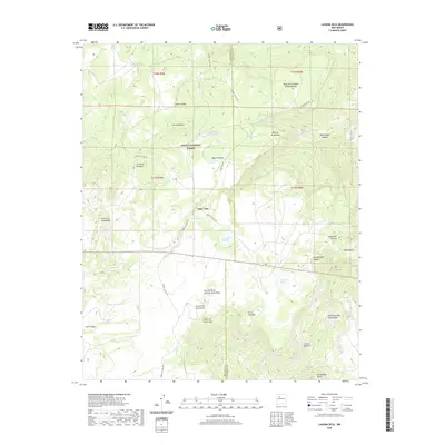
 1995 Laguna Seca1998 Print · USGSHigh-plateau ranching and wildlife lands in McKinley and Sandoval counties are captured here during the mid-nineties. Trace the boundaries of the Nuestra Señora de la Luz de las Lagunitas Grant and find vital water sources like Ojo Frio and Laguna Seca.
 - 2011 Map of Laguna Seca, 2011 Print
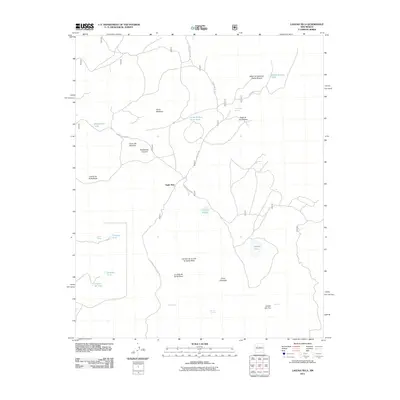 2011 Laguna Seca2011 Print · USGSCovers Eagle Nest, including Sandoval County, McKinley County, and other nearby areas
 - 2013 Map of Laguna Seca, 2013 Print
 2013 Laguna Seca2013 Print · USGSCovers Eagle Nest, including Sandoval County, McKinley County, and other nearby areas
 - 2017 Map of Laguna Seca, 2017 Print
 2017 Laguna Seca2017 Print · USGSCovers Eagle Nest, including Sandoval County, McKinley County, and other nearby areas
 - 2020 Map of Laguna Seca, 2020 Print
 2020 Laguna Seca2020 Print · USGSCovers Eagle Nest, including Sandoval County, McKinley County, and other nearby areas
 - 2023 Map of Laguna Seca, 2023 Print
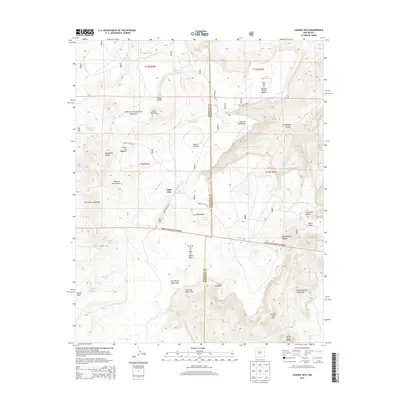
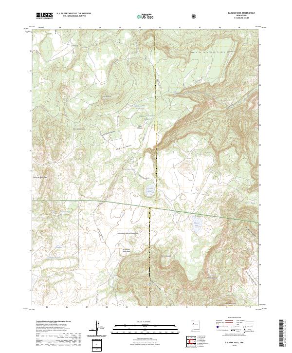 2023 Laguna Seca2023 Print · USGSHigh-desert mesa country on the McKinley and Sandoval county line is documented here in the early twenty-first century. Researchers can trace land use through isolated water sources and named landmarks like La Jolla de Santa Rosa, Eagle Nest Tank, and Cerro Montoso.
End of results
Showing maps 1-16 of 16
Top cities near Eagle Nest
Frequently asked questions
- What are the different types of historical maps available for Eagle Nest?
- What is the oldest map of Eagle Nest?
- Where can I purchase historical maps of Eagle Nest for my home or office?
- Where can I download high-res historical maps of Eagle Nest?
- Are there historical topographic maps available for Eagle Nest?
- Is there historical aerial imagery available for Eagle Nest?
- Where are historical maps of Eagle Nest sourced from?