Old Maps of Hudson, New Mexico
Explore 9 old maps of Hudson, spanning from 1930 to today. These high-resolution historic maps reveal how streets, neighborhoods, landmarks, and natural features evolved over time — perfect for genealogy, metal detecting, research, and local history exploration.
What you can do with these maps:
- See how Hudson changed over time: Compare historical maps to modern-day views to trace roads, homesites, rail lines & more.
- View detailed metadata: Each map includes creators, publishers, year, scale, and archive source.
- Overlay maps with satellite & LiDAR: Visualize the past alongside modern tools to explore terrain & human change.
- Trusted historical sources: Maps sourced from the USGS, Library of Congress, and other archives.
- Access maps your way: View online, download high-res files, or order prints for personal or research use.
Start exploring old maps of Hudson to uncover forgotten places, hidden landmarks, and the deep history beneath your feet.
Hudson, NM maps
(9)- 1930 Map of Tucumcari
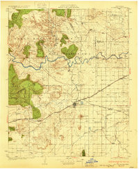 1930 Tucumcari1930 Print · USGSTucumcari and the surrounding ranch lands of eastern New Mexico are captured here during the peak of the steam rail era. Genealogists and historians can trace family-named sites like the Elliott Ranch, remote schools such as Bryantine Sch, and the winding Canadian River corridor.2 unique versions available
 - 1954 Map of Tucumcari, 1965 Print
 1954 Tucumcari1965 Print · USGSThe high plains along the New Mexico and Texas border come alive in this mid-century survey, just as the regional highway network was maturing. Trace the historic route of U.S. 66 through Glenrio and San Jon or locate remote rail sidings like Rehm Station and Obar.2 unique versions available
 - 1958 Map of Tucumcari
 1958 Tucumcari1958 Print · USGSEastern New Mexico and the Texas Panhandle meet in this mid-century survey of the high plains ranching and rail corridor. Researchers can trace the path of Mother Road travelers through Tucumcari and Glenrio or locate remote rail stops like Nara Visa Station and Hartley Station.
 - 1968 Map of Hudson, 1971 Print
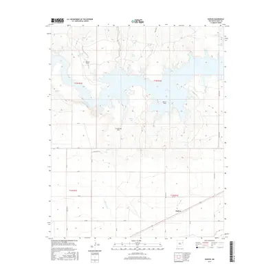
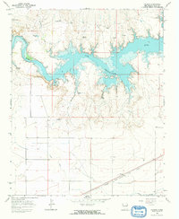 1968 Hudson1971 Print · USGSEastern New Mexico ranching country meets modern water engineering in the late 1960s as the Ute Reservoir fills the valley. You can trace the path of the Chicago Rock Island and Pacific railroad through Hudson or find old watering holes like Ochenta Tank.
 - 2010 Map of Hudson, 2010 Print
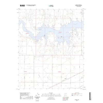
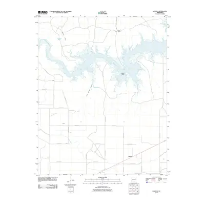 2010 Hudson2010 Print · USGSCovers Hudson, including Quay County, United States, and other nearby areas
 - 2013 Map of Hudson, 2013 Print
 2013 Hudson2013 Print · USGSCovers Hudson, including Quay County, United States, and other nearby areas
 - 2017 Map of Hudson, 2017 Print
 2017 Hudson2017 Print · USGSCovers Hudson, including Quay County, United States, and other nearby areas
 - 2020 Map of Hudson, 2020 Print
 2020 Hudson2020 Print · USGSCovers Hudson, including Quay County, United States, and other nearby areas
 - 2023 Map of Hudson, 2023 Print
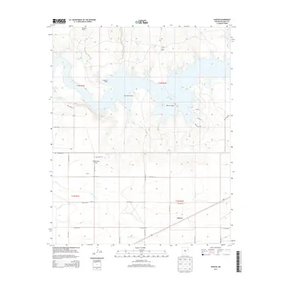
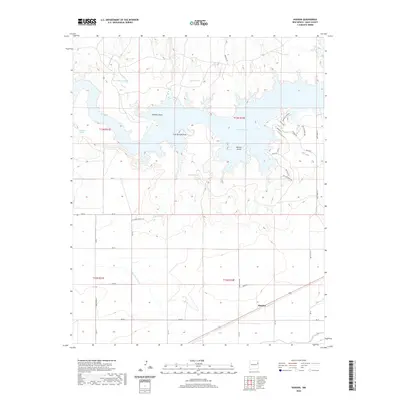
 2023 Hudson2023 Print · USGSQuay County is defined by the expanse of the Ute Reservoir and the Canadian River in this modern survey. Researchers can trace the layout of Hudson, locate the Hudson Cem, and see the network of draws and tanks like Willow Tank that support this landscape.
End of results
Showing maps 1-9 of 9
Top cities near Hudson
Frequently asked questions
- What are the different types of historical maps available for Hudson?
- What is the oldest map of Hudson?
- Where can I purchase historical maps of Hudson for my home or office?
- Where can I download high-res historical maps of Hudson?
- Are there historical topographic maps available for Hudson?
- Is there historical aerial imagery available for Hudson?
- Where are historical maps of Hudson sourced from?