Old Maps of Montoya, New Mexico for Genealogy
Trace your family roots with 8 historic maps of Montoya. These high-res maps reveal old neighborhoods, homesites, landmarks, and streets — helping you uncover where your ancestors lived and how the area evolved over time.
- Explore historic neighborhoods: Identify where your relatives may have lived in the 1800s or 1900s.
- Compare maps over time: Trace the changes in streets, buildings, and landmarks for multi-generational research.
- Perfect for genealogy & ancestry research: Used by family historians and researchers to map out lineage and migration.
These maps are an incredible resource for exploring your personal connection to Montoya's past.
Montoya, NM maps
(8)- 1954 Map of Santa Fe, 1963 Print
 1954 Santa Fe1963 Print · USGSNew Mexico's high mountains and eastern plains meet in the mid-fifties, showing a landscape defined by the Sangre de Cristo Mountains and the Pecos River. Trace family roots and local history through San Christobal Church, Sena School, and the historic Las Vegas rail corridor.4 unique versions available
 - 1958 Map of Santa Fe
 1958 Santa Fe1958 Print · USGSThe Sangre De Cristo Mountains meet the high plains in the late 1950s, showing a landscape defined by rail corridors and ranching. Genealogists can trace family-named sites like Upton Ranch or visit the Fort Union (Ruins) and Tuloso School.
 - 1964 Map of Montoya, 1967 Print
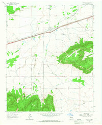 1964 Montoya1967 Print · USGSEastern New Mexico ranching and railroading are captured here in the mid-1960s as the modern interstate began to parallel old Route 66. Genealogists can trace family landmarks like Juana de Darca Ch or cattle operations centered at Headquarters Windmill and Registered Windmill.
 - 2010 Map of Montoya, 2010 Print
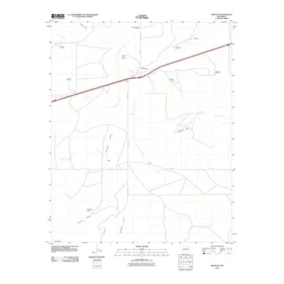 2010 Montoya2010 Print · USGSCovers Montoya, including Quay County, United States, and other nearby areas
 - 2013 Map of Montoya, 2013 Print
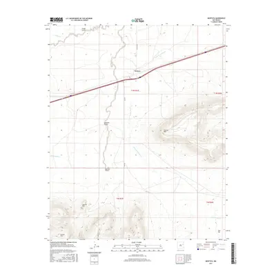
 2013 Montoya2013 Print · USGSCovers Montoya, including Quay County, United States, and other nearby areas
 - 2017 Map of Montoya, 2017 Print
 2017 Montoya2017 Print · USGSCovers Montoya, including Quay County, United States, and other nearby areas
 - 2020 Map of Montoya, 2020 Print
 2020 Montoya2020 Print · USGSCovers Montoya, including Quay County, United States, and other nearby areas
 - 2023 Map of Montoya, 2023 Print
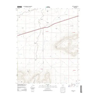
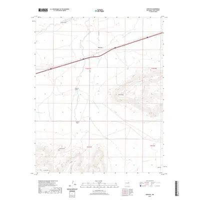
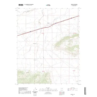 2023 Montoya2023 Print · USGSIn this modern survey of eastern New Mexico, the plains of Quay County are defined by dramatic mesas and the central settlement of Montoya. Researchers can trace local heritage at the Montoya Cem or map the terrain from Palomas Mesa to the Sunflower Canyon drainages.
End of results
Showing maps 1-8 of 8
Frequently asked questions
- What are the different types of historical maps available for Montoya?
- What is the oldest map of Montoya?
- Where can I purchase historical maps of Montoya for my home or office?
- Where can I download high-res historical maps of Montoya?
- Are there historical topographic maps available for Montoya?
- Is there historical aerial imagery available for Montoya?
- Where are historical maps of Montoya sourced from?