Old Maps of Cowles, New Mexico for Academic Research
Study the evolution of Cowles with 12 high-resolution historic maps. Whether you're teaching, researching, or modeling changes in land use, these maps provide essential visual documentation of urban, environmental, and geographic change.
- Analyze long-term change: Track patterns in development, transportation, and natural features.
- Ideal for environmental or urban studies: Support academic projects with primary historical map data.
- Use in the classroom or lab: Educators and researchers rely on these maps to bring historical context to life.
These maps are a powerful tool for teaching, research, and visualizing how Cowles has changed over the decades.
Cowles, NM maps
(12)- 1889 Map of Santa Fe, 1963 Print
 1889 Santa Fe1963 Print · USGSSanta Fe and the surrounding high country appear here in the late nineteenth century as the railroad began transforming the territory. Genealogists and historians can trace early settlements like Santuario, identify family sites at Gonzales Ranch, and locate the historic Old Fort Marcy.
 - 1894 Map of Santa Fe
 1894 Santa Fe1894 Print · USGSSanta Fe and its surrounding high-country villages appear here during the territorial era of the late nineteenth century. Genealogists and historians can trace the routes of early railroads and locate specific landmarks like Old Fort Marcy, Gonzales Ranch, and Tesuque Pueblo.5 unique versions available
 - 1954 Map of Santa Fe, 1963 Print
 1954 Santa Fe1963 Print · USGSNew Mexico's high mountains and eastern plains meet in the mid-fifties, showing a landscape defined by the Sangre de Cristo Mountains and the Pecos River. Trace family roots and local history through San Christobal Church, Sena School, and the historic Las Vegas rail corridor.4 unique versions available
 - 1958 Map of Santa Fe
 1958 Santa Fe1958 Print · USGSThe Sangre De Cristo Mountains meet the high plains in the late 1950s, showing a landscape defined by rail corridors and ranching. Genealogists can trace family-named sites like Upton Ranch or visit the Fort Union (Ruins) and Tuloso School.
 - 1961 Map of Cowles, 1966 Print
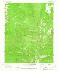 1961 Cowles1966 Print · USGSThe Sangre de Cristo foothills near the San Miguel and Santa Fe county lines appear here in the early sixties, centered on the Pecos River. You can trace alpine trails to Spirit Lake or locate the historic Panchuela Ranger Station and Cowles settlement.4 unique versions available
 - 1983 Map of Santa Fe, 1984 Print
 1983 Santa Fe1984 Print · USGSThe high Sangre de Cristo Mountains and the growing state capital define this early 1980s landscape during a period of expanding infrastructure. Researchers can trace historic land patterns and transit routes from Nambe Pueblo and Glorieta Pass to the Atchison Topeka and Santa Fe RR line.
 - 2002 Map of Cowles, 2003 Print
 2002 Cowles2003 Print · USGSHigh in the mountains of San Miguel County just after the millennium, this area shows a unique mix of remote wilderness and seasonal mountain retreats. You can trace the path of the Pecos River, locate the historic Tererro Mine, and find secluded spots like the Winsor Creek Summer Home Area.
 - 2011 Map of Cowles, 2011 Print
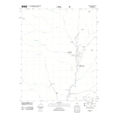 2011 Cowles2011 Print · USGSCovers Cowles, including Geronimo, Grass Mountain Summer Home Area, and other nearby areas
 - 2013 Map of Cowles, 2013 Print
 2013 Cowles2013 Print · USGSCovers Cowles, including Geronimo, Grass Mountain Summer Home Area, and other nearby areas
 - 2017 Map of Cowles, 2017 Print
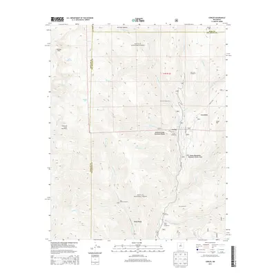
 2017 Cowles2017 Print · USGSCovers Cowles, including Geronimo, Grass Mountain Summer Home Area, and other nearby areas
 - 2020 Map of Cowles, 2020 Print
 2020 Cowles2020 Print · USGSCovers Cowles, including Geronimo, Grass Mountain Summer Home Area, and other nearby areas
 - 2023 Map of Cowles, 2023 Print
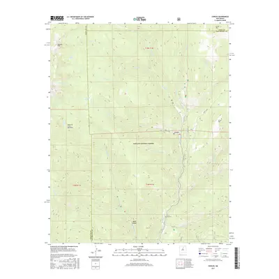
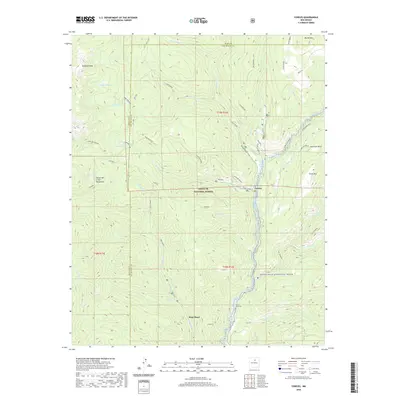
 2023 Cowles2023 Print · USGSThe high Sangre de Cristo Mountains are captured here in the early twenty-first century as a landscape of recreation and mining history. Researchers can trace the path of the Pecos River or locate the Pecos Mine Cem near the Holy Ghost settlement.
End of results
Showing maps 1-12 of 12
Top cities near Cowles
Frequently asked questions
- What are the different types of historical maps available for Cowles?
- What is the oldest map of Cowles?
- Where can I purchase historical maps of Cowles for my home or office?
- Where can I download high-res historical maps of Cowles?
- Are there historical topographic maps available for Cowles?
- Is there historical aerial imagery available for Cowles?
- Where are historical maps of Cowles sourced from?