Old Maps of Estancia Ranchettes, New Mexico for Hiking & Exploration
Hike through history with 10 historic maps of Estancia Ranchettes. Explore old trails, ghost towns, and forgotten backroads — perfect for outdoor adventurers and local explorers.
- Rediscover forgotten places: Map out old mining camps, roads, and footpaths that no longer exist on modern maps.
- Layer with modern tools: Combine with LiDAR or satellite views to plan hikes through historical terrain.
- Made for exploration: Popular among hikers, overlanders, and local history lovers.
Use these maps to find adventure and explore the hidden past of Estancia Ranchettes.
Estancia Ranchettes, NM maps
(10)- 1954 Map of Fort Sumner, 1964 Print
 1954 Fort Sumner1964 Print · USGSEast-central New Mexico's ranching and rail heartland is captured here in the mid-1950s, centered on the strategic junctions of the high plains. Researchers can trace the development of early highway networks and rail towns like Vaughn, Fort Sumner, and the copper operations at Guadalupe Mine.3 unique versions available
 - 1958 Map of Fort Sumner
 1958 Fort Sumner1958 Print · USGSEast-central New Mexico in the mid-fifties is captured here as a sprawling landscape of high mesas and cattle ranching. Researchers can trace the convergence of the Southern Pacific railroad at Vaughn and locate family landmarks like Borica School or Marquez Ranch.
 - 1960 Map of Lobo Hill, 1963 Print
 1960 Lobo Hill1963 Print · USGSTorrance County ranching life in the early 1960s is captured here through a network of family homesteads and desert water draws. Researchers can locate specific legacy sites like the Lamb Homestead, Kincheloe Homestead, and Price Ranch.
 - 1984 Map of Vaughn, 1992 Print
 1984 Vaughn1992 Print · USGSCentral New Mexico’s high plains are captured here in the mid-1980s, revealing a landscape shaped by transcontinental rail and highway travel. Trace the paths of the Atchison Topeka and Santa Fe through settlements like Encino, Vaughn, and Milagro.
 - 1990 Map of Lobo Hill
 1990 Lobo Hill1990 Print · USGSThe high plains of Torrance County are revealed in the early nineties, showing a landscape shaped by water rights and energy infrastructure. Trace the routes of the PIPELINE across the Cañada de la Puerta and locate rural landmarks like Cottonwood Well and Lobo Hill.
 - 2010 Map of Lobo Hill, 2010 Print
 2010 Lobo Hill2010 Print · USGSCovers Estancia Ranchettes, including Torrance County, United States, and other nearby areas
 - 2013 Map of Lobo Hill, 2013 Print
 2013 Lobo Hill2013 Print · USGSCovers Estancia Ranchettes, including Torrance County, United States, and other nearby areas
 - 2017 Map of Lobo Hill, 2017 Print
 2017 Lobo Hill2017 Print · USGSCovers Estancia Ranchettes, including Torrance County, United States, and other nearby areas
 - 2020 Map of Lobo Hill, 2020 Print
 2020 Lobo Hill2020 Print · USGSCovers Estancia Ranchettes, including Torrance County, United States, and other nearby areas
 - 2023 Map of Lobo Hill, 2023 Print
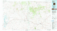
 2023 Lobo Hill2023 Print · USGSTorrance County’s high-desert landscape comes into focus in this contemporary survey of the area surrounding Moriarty. Genealogists and local historians can trace the development of rural subdivisions and drainage features like Lobo Hill and Salt Draw.
End of results
Showing maps 1-10 of 10
Top cities near Estancia Ranchettes
- Edgewood historical maps
- Moriarty historical maps
- Estancia historical maps
- Johnny's Place historical maps
Frequently asked questions
- What are the different types of historical maps available for Estancia Ranchettes?
- What is the oldest map of Estancia Ranchettes?
- Where can I purchase historical maps of Estancia Ranchettes for my home or office?
- Where can I download high-res historical maps of Estancia Ranchettes?
- Are there historical topographic maps available for Estancia Ranchettes?
- Is there historical aerial imagery available for Estancia Ranchettes?
- Where are historical maps of Estancia Ranchettes sourced from?