Old Maps of Conquest, New York for Metal Detecting
Plan your next treasure hunt with 34 historic maps of Conquest. Find old homesites, ghost towns, trails, and gathering spots that may be lost to time — perfect for identifying promising metal detecting locations.
- Locate forgotten sites: Uncover places like long-lost settlements, abandoned rail lines, or gathering spots.
- Plan better hunts: Use map overlays combined with LiDAR or satellite views to narrow in on historically rich areas.
- Made for detectorists: Thousands of hobbyists use these maps to discover relics, coins, and hidden history.
Use these historic maps to boost your research and find new opportunities beneath the surface of Conquest.
Conquest, NY maps
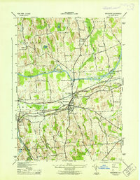
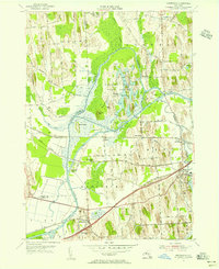
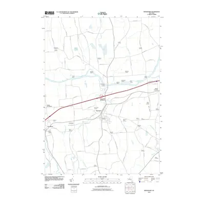
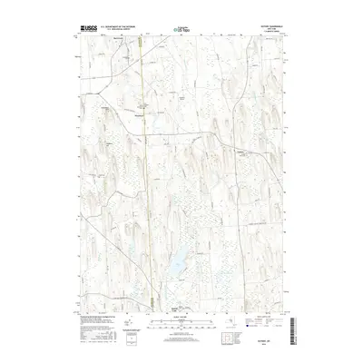
(34)- 1902 Map of Weedsport
 1902 Weedsport1902 Print · USGSCentral New York at the turn of the century reveals a landscape shaped by the Erie Canal and a dense network of early railroads. Genealogists and historians can trace the foundations of Weedsport and Port Byron, or locate landmarks like the Brick Church and the Canal Basin at Montezuma.10 unique versions available
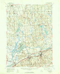
 - 1943 Map of Montezuma
 1943 Montezuma1943 Print · USGSThe Cayuga County marshlands are captured here during the Second World War as the region’s massive river and canal systems were being managed for conservation. You can trace the early path of the Erie Canal (Abandoned) or find family sites near Port Byron and Murray Cem.
 - 1943 Map of Cato
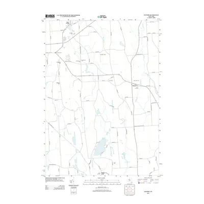
 1943 Cato1943 Print · USGSNorthwestern Cayuga County in the 1940s shows a landscape of drumlins and dairy farms centered on the village of Cato. Researchers can trace the path of the Lehigh Valley railroad and find historic local sites like Union Hill Cem and School No 9.
 - 1943 Map of Weedsport
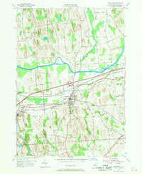
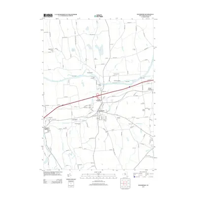
 1943 Weedsport1943 Print · USGSMid-century Cayuga County is defined by its deep layering of transport history as the modern Barge Canal replaces the original Erie route. Researchers can trace the transition between eras at the Weedsport Canal Terminal and the Erie Canal (Abandoned), or locate family sites like La Due Cem and Brick Church.
 - 1943 Map of Red Creek
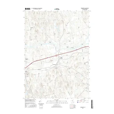
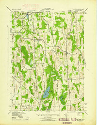 1943 Red Creek1943 Print · USGSUpper New York state during the early 1940s shows a landscape of small farming hamlets and rural school districts along the Wayne and Cayuga county line. Researchers can trace historic cemeteries like French Cem, early landmarks like the Airport, and old district schoolhouses.
 - 1954 Map of Cato, 1955 Print
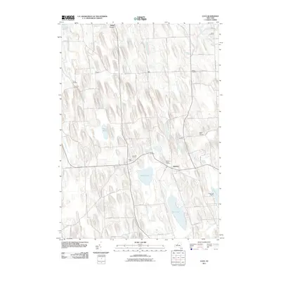
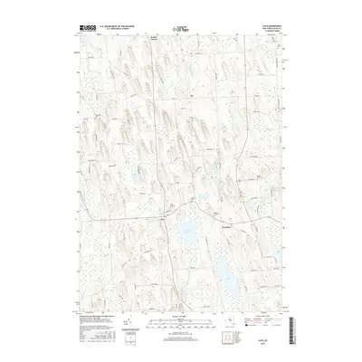
 1954 Cato1955 Print · USGSMid-century Cayuga County is defined by its unique glacial topography and the growing rural hubs of Cato and Meridian. You can trace old family property lines along Brandt Road or find the White Cem and Cato-Meridian Central School.3 unique versions available
 - 1954 Map of Weedsport, 1956 Print
 1954 Weedsport1956 Print · USGSMid-century Cayuga County is defined by its transit corridors, where the New York State Thruway meets older rail lines and canal beds. You can trace family roots at Weedsport Rural Cem or locate former landmarks like the Arthur Gates Sch and the Weedsport Canal Terminal.4 unique versions available
 - 1954 Map of Montezuma, 1956 Print
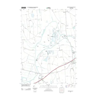
 1954 Montezuma1956 Print · USGSThe Seneca River and Erie Canal corridors are captured here in the mid-fifties, just as the New York State Thruway began to reshape the region. Trace local history through Port Byron, Willow Grove, and the wetlands of the Montezuma National Wildlife Refuge.3 unique versions available
 - 1954 Map of Victory, 1956 Print
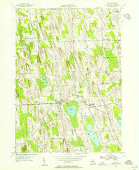
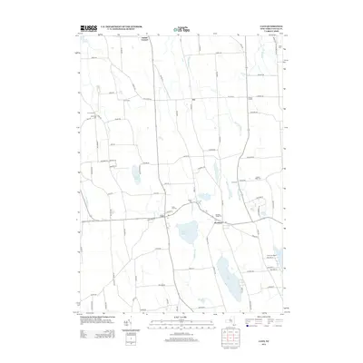
 1954 Victory1956 Print · USGSThe rural border of Wayne and Cayuga counties is captured here in the mid-fifties, showing a landscape shaped by glacial drumlins. Researchers can locate the Schuler Farms Landing Field, several rural cemeteries like French Cem, and the waters of Duck Lake.
 - 1954 Map of Weedsport, 1961 Print
 1954 Weedsport1961 Print · USGSMid-century Cayuga County is captured here as the new thruway begins to reshape the historic canal and rail corridor. Researchers can trace the legacy of the Erie Canal and New York Central through Port Byron, or locate family landmarks like Brick Ch and Schuler Farms Airfield.3 unique versions available
 - 1960 Map of Rochester
 1960 Rochester1960 Print · USGSThe Lake Ontario shoreline in the late fifties was a bustling corridor of rail and water commerce. Genealogists and historians can trace the path of the New York Central through canal towns like Newark or explore the coastal landmarks around Sackets Harbor.2 unique versions available
 - 1961 Map of Rochester, 1973 Print
 1961 Rochester1973 Print · USGSThe Lake Ontario shoreline and Finger Lakes frontier are shown here at the height of the mid-century infrastructure boom. Genealogists and historians can trace the rail-and-road evolution from Sackets Harbor down to the New York State Thruway, passing through centers like Pulaski and Adams Center.3 unique versions available
 - 1965 Map of Rochester
 1965 Rochester1965 Print · USGSUpstate New York's industrial heartland is captured here during a period of significant growth between the Great Lakes and the Finger Lakes. Genealogists and historians can trace the evolution of canal towns and rail hubs from Rochester to Syracuse, noting features like the Erie Canal and the New York State Thruway.
 - 1985 Map of Syracuse
 1985 Syracuse1985 Print · USGSCentral New York in the mid-eighties shows a landscape of established canal towns and growing metropolitan suburbs linked by rail and water. Researchers can trace the path of the Erie Canal, find the boundaries of Montezuma Marsh, and locate regional landmarks like Oneida Lake and Chimney Bluffs.3 unique versions available
 - 2010 Map of Victory, 2010 Print
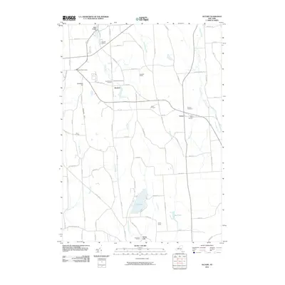 2010 Victory2010 Print · USGSCovers Conquest, including Wolcott, Sterling, and other nearby areas
 - 2010 Map of Montezuma, 2010 Print
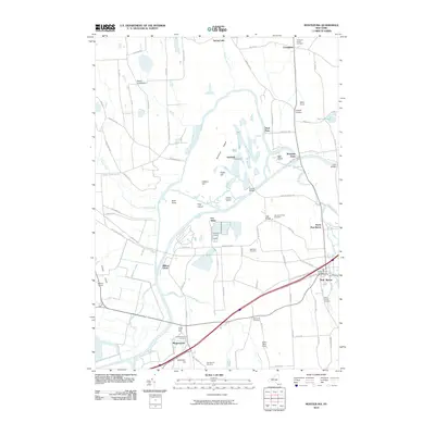 2010 Montezuma2010 Print · USGSCovers Conquest, including Mentz, Throop, and other nearby areas
 - 2010 Map of Weedsport, 2010 Print
 2010 Weedsport2010 Print · USGSCovers Conquest, including Brutus, Sennett, and other nearby areas
 - 2011 Map of Cato, 2011 Print
 2011 Cato2011 Print · USGSCovers Conquest, including Cato, Ira, and other nearby areas
 - 2013 Map of Montezuma, 2013 Print
 2013 Montezuma2013 Print · USGSCovers Conquest, including Mentz, Throop, and other nearby areas
 - 2013 Map of Victory, 2013 Print
 2013 Victory2013 Print · USGSCovers Conquest, including Wolcott, Sterling, and other nearby areas
 - 2013 Map of Cato, 2013 Print
 2013 Cato2013 Print · USGSCovers Conquest, including Cato, Ira, and other nearby areas
 - 2013 Map of Weedsport, 2013 Print
 2013 Weedsport2013 Print · USGSCovers Conquest, including Brutus, Sennett, and other nearby areas
 - 2016 Map of Cato, 2016 Print
 2016 Cato2016 Print · USGSCovers Conquest, including Cato, Ira, and other nearby areas
 - 2016 Map of Weedsport, 2016 Print
 2016 Weedsport2016 Print · USGSCovers Conquest, including Brutus, Sennett, and other nearby areas
 - 2016 Map of Victory, 2016 Print
 2016 Victory2016 Print · USGSCovers Conquest, including Wolcott, Sterling, and other nearby areas
Showing maps 1-25 of 34
Top cities near Conquest
- Auburn historical maps
- Lysander historical maps
- Van Buren historical maps
- Fulton historical maps
- Seneca Falls historical maps
- Waterloo historical maps
See more
Top neighborhoods of Conquest
Frequently asked questions
- What are the different types of historical maps available for Conquest?
- What is the oldest map of Conquest?
- Where can I purchase historical maps of Conquest for my home or office?
- Where can I download high-res historical maps of Conquest?
- Are there historical topographic maps available for Conquest?
- Is there historical aerial imagery available for Conquest?
- Where are historical maps of Conquest sourced from?