1940s Maps of Locke, New York
Explore 6 historic maps of Locke from the 1940s. These maps offer a rare glimpse into what life looked like during the 1940s — showing old roads, neighborhoods, homes, and landmarks that have changed or disappeared over time.
Whether you're researching your family's past, planning a metal detecting trip, or studying how Locke's landscape evolved across the 1940s, these high-resolution maps are a powerful tool for exploring the history of this region.
- Focus on a specific era: All maps on this page are from the 1940s, giving you a focused view of this time period.
- See what’s changed: Compare century-old streets, trails, and buildings to today's modern landscape using overlays and satellite layers.
- Research with precision: Use these maps for genealogy, historical research, land use analysis, or educational projects.
- View, download, or print: Maps are fully viewable online in high resolution, and can be downloaded or printed for your own records.
Start exploring Locke's history through authentic maps from the 1940s. This is your window into the past.
Locke, NY maps
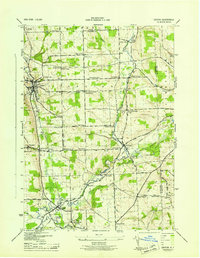
(6)- 1942 Map of Groton, 1956 Print
 1942 Groton1956 Print · USGSTompkins County rural life is captured here during the early war years, showing a landscape defined by small hamlets and a remarkable number of local schools. Trace the old Lehigh Valley rail line and locate landmarks like the George Junior Republic or Red Mills.2 unique versions available
 - 1943 Map of Moravia
 1943 Moravia1943 Print · USGSSouthern Cayuga County's valley farms and steep ravines are captured here in the early 1940s, centered on the village of Moravia. Genealogists can trace family connections through numerous landmarks like Baker Cem, Wilson Corners, and a dozen district schools including School No 9.3 unique versions available
 - 1943 Map of West Groton
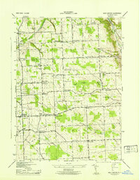 1943 West Groton1943 Print · USGSTompkins County was a landscape of close-knit farming hamlets and rural school districts in the years before mid-century. Genealogists can trace family names through landmarks like Munson Corner, the North Lansing Cem, and the path of the Lehigh Valley RR.3 unique versions available
 - 1943 Map of Groton
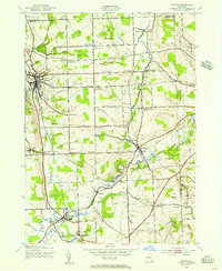
 1943 Groton1943 Print · USGSTompkins County during the 1940s is mapped here in detail, showing a landscape of established dairy farms and rail-dependent villages. Genealogists can trace family land via numerous crossroads like Jones Corners and find old schoolhouses including the Mud Schoolhouse Corners.
 - 1943 Map of Sempronius, 1953 Print
 1943 Sempronius1953 Print · USGSThe rural uplands of Cayuga County come alive in this wartime survey of the Finger Lakes region. Genealogists and local historians can locate several district schools and family landmarks like Morse Mill, Lake Como, and Sand Hill Cem.2 unique versions available
 - 1949 Map of Moravia
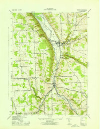
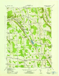
 1949 Moravia1949 Print · USGSThe Finger Lakes uplands around Moravia and Locke are shown here in the late 1940s as a landscape of rural schoolhouses and valleys. Researchers can trace the Lehigh Valley rail line and locate ancestral sites like St Patricks Ch or the Monaghan Cem.
End of results
Showing maps 1-6 of 6
Top cities near Locke
- Ithaca historical maps
- Ithaca historical maps
- Cortland historical maps
- Dryden historical maps
- Lansing historical maps
- Cortlandville historical maps
See more
Top neighborhoods of Locke
Frequently asked questions
- What are the different types of historical maps available for Locke?
- What is the oldest map of Locke?
- Where can I purchase historical maps of Locke for my home or office?
- Where can I download high-res historical maps of Locke?
- Are there historical topographic maps available for Locke?
- Is there historical aerial imagery available for Locke?
- Where are historical maps of Locke sourced from?