1940s Maps of Gerry, New York
Explore 4 historic maps of Gerry from the 1940s. These maps offer a rare glimpse into what life looked like during the 1940s — showing old roads, neighborhoods, homes, and landmarks that have changed or disappeared over time.
Whether you're researching your family's past, planning a metal detecting trip, or studying how Gerry's landscape evolved across the 1940s, these high-resolution maps are a powerful tool for exploring the history of this region.
- Focus on a specific era: All maps on this page are from the 1940s, giving you a focused view of this time period.
- See what’s changed: Compare century-old streets, trails, and buildings to today's modern landscape using overlays and satellite layers.
- Research with precision: Use these maps for genealogy, historical research, land use analysis, or educational projects.
- View, download, or print: Maps are fully viewable online in high resolution, and can be downloaded or printed for your own records.
Start exploring Gerry's history through authentic maps from the 1940s. This is your window into the past.
Gerry, NY maps
(4)- 1941 Map of Cherry Creek
 1941 Cherry Creek1941 Print · USGSChautauqua and Cattaraugus counties are captured here at the dawn of the 1940s, when the Erie railroad still bound these rural townships together. Genealogists can trace family footprints through numerous small villages like Forestville, South Dayton, and Charlotte Center.
 - 1941 Map of Chautauqua
 1941 Chautauqua1941 Print · USGSChautauqua Lake was a bustling hub of rail and water travel in the early 1940s. Genealogists and local historians can trace family-named sites like Starr Farm and Jones Corners alongside the path of the Chautauqua Traction Co.
 - 1942 Map of Jamestown
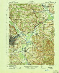 1942 Jamestown1942 Print · USGSJamestown and the Chautauqua County interior are captured here in the early 1940s, showing a landscape defined by industry and deep-set river valleys. Genealogists can trace family roots in old settlements like Frewsburg, Gerry, and the Rutledge Conewango PO.
 - 1943 Map of Dunkirk
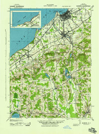 1943 Dunkirk1943 Print · USGSCoastal industry and rural spiritualist retreats meet in Chautauqua County during the early 1940s. Genealogists and historians can trace the rail corridors of the Nickel Plate and find local landmarks like Lily Dale, Cushing (PO), and the County Hospital.3 unique versions available
End of results
Showing maps 1-4 of 4
Top cities near Gerry
- Jamestown historical maps
- Pomfret historical maps
- Fredonia historical maps
- Ellicott historical maps
- Busti historical maps
- Hanover historical maps
See more
Top neighborhoods of Gerry
Frequently asked questions
- What are the different types of historical maps available for Gerry?
- What is the oldest map of Gerry?
- Where can I purchase historical maps of Gerry for my home or office?
- Where can I download high-res historical maps of Gerry?
- Are there historical topographic maps available for Gerry?
- Is there historical aerial imagery available for Gerry?
- Where are historical maps of Gerry sourced from?