Old Maps of Portland, New York
Explore 31 old maps of Portland, spanning from 1899 to today. These high-resolution historic maps reveal how streets, neighborhoods, landmarks, and natural features evolved over time — perfect for genealogy, metal detecting, research, and local history exploration.
What you can do with these maps:
- See how Portland changed over time: Compare historical maps to modern-day views to trace roads, homesites, rail lines & more.
- View detailed metadata: Each map includes creators, publishers, year, scale, and archive source.
- Overlay maps with satellite & LiDAR: Visualize the past alongside modern tools to explore terrain & human change.
- Trusted historical sources: Maps sourced from the USGS, Library of Congress, and other archives.
- Access maps your way: View online, download high-res files, or order prints for personal or research use.
Start exploring old maps of Portland to uncover forgotten places, hidden landmarks, and the deep history beneath your feet.
Portland, NY maps
(31)- 1899 Map of Westfield
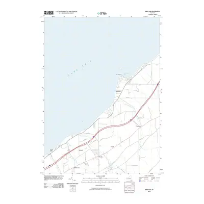
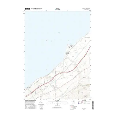
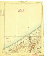 1899 Westfield1899 Print · USGSThe Lake Erie shoreline and the village of Westfield are captured here at the close of the nineteenth century, when railroads dominated the Chautauqua County landscape. Trace the parallel routes of the Lake Shore and Michigan Southern R. R. and find local stops like Prospect Sta. and Barcelona.6 unique versions available
 - 1900 Map of Dunkirk
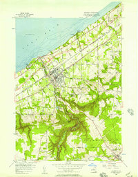
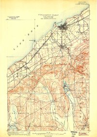 1900 Dunkirk1900 Print · USGSThe Lake Erie shoreline and Chautauqua hills are shown here in the late nineteenth century during a peak era of railroad expansion. Genealogists can trace early post offices like Van Buren (Cushing P.O.) and established towns such as Fredonia and Brocton.6 unique versions available
 - 1943 Map of Dunkirk
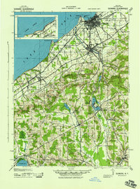 1943 Dunkirk1943 Print · USGSCoastal industry and rural spiritualist retreats meet in Chautauqua County during the early 1940s. Genealogists and historians can trace the rail corridors of the Nickel Plate and find local landmarks like Lily Dale, Cushing (PO), and the County Hospital.3 unique versions available
 - 1954 Map of Brocton, 1956 Print
 1954 Brocton1956 Print · USGSThe Chautauqua County shoreline was in a state of rapid change during the mid-fifties as the Thruway cut through established farmland. Researchers can trace family roots through the Pecor Cem or locate vintage landmarks like the Drive-in Theater and Van Buren Sch.2 unique versions available
 - 1954 Map of Hartfield, 1956 Print
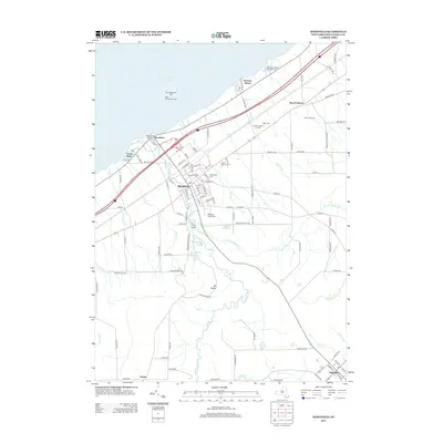
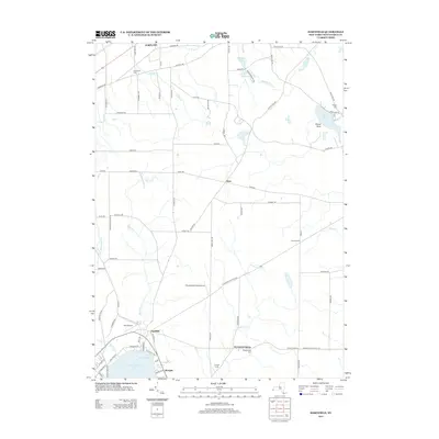
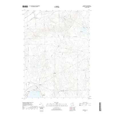
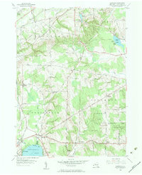 1954 Hartfield1956 Print · USGSMid-century Chautauqua County is captured here at the head of the lake, showing the rural crossroads and rail lines that connected these upland farms. Genealogists can trace family sites near Evergreen Cem, Coes Corners, and the Howard Hill Ch.2 unique versions available
 - 1954 Map of Westfield, 1957 Print
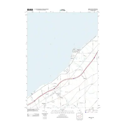
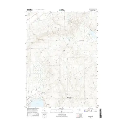
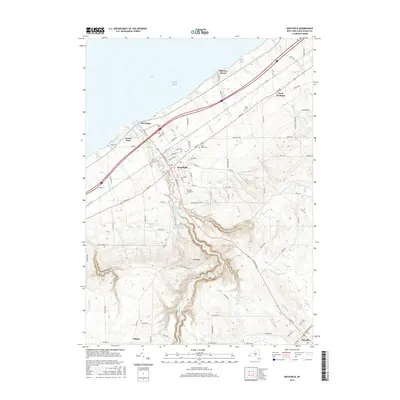
 1954 Westfield1957 Print · USGSWestfield and the Chautauqua lakefront are captured here in the mid-fifties, just as the New York State Thruway was being carved through the landscape. Genealogists and local historians can locate the Old St James Cemetery, the Drive-in Theater, and the lakeside docks at Barcelona.5 unique versions available
 - 1960 Map of Buffalo
 1960 Buffalo1960 Print · USGSWestern New York and the Niagara Peninsula thrive during the mid-twentieth century industrial peak. Genealogists and historians can trace family-named points and early settlements from Dunkirk Light to the Allegany Indian Reservation.
 - 1962 Map of Buffalo, 1980 Print
 1962 Buffalo1980 Print · USGSThe Niagara Frontier and Western New York are captured here in the early sixties, showing the vital industrial and maritime nexus between the U.S. and Canada. Researchers can trace the path of the Welland Canal, locate the Allegany Indian Reservation, or find family sites near Chautauqua Lake.2 unique versions available
 - 1967 Map of Buffalo
 1967 Buffalo1967 Print · USGSWestern New York and the Lake Erie shoreline are shown here during the mid-1960s industrial peak. Researchers can trace the massive rail networks of the Erie Railroad, locate the Cattaraugus Indian Reservation, or find historic sites like Fort Erie.
 - 1973 Map of Buffalo
 1973 Buffalo1973 Print · USGSWestern New York and Ontario's Golden Horseshoe meet in the early seventies, spanning from the industrial waterfronts of Buffalo to the hills of Allegany State Park. Trace the paths of the Welland Canal and Erie Lackawanna railroad through the lakefront towns of Dunkirk and Port Colborne.
 - 1986 Map of Jamestown
 1986 Jamestown1986 Print · USGSChautauqua County and the Lake Erie shoreline are captured in the mid-eighties as the region balanced its industrial rail hubs with lakeside culture. Local historians can trace the grounds of the Chautauqua Institution, the expansion of Jamestown, and rural landmarks like Sunset Hill Cemetery.2 unique versions available
 - 2010 Map of Hartfield, 2010 Print
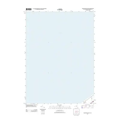
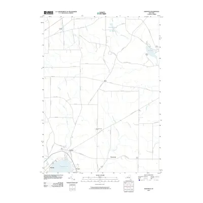 2010 Hartfield2010 Print · USGSCovers Portland, including Pomfret, Chautauqua, and other nearby areas
 - 2010 Map of Westfield, 2010 Print
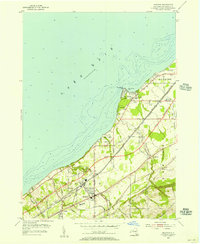
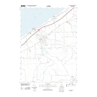 2010 Westfield2010 Print · USGSCovers Portland, including Westfield, Chautauqua, and other nearby areas
 - 2010 Map of Brocton, 2010 Print
 2010 Brocton2010 Print · USGSCovers Portland, including Pomfret, Brocton, and other nearby areas
 - 2010 Map of Westfield OE N, 2010 Print
 2010 Westfield OE N2010 Print · USGSCovers Portland, including Chautauqua County, United States, and other nearby areas
 - 2013 Map of Brocton, 2013 Print
 2013 Brocton2013 Print · USGSCovers Portland, including Pomfret, Brocton, and other nearby areas
 - 2013 Map of Westfield, 2013 Print
 2013 Westfield2013 Print · USGSCovers Portland, including Westfield, Chautauqua, and other nearby areas
 - 2013 Map of Westfield OE N, 2013 Print
 2013 Westfield OE N2013 Print · USGSCovers Portland, including Chautauqua County, United States, and other nearby areas
 - 2013 Map of Hartfield, 2013 Print
 2013 Hartfield2013 Print · USGSCovers Portland, including Pomfret, Chautauqua, and other nearby areas
 - 2016 Map of Hartfield, 2016 Print
 2016 Hartfield2016 Print · USGSCovers Portland, including Pomfret, Chautauqua, and other nearby areas
 - 2016 Map of Brocton, 2016 Print
 2016 Brocton2016 Print · USGSCovers Portland, including Pomfret, Brocton, and other nearby areas
 - 2016 Map of Westfield, 2016 Print
 2016 Westfield2016 Print · USGSCovers Portland, including Westfield, Chautauqua, and other nearby areas
 - 2016 Map of Westfield OE N, 2016 Print
 2016 Westfield OE N2016 Print · USGSCovers Portland, including Chautauqua County, United States, and other nearby areas
 - 2019 Map of Hartfield, 2019 Print
 2019 Hartfield2019 Print · USGSCovers Portland, including Pomfret, Chautauqua, and other nearby areas
 - 2019 Map of Westfield OE N, 2019 Print
 2019 Westfield OE N2019 Print · USGSCovers Portland, including Chautauqua County, United States, and other nearby areas
Showing maps 1-25 of 31
Top cities near Portland
- Pomfret historical maps
- Dunkirk historical maps
- Fredonia historical maps
- Ellicott historical maps
- Westfield historical maps
- Ellery historical maps
See more
Top neighborhoods of Portland
- Van Buren Point historical maps
- Green Hills historical maps
- Vineyard historical maps
- Greencrest historical maps
- West Portland historical maps
- Brocton historical maps
Frequently asked questions
- What are the different types of historical maps available for Portland?
- What is the oldest map of Portland?
- Where can I purchase historical maps of Portland for my home or office?
- Where can I download high-res historical maps of Portland?
- Are there historical topographic maps available for Portland?
- Is there historical aerial imagery available for Portland?
- Where are historical maps of Portland sourced from?