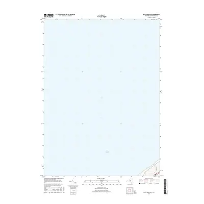
2016 Map of Westfield OE N
USGS Topo · Published 2016About this map
Lake Erie dominates this offshore survey, capturing the expanse of the lake waters north of the Chautauqua County shoreline. The map focuses primarily on the maritime environment and the hydrographic characteristics of the lake, providing a clear view of the water's edge and the immediate coastal approach. On the very southeastern edge of the sheet, the terrain begins to rise toward the shoreline, where E Forest Ave makes a brief appearance in the corner. This specific perspective illustrates the transition from the deep waters of the lake to the residential and wooded fringes of Portland, New York, reflecting the coastal infrastructure as it existed in 2016.
Find a feature on this map
3 named features on this map. Tap any name to fly to it.
Don’t see what you’re looking for? This feature index may not catch every label — zoom into the map to look around manually.
Map Details
Editions of this 2016 Westfield OE N Map
This is the sole edition of this map. No revisions or reprints were ever made.
Other maps of this area

1899 · Westfield
USGS Topo · 1:62,500

1900 · Dunkirk
USGS Topo · 1:62,500

1943 · Dunkirk
USGS Topo · 1:62,500
1954 · Brocton
USGS Topo · 1:24,000
1954 · Hartfield
USGS Topo · 1:24,000

1954 · Ripley
USGS Topo · 1:24,000
1954 · Westfield
USGS Topo · 1:24,000

1960 · Buffalo
USGS Topo · 1:250,000

1962 · Buffalo
USGS Topo · 1:250,000

1967 · Buffalo
USGS Topo · 1:250,000