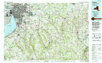
1967 Map of Buffalo
USGS Topo · Published 1967About this map
The industrial and transportation hub of Buffalo anchors this regional overview, showing the city's complex network of rails and waterways during the mid-1960s. The convergence of the New York Central, Erie Railroad, and Baltimore & Ohio RR highlights the importance of the rail economy, while the Welland Canal and Buffalo Harbor emphasize the maritime significance of Lake Erie. Moving south and west, the landscape transitions from the urban density of Cheektowaga and Lackawanna to the expansive Cattaraugus Indian Reservation and the southern highlands near Jamestown.
Find a feature on this map
87 named features on this map. Tap any name to fly to it.
Don’t see what you’re looking for? This feature index may not catch every label — zoom into the map to look around manually.
Map Details
Editions of this 1967 Buffalo Map
This is the sole edition of this map. No revisions or reprints were ever made.
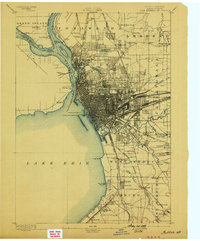
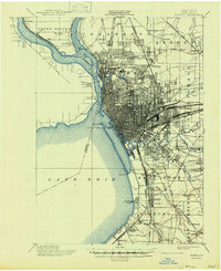
Historical Maps of Buffalo Through Time
8 maps found