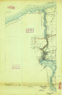
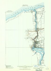
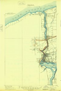
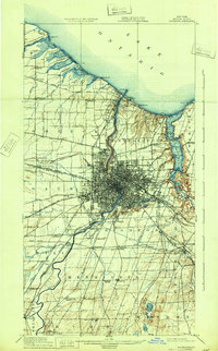
1894 Map of Niagara Falls
USGS Topo · Published 1894About this map
The Niagara River serves as the dominant axis for this late-19th-century survey, detailing the international border between New York and the Dominion of Canada. The map documents a period of significant industrial and transit growth, highlighted by the intricate rail networks of the Michigan Central R. R. and the Niagara Construction Company R. R. crossing the landscape. At the center of this activity is Suspension Bridge, a critical junction where the river's narrow gorge meets a complex web of steel and steam.
Find a feature on this map
46 named features on this map. Tap any name to fly to it.
Don’t see what you’re looking for? This feature index may not catch every label — zoom into the map to look around manually.
Map Details
Editions of this 1894 Niagara Falls Map
This is the sole edition of this map. No revisions or reprints were ever made.
Historical Maps of Niagara Falls Through Time
10 maps found