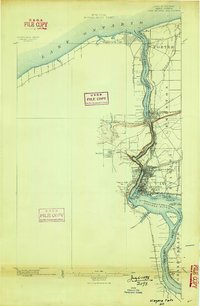
1896 Map of Niagara Falls
USGS Topo · Published 1898About this map
Niagara River serves as the dominant geographic and political spine of this survey, defining the international border between the United States and the Dominion of Canada. The 1890s landscape is remarkably industrial and transit-heavy, centered on the concentration of power and movement near the falls. A complex web of rail infrastructure, including the New York Central and Hudson River R. R. and the Michigan Central R. R., converges at the Suspension Bridge crossing, illustrating the era's reliance on these iron arteries for binational commerce.
Find a feature on this map
45 named features on this map. Tap any name to fly to it.
Don’t see what you’re looking for? This feature index may not catch every label — zoom into the map to look around manually.
Map Details
Editions of this 1896 Niagara Falls Map
2 editions found
Other maps of this area

1894 · Buffalo
USGS Topo · 1:62,500

1894 · Niagara Falls
USGS Topo · 1:62,500

1894 · Wilson
USGS Topo · 1:62,500

1896 · Niagara Falls
USGS Topo · 1:62,500

1897 · Tonawanda
USGS Topo · 1:62,500

1899 · Niagara
USGS Topo · 1:125,000

1900 · Wilson
USGS Topo · 1:62,500

1900 · Tonawanda
USGS Topo · 1:62,500

1900 · Niagara Falls
USGS Topo · 1:62,500

1901 · Buffalo
USGS Topo · 1:62,500