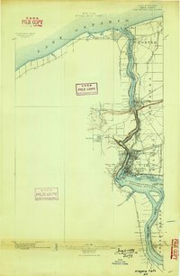
1900 Map of Niagara Falls
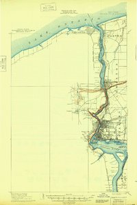
USGS Topo · Published 1961About this map
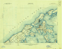
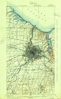
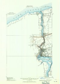
The Niagara River serves as the focal point of this international border survey, captured during a period of significant industrial and hydroelectric development. The river's dramatic descent is punctuated by the Whirlpool and Goat Id., while the twin cities of Niagara Falls and Niagara Falls Ont. sit at the center of a dense network of rail infrastructure. The map reveals the early importance of power and transit, featuring the Niagara Construction Company R. R. and the Suspension Bridge crossing. Military history is well-represented at the mouth of Lake Ontario by Fort Niagara and Fort Massassauga, marking the entrance to the waterway. Inland, the transition from maritime and industrial hubs to the townships of Porter and Lewiston is traced through creek systems like Fourmile Cr. and the sprawling lines of the Michigan Central R. R.
Find a feature on this map
45 named features on this map. Tap any name to fly to it.
Don’t see what you’re looking for? This feature index may not catch every label — zoom into the map to look around manually.
Map Details
Editions of this 1900 Niagara Falls Map
4 editions found
Historical Maps of Niagara Falls Through Time
10 maps found