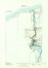
1900 Map of Niagara Falls
USGS Topo · Published 1965About this map
The Niagara River serves as the focal point of this late 19th-century survey, detailing the international corridor between New York and the Dominion of Canada. The map documents the immense infrastructure surrounding the cataract, including the concentration of rails such as the N. Y. C. & H. R. R. R. and the Suspension Bridge crossing. Strategic military sites guard the mouth of the river at Lake Ontario, specifically Fort Niagara on the American side and Fort Massassauga on the Canadian shore.
Find a feature on this map
48 named features on this map. Tap any name to fly to it.
Don’t see what you’re looking for? This feature index may not catch every label — zoom into the map to look around manually.
Map Details
Editions of this 1900 Niagara Falls Map
4 editions found
Other maps of this area

1894 · Buffalo
USGS Topo · 1:62,500

1894 · Niagara Falls
USGS Topo · 1:62,500

1894 · Wilson
USGS Topo · 1:62,500

1896 · Niagara Falls
USGS Topo · 1:62,500

1897 · Tonawanda
USGS Topo · 1:62,500

1899 · Niagara
USGS Topo · 1:125,000

1900 · Wilson
USGS Topo · 1:62,500

1900 · Tonawanda
USGS Topo · 1:62,500

1900 · Niagara Falls
USGS Topo · 1:62,500

1901 · Buffalo
USGS Topo · 1:62,500