
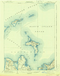
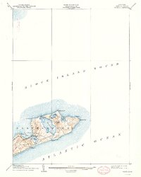
1921 Map of Gardiners Island
USGS Topo · Published 1921About this map
Gardiners Island and the surrounding maritime landscape of eastern Long Island are documented here during the early twentieth century. This tactical survey highlights the strategic importance of the area, featuring the coastal defenses at Fort Terry on Great Gull I. and the maritime navigation aid at Race Rock L.H. marking The Race. The map captures the intricate shoreline of Gardiners Bay, including the isolated settlements and landings of the eastern Easthampton coast such as Fireplace, Alberts Landing, and Quincetree Landing.
Find a feature on this map
53 named features on this map. Tap any name to fly to it.
Don’t see what you’re looking for? This feature index may not catch every label — zoom into the map to look around manually.
Map Details
Editions of this 1921 Gardiners Island Map
This is the sole edition of this map. No revisions or reprints were ever made.
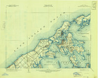
Historical Maps of East Hampton Through Time
10 maps found


Featured Locations
- East Hampton, NY
- Southold, NY
- Montauk, East Hampton
- Northwest Harbor, East Hampton
- Springs, East Hampton