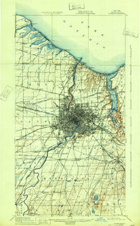
1920 Map of Rochester
USGS Topo · Published 1933About this map
The Genesee River cuts through the heart of Rochester in this early twentieth-century survey, revealing a landscape defined by industrial growth and shoreline recreation. Along the Lake Ontario coast, numerous beach resorts and points such as Ontario Beach, Windsor Beach, and Manitou Beach indicate the area's role as a regional retreat. The city itself is a hub of connectivity, where the Erie Canal and major rail lines like the New York Central and Hudson River R.R. converge near Lincoln Park.
Find a feature on this map
88 named features on this map. Tap any name to fly to it.
Don’t see what you’re looking for? This feature index may not catch every label — zoom into the map to look around manually.
Map Details
Editions of this 1920 Rochester Map
5 editions found

Other maps of this area

1895 · Rochester
USGS Topo · 1:62,500

1895 · Ontario Beach
USGS Topo · 1:62,500

1898 · Rochester
USGS Topo · 1:62,500

1899 · Hamlin
USGS Topo · 1:62,500

1899 · Ontario Beach
USGS Topo · 1:62,500

1899 · Brockport
USGS Topo · 1:62,500

1900 · Macedon
USGS Topo · 1:62,500

1900 · Canandaigua
USGS Topo · 1:62,500

1901 · Honeoye
USGS Topo · 1:62,500

1903 · Canandaigua
USGS Topo · 1:62,500