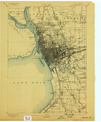
1962 Map of Buffalo
USGS Topo · Published 1980About this map
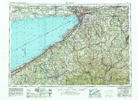
Lake Erie defines the western orientation of this region, serving as the gateway between the industrial hubs of New York and Ontario. In the early 1960s, the urban corridor from Buffalo and Cheektowaga south to Lackawanna reflects a landscape built on heavy transport, where the New York Central and Pennsylvania Railroad intersect with the New York State Thruway. To the north, the Welland Canal and Niagara River manage the flow of commerce around the falls, while to the south, the terrain rises into the Allegheny Plateau. This survey details the significant cultural presence of the Cattaraugus Indian Reservation and Allegany Indian Reservation, alongside large-scale natural preservation areas like Allegany State Park and Letchworth State Park. The map captures a moment when mid-century aviation infrastructure, such as the Greater Buffalo International Airport, was expanding alongside established institutional landmarks like the University of Buffalo.
Find a feature on this map
74 named features on this map. Tap any name to fly to it.
Don’t see what you’re looking for? This feature index may not catch every label — zoom into the map to look around manually.
Map Details
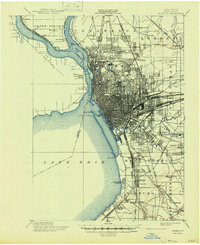
Editions of this 1962 Buffalo Map
2 editions found
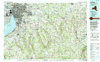
Historical Maps of Buffalo Through Time
8 maps found