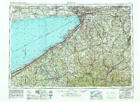
1962 Map of Buffalo
USGS Topo · Published 1980About this map
Industrial hubs and extensive state lands define this international border region along the eastern shores of Lake Erie. The 1960s landscape is anchored by the manufacturing and shipping centers of Buffalo and Lackawanna, with the Niagara River and Welland River serving as critical corridors for trade between the United States and Canada. Further south, the map illustrates the transition from the lake plains into the heavily wooded Allegheny Plateau, where the massive Allegany State Park and Letchworth State Park preserve significant reaches of the Allegheny River and Genesee River valleys. The sheet reveals a dense network of transit, from the New York State Thruway to legacy rail lines like the Erie RR and Baltimore & Ohio RR. Unique local landmarks such as Wainfleet Marsh and the Seneca Ordnance Depot provide specific points of interest for those tracking regional history or family connections in Western New York.
Find a feature on this map
107 named features on this map. Tap any name to fly to it.
Don’t see what you’re looking for? This feature index may not catch every label — zoom into the map to look around manually.
Map Details
Editions of this 1962 Buffalo Map
2 editions found

Other maps of this area

1894 · Buffalo
USGS Topo · 1:62,500

1894 · Niagara Falls
USGS Topo · 1:62,500

1896 · Niagara Falls
USGS Topo · 1:62,500

1897 · Tonawanda
USGS Topo · 1:62,500

1897 · Albion
USGS Topo · 1:62,500

1897 · Medina
USGS Topo · 1:62,500

1897 · Lockport
USGS Topo · 1:62,500

1898 · Olean
USGS Topo · 1:62,500

1899 · Westfield
USGS Topo · 1:62,500

1899 · Silver Creek
USGS Topo · 1:62,500