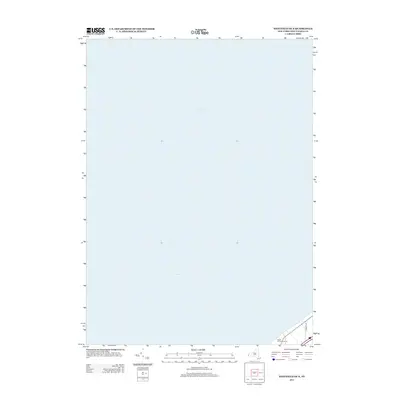
2013 Map of Westfield OE N
USGS Topo · Published 2013About this map
Lake Erie dominates this coastal survey, which primarily documents the open waters north of Chautauqua County. The map provides a focused view of the shoreline and maritime expanse during the early 21st century, capturing the area before it transitions into the more developed inland reaches of New York. On the thin strip of land at the southern edge, the Sugar Hill Golf Course represents local recreation and land use near the lakefront. This small pocket of terrestrial detail also shows the path of E Forest Ave, offering a specific point of reference for those studying the road network and property boundaries in this specific coastal corridor.
Find a feature on this map
3 named features on this map. Tap any name to fly to it.
Don’t see what you’re looking for? This feature index may not catch every label — zoom into the map to look around manually.
Map Details
Editions of this 2013 Westfield OE N Map
This is the sole edition of this map. No revisions or reprints were ever made.
Other maps of this area

1899 · Westfield
USGS Topo · 1:62,500

1900 · Dunkirk
USGS Topo · 1:62,500

1943 · Dunkirk
USGS Topo · 1:62,500
1954 · Brocton
USGS Topo · 1:24,000
1954 · Hartfield
USGS Topo · 1:24,000

1954 · Ripley
USGS Topo · 1:24,000
1954 · Westfield
USGS Topo · 1:24,000

1960 · Buffalo
USGS Topo · 1:250,000

1962 · Buffalo
USGS Topo · 1:250,000

1967 · Buffalo
USGS Topo · 1:250,000