Old Maps of Champlain, New York for Academic Research
Study the evolution of Champlain with 21 high-resolution historic maps. Whether you're teaching, researching, or modeling changes in land use, these maps provide essential visual documentation of urban, environmental, and geographic change.
- Analyze long-term change: Track patterns in development, transportation, and natural features.
- Ideal for environmental or urban studies: Support academic projects with primary historical map data.
- Use in the classroom or lab: Educators and researchers rely on these maps to bring historical context to life.
These maps are a powerful tool for teaching, research, and visualizing how Champlain has changed over the decades.
Champlain, NY maps
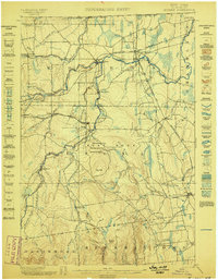
(21)- 1895 Map of Mooers
 1895 Mooers1895 Print · USGSCovers Champlain, including Beekmantown, Chazy, and other nearby areas
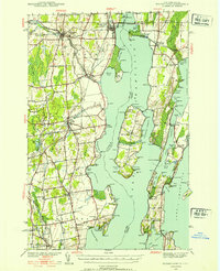
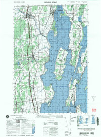
 - 1895 Map of Rouse Point
 1895 Rouse Point1895 Print · USGSCovers Champlain, including Plattsburgh, Beekmantown, and other nearby areas3 unique versions available
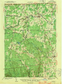
 - 1899 Map of Mooers
 1899 Mooers1899 Print · USGSCovers Champlain, including Beekmantown, Chazy, and other nearby areas6 unique versions available
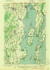
 - 1907 Map of Rouse Point
 1907 Rouse Point1907 Print · USGSCovers Champlain, including Plattsburgh, Beekmantown, and other nearby areas5 unique versions available
 - 1939 Map of Rouses Point
 1939 Rouses Point1939 Print · USGSCovers Champlain, including Plattsburgh, Beekmantown, and other nearby areas4 unique versions available
 - 1942 Map of Mooers, 1956 Print
 1942 Mooers1956 Print · USGSCovers Champlain, including Beekmantown, Chazy, and other nearby areas
 - 1943 Map of Mooers
 1943 Mooers1943 Print · USGSCovers Champlain, including Beekmantown, Chazy, and other nearby areas2 unique versions available
 - 1943 Map of Rouses Point
 1943 Rouses Point1943 Print · USGSCovers Champlain, including Plattsburgh, Beekmantown, and other nearby areas2 unique versions available
 - 1950 Map of Lake Champlain
 1950 Lake Champlain1950 Print · USGSCovers Champlain, including Burlington, South Burlington, and other nearby areas2 unique versions available
 - 1956 Map of Rouses Point, 1958 Print
 1956 Rouses Point1958 Print · USGSCovers Champlain, including Plattsburgh, Beekmantown, and other nearby areas2 unique versions available
 - 1956 Map of Mooers, 1958 Print
 1956 Mooers1958 Print · USGSCovers Champlain, including Beekmantown, Chazy, and other nearby areas3 unique versions available
 - 1958 Map of Lake Champlain
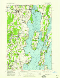
 1958 Lake Champlain1958 Print · USGSCovers Champlain, including Burlington, South Burlington, and other nearby areas2 unique versions available
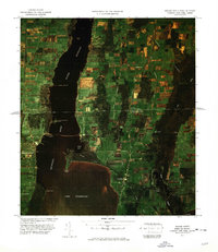
 - 1962 Map of Lake Champlain, 1975 Print
 1962 Lake Champlain1975 Print · USGSCovers Champlain, including Burlington, South Burlington, and other nearby areas3 unique versions available
 - 1966 Map of Rouses Point, 1968 Print
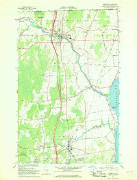
 1966 Rouses Point1968 Print · USGSCovers Champlain, including Chazy, Rouses Point, and other nearby areas
 - 1966 Map of Champlain, 1968 Print
 1966 Champlain1968 Print · USGSCovers Champlain, including Chazy, Rouses Point, and other nearby areas2 unique versions available
 - 1966 Map of Mooers, 1968 Print
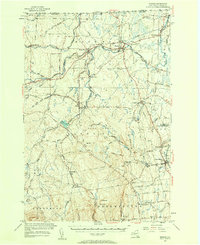
 1966 Mooers1968 Print · USGSCovers Champlain, including Chazy, Mooers, and other nearby areas
 - 1977 Map of Champlain Port of Entry, 1978 Print
 1977 Champlain Port of Entry1978 Print · USGSCovers Champlain, including Lacolle, Rouses Point, and other nearby areas
 - 1977 Map of Mooers Station, 1978 Print
 1977 Mooers Station1978 Print · USGSCovers Champlain, including Mooers, Mooers, and other nearby areas
 - 1977 Map of Rouses Point Port Of Entry, 1978 Print
 1977 Rouses Point Port Of Entry1978 Print · USGSCovers Champlain, including Lacolle, Rouses Point, and other nearby areas
 - 1986 Map of Lake Champlain North
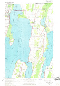
 1986 Lake Champlain North1986 Print · USGSCovers Champlain, including Burlington, South Burlington, and other nearby areas2 unique versions available
 - 2000 Map of Rouses Point
 2000 Rouses Point2000 Print · USGSCovers Champlain, including Plattsburgh, Beekmantown, and other nearby areas
End of results
Showing maps 1-21 of 21
Top cities near Champlain
- Plattsburgh historical maps
- Swanton historical maps
- Beekmantown historical maps
- Chazy historical maps
- Mooers historical maps
- Altona historical maps
See more
Top neighborhoods of Champlain
- Coopersville historical maps
- Perry Mills historical maps
- Rouses Point historical maps
- Champlain historical maps
Frequently asked questions
- What are the different types of historical maps available for Champlain?
- What is the oldest map of Champlain?
- Where can I purchase historical maps of Champlain for my home or office?
- Where can I download high-res historical maps of Champlain?
- Are there historical topographic maps available for Champlain?
- Is there historical aerial imagery available for Champlain?
- Where are historical maps of Champlain sourced from?