Old Maps of Taconic Shores, Copake for Hiking & Exploration
Hike through history with 21 historic maps of Taconic Shores. Explore old trails, ghost towns, and forgotten backroads — perfect for outdoor adventurers and local explorers.
- Rediscover forgotten places: Map out old mining camps, roads, and footpaths that no longer exist on modern maps.
- Layer with modern tools: Combine with LiDAR or satellite views to plan hikes through historical terrain.
- Made for exploration: Popular among hikers, overlanders, and local history lovers.
Use these maps to find adventure and explore the hidden past of Taconic Shores.
Taconic Shores, Copake maps
(21)- 1902 Map of Copake, 1954 Print
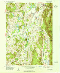
 1902 Copake1954 Print · USGSColumbia County at the turn of the century shows a landscape defined by industry and iron, before modern highways bypassed these hillside hamlets. Trace the rail-and-mine economy through Copake Ironworks, the Weed Mines, and the busy junction at Boston Corners.
 - 1904 Map of Copake
 1904 Copake1904 Print · USGSColumbia County at the turn of the century shows a landscape defined by deep-rooted industry and an extensive rail network. Researchers can trace the legacy of mining and milling at Ancram Leadmines, Weed Mines, and the Spaulding Furnace along the Roeliff Jansen Kill.7 unique versions available
 - 1948 Map of Albany, 1951 Print
 1948 Albany1951 Print · USGSThe Hudson and Connecticut River valleys are captured here in the late 1940s, showing the vital rail and water corridors of the Northeast. You can trace the Boston and Maine tracks past Mt Greylock or locate early settlements like Great Barrington and Bennington.
 - 1953 Map of Copake, 1955 Print
 1953 Copake1955 Print · USGSColumbia County at the dawn of the fifties shows a landscape of rail-connected hamlets and highland parks. Researchers can trace the old rail lines through Boston Corner and Whitehouse Crossing or locate family roots near West Copake Ch.4 unique versions available
 - 1953 Map of Hillsdale, 1955 Print
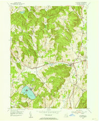 1953 Hillsdale1955 Print · USGSColumbia County at the mid-century reveals a landscape of high ridges and railroad-centered hamlets like Craryville and Hillsdale. Genealogists and local historians can trace the New York Central line and find rural landmarks like Drum Church and Williams Cem.3 unique versions available
 - 1956 Map of Albany, 1968 Print
 1956 Albany1968 Print · USGSThe industrial heart of the Northeast is revealed in the mid-1950s, from the Hudson Valley to the Connecticut River. Researchers can trace the legacy of the Quabbin Reservoir, locate Westover Air Force Base, or follow the Rutland RR through the Green Mountains.2 unique versions available
 - 1957 Map of Albany
 1957 Albany1957 Print · USGSThe Tri-State region and Connecticut River Valley are captured here during a period of significant postwar growth and infrastructure expansion. Genealogists and historians can trace the rail-and-river economy through landmarks like the Boston and Maine railroad, Quabbin Reservoir, and Westover Air Force Base.
 - 1959 Map of Albany
 1959 Albany1959 Print · USGSThe Hudson and Connecticut River valleys are captured here during the late fifties, showing the region's dense rail networks and massive water projects. Researchers can trace the New York State Thruway or locate local landmarks like Mt Greylock and the Quabbin Reservoir.
 - 1962 Map of Albany
 1962 Albany1962 Print · USGSThe Hudson and Connecticut River valleys meet the Green Mountains and Berkshires in this mid-century overview of the Northeast. Genealogists and historians can trace the industrial hearts of Albany and Springfield or locate features like Quabbin Reservoir and Westover Air Force Base.
 - 1980 Map of Hillsdale, 1981 Print
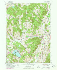 1980 Hillsdale1981 Print · USGSThe hills of Columbia County are captured here in the early eighties, showing a landscape defined by dairy country and growing summer retreats. Genealogists can locate family-named sites like Crum Cem and Collins Cem, or trace the New York Central rail line.
 - 1986 Map of Pittsfield
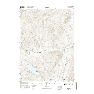
 1986 Pittsfield1986 Print · USGSThe Berkshires and the Hudson Valley meet in the mid-1980s, documenting a cross-border landscape of mountain forests and river towns. Genealogists and historians can trace the paths of Conrail and the Taconic State Parkway as they pass through Stockbridge, Great Barrington, and Kinderhook.2 unique versions available
 - 2010 Map of Copake, 2010 Print
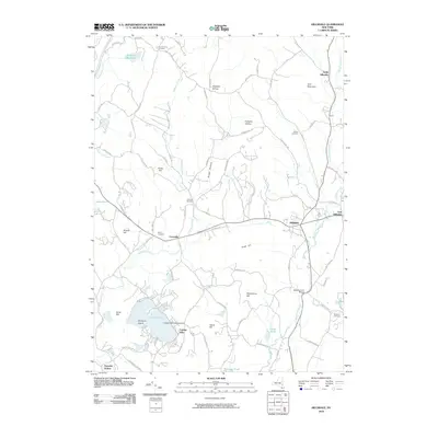
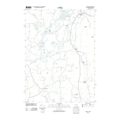 2010 Copake2010 Print · USGSCovers Taconic Shores, including Copake, North East, and other nearby areas
 - 2010 Map of Hillsdale, 2010 Print
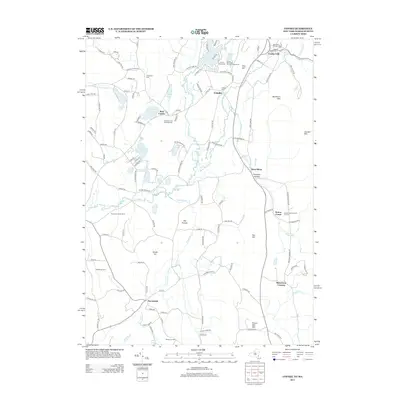
 2010 Hillsdale2010 Print · USGSCovers Taconic Shores, including Claverack, Copake, and other nearby areas
 - 2013 Map of Hillsdale, 2013 Print
 2013 Hillsdale2013 Print · USGSCovers Taconic Shores, including Claverack, Copake, and other nearby areas
 - 2013 Map of Copake, 2013 Print
 2013 Copake2013 Print · USGSCovers Taconic Shores, including Copake, North East, and other nearby areas
 - 2016 Map of Hillsdale, 2016 Print
 2016 Hillsdale2016 Print · USGSCovers Taconic Shores, including Claverack, Copake, and other nearby areas
 - 2016 Map of Copake, 2016 Print
 2016 Copake2016 Print · USGSCovers Taconic Shores, including Copake, North East, and other nearby areas
 - 2019 Map of Copake, 2019 Print
 2019 Copake2019 Print · USGSCovers Taconic Shores, including Copake, North East, and other nearby areas
 - 2019 Map of Hillsdale, 2019 Print
 2019 Hillsdale2019 Print · USGSCovers Taconic Shores, including Claverack, Copake, and other nearby areas
 - 2023 Map of Copake, 2023 Print
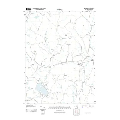
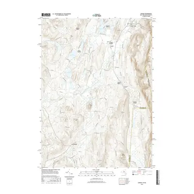
 2023 Copake2023 Print · USGSColumbia County’s eastern borderland comes alive in this survey, capturing the agricultural and industrial valley at the foot of the Taconic Range. Genealogists and historians can trace the roads to Boston Corner, locate the Weed Mines, or find family names near Ancramdale.
 - 2023 Map of Hillsdale, 2023 Print
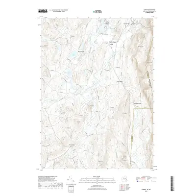
 2023 Hillsdale2023 Print · USGSColumbia County’s eastern uplands come into focus in this contemporary survey of the hills surrounding Craryville and East Hillsdale. Genealogists and local researchers can locate established sites like Krum Church Cemetery and Williams Cem or trace the drainage of the Roeliff Jansen Kill.
End of results
Showing maps 1-21 of 21
Top cities near Taconic Shores
- Great Barrington historical maps
- Claverack historical maps
- Hudson historical maps
- Ghent historical maps
- Lenox historical maps
- Greenport historical maps
See more
Frequently asked questions
- What are the different types of historical maps available for Taconic Shores?
- What is the oldest map of Taconic Shores?
- Where can I purchase historical maps of Taconic Shores for my home or office?
- Where can I download high-res historical maps of Taconic Shores?
- Are there historical topographic maps available for Taconic Shores?
- Is there historical aerial imagery available for Taconic Shores?
- Where are historical maps of Taconic Shores sourced from?