1940s Maps of Greenport, New York
Explore 4 historic maps of Greenport from the 1940s. These maps offer a rare glimpse into what life looked like during the 1940s — showing old roads, neighborhoods, homes, and landmarks that have changed or disappeared over time.
Whether you're researching your family's past, planning a metal detecting trip, or studying how Greenport's landscape evolved across the 1940s, these high-resolution maps are a powerful tool for exploring the history of this region.
- Focus on a specific era: All maps on this page are from the 1940s, giving you a focused view of this time period.
- See what’s changed: Compare century-old streets, trails, and buildings to today's modern landscape using overlays and satellite layers.
- Research with precision: Use these maps for genealogy, historical research, land use analysis, or educational projects.
- View, download, or print: Maps are fully viewable online in high resolution, and can be downloaded or printed for your own records.
Start exploring Greenport's history through authentic maps from the 1940s. This is your window into the past.
Greenport, NY maps
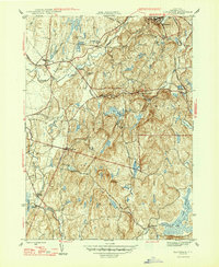
(4)- 1941 Map of Catskill, 1945 Print
 1941 Catskill1945 Print · USGSThe Hudson River valley at the start of the Second World War shows a landscape defined by historic estates and new river crossings. Genealogists and historians can trace the foundations of Bard College, locate the Birthplace of Robert Livingston, and explore early hamlets like Katsbaan and Cheviot.
 - 1947 Map of Claverack
 1947 Claverack1947 Print · USGSPost-war Columbia County comes to life in this survey of the hills and hamlets south of Ghent. Trace the legacy of family farms and early industry through the New York Central Railroad, Red Mills, and numerous district schools.3 unique versions available
 - 1948 Map of Albany, 1951 Print
 1948 Albany1951 Print · USGSThe Hudson and Connecticut River valleys are captured here in the late 1940s, showing the vital rail and water corridors of the Northeast. You can trace the Boston and Maine tracks past Mt Greylock or locate early settlements like Great Barrington and Bennington.
 - 1949 Map of Kinderhook
 1949 Kinderhook1949 Print · USGSColumbia County’s landscape is captured here during the post-war era, showing a region shaped by both rail-borne industry and early American history. Genealogists and historians can trace the Boston and Albany tracks to landmarks like the Martin Van Buren Homestead and the Ichabod Crane Sch.
End of results
Showing maps 1-4 of 4
Top cities near Greenport
- Saugerties historical maps
- Ulster historical maps
- Catskill historical maps
- Red Hook historical maps
- Coxsackie historical maps
- Kinderhook historical maps
See more
Top neighborhoods of Greenport
Frequently asked questions
- What are the different types of historical maps available for Greenport?
- What is the oldest map of Greenport?
- Where can I purchase historical maps of Greenport for my home or office?
- Where can I download high-res historical maps of Greenport?
- Are there historical topographic maps available for Greenport?
- Is there historical aerial imagery available for Greenport?
- Where are historical maps of Greenport sourced from?