Old Maps of Hillsdale, New York for Hiking & Exploration
Hike through history with 63 historic maps of Hillsdale. Explore old trails, ghost towns, and forgotten backroads — perfect for outdoor adventurers and local explorers.
- Rediscover forgotten places: Map out old mining camps, roads, and footpaths that no longer exist on modern maps.
- Layer with modern tools: Combine with LiDAR or satellite views to plan hikes through historical terrain.
- Made for exploration: Popular among hikers, overlanders, and local history lovers.
Use these maps to find adventure and explore the hidden past of Hillsdale.
Hillsdale, NY maps
(63)- 1885 Map of Sheffield
 1885 Sheffield1885 Print · USGSThe Berkshires meet the Connecticut and New York borders during a period of heavy rail expansion and riverside industry. Genealogists can trace family roots through settlements like Gomorrah, Sodom, and North Egremont, or locate landmarks such as Union Church and Ashley Falls.
 - 1888 Map of Sheffield
 1888 Sheffield1888 Print · USGSThe Housatonic Valley in the 1880s is captured here at the height of its rail-and-mill era, spanning the borderlands of Massachusetts and Connecticut. Researchers can trace the original routes of the Housatonic Railroad and locate community landmarks like Union Church and Twin Lakes Station.
 - 1888 Map of Pittsfield
 1888 Pittsfield1888 Print · USGSThe Berkshires and eastern New York meet in this late 19th-century record of a landscape defined by communal settlements and early industry. Genealogists and historians can trace the footprint of the Canaan Shakers, industrial sites at Richmond Furnace, and the early rail stops at Edwards Station.
 - 1890 Map of Pittsfield
 1890 Pittsfield1890 Print · USGSThe Berkshires and New York borderlands are captured here in the late nineteenth century, showing a landscape defined by communal Shaker life and iron works. Researchers can trace the Lebanon Springs Railroad through Lebanon Springs or locate early industrial hubs like Richmond Furnace and Lower Barkerville.
 - 1891 Map of Sheffield
 1891 Sheffield1891 Print · USGSThe Housatonic Valley in the 1890s reveals a bustling corridor of rail-and-river commerce at the foot of the Berkshire mountains. Genealogists and historians can trace Victorian-era settlements from Great Barrington to Sheffield, locating old landmarks like Union Church and Chapinville Station.
 - 1893 Map of Sheffield
 1893 Sheffield1893 Print · USGSThe Housatonic River valley flourished at the end of the century as a hub for rail and water-powered industry. Researchers can trace the path of the Housatonic Railroad through Great Barrington and locate landmarks like Union Church and Bashbish Falls.
 - 1893 Map of Pittsfield
 1893 Pittsfield1893 Print · USGSThe Berkshires and the New York border are captured here in the late nineteenth century, showing a landscape of Shaker communities and early industrial sites. Genealogists can trace family roots in Barkerville, Curtisville, and near the historic Richmond Furnace.
 - 1894 Map of Pittsfield
 1894 Pittsfield1894 Print · USGSThe Massachusetts and New York borderlands meet in the 1890s, where industrial villages and Shaker settlements thrive along the rail corridors. Genealogists and historians can trace family roots through communities like Canaan Shakers, Richmond Furnace, and Lower Barkerville.
 - 1897 Map of Pittsfield
 1897 Pittsfield1897 Print · USGSThe Berkshires and Columbia County come to life in the late nineteenth century as a hub of rail travel and communal living. Trace the historic Canaan Shakers settlement, find long-gone stops like Edwards Station, or study the industrial layout of Richmond Furnace.11 unique versions available
 - 1897 Map of Sheffield
 1897 Sheffield1897 Print · USGSThe Housatonic valley and the Berkshire foothills are captured here in the late 1800s, showing a landscape defined by river-driven industry and early rail lines. Trace family roots and old homesteads in Great Barrington, South Egremont, and the high mountain village of Mt Washington.10 unique versions available
 - 1899 Map of Housatonic
 1899 Housatonic1899 Print · USGSThe Berkshire hills at the close of the nineteenth century reveal a landscape of industrial hamlets and Shaker settlements. Trace the rail-and-river economy through Lenox Furnace, locate the historic Shaker Village, and find landmarks like Laura Tower.
 - 1900 Map of Housatonic
 1900 Housatonic1900 Print · USGSThe Berkshires and the Housatonic Valley are captured here at a moment of industrial and social transition during the late Victorian era. Genealogists and historians can trace the early rail networks of the Boston and Albany R.R. through old settlements like Shaker Village and Lenox Furnace.5 unique versions available
 - 1902 Map of Copake, 1954 Print
 1902 Copake1954 Print · USGSColumbia County at the turn of the century shows a landscape defined by industry and iron, before modern highways bypassed these hillside hamlets. Trace the rail-and-mine economy through Copake Ironworks, the Weed Mines, and the busy junction at Boston Corners.
 - 1903 Map of Kinderhook
 1903 Kinderhook1903 Print · USGSColumbia County at the turn of the century shows a landscape defined by the intersection of water power and rail. Trace the industrial heritage of Stuyvesant Falls and White Mills or locate ancestral homes in Old Chatham and Valatie.6 unique versions available
 - 1904 Map of Copake
 1904 Copake1904 Print · USGSColumbia County at the turn of the century shows a landscape defined by deep-rooted industry and an extensive rail network. Researchers can trace the legacy of mining and milling at Ancram Leadmines, Weed Mines, and the Spaulding Furnace along the Roeliff Jansen Kill.7 unique versions available
 - 1933 Map of Kinderhook
 1933 Kinderhook1933 Print · USGSColumbia County in the early thirties is a landscape of thriving mill towns and rail junctions. Genealogists and historians can locate family-named schoolhouses like Woltermire Sch or trace the grounds of the Martin Van Buren Homestead.3 unique versions available
 - 1943 Map of Housatonic
 1943 Housatonic1943 Print · USGSThe Berkshires and the Housatonic Valley are captured during the war years, showing a landscape of traditional Shaker settlements and growing industrial centers. Trace the routes of the NY NH & H RR and explore sites like Shaker Village, Richmond Furnace, and Rockdale Mills.
 - 1944 Map of State Line, 1954 Print
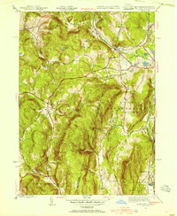 1944 State Line1954 Print · USGSThe New York and Massachusetts border during the mid-1940s reveals a landscape of industrial hamlets and mountain schools. Genealogists and historians can trace the rail corridors of the Boston and Albany or locate Red Rock Sch and Richmond Furnace.3 unique versions available
 - 1946 Map of State Line
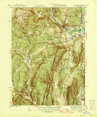 1946 State Line1946 Print · USGSThe Berkshires meet the New York border in the late 1940s, where heavy rail lines and old iron works define the mountain passes. Genealogists can trace family footprints through high-elevation settlements like Austerlitz and Williamsville or locate rural landmarks such as Red Rock Sch and Richmond Furnace.
 - 1948 Map of Egremont
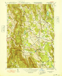 1948 Egremont1948 Print · USGSThe Berkshires of western Massachusetts are shown in the late 1940s, highlighting the valley settlements and steep ridges along the New York border. Genealogists and hikers can trace the Appalachian Trail, find Bow Wow Cem, and explore old routes like Jug End Road.3 unique versions available
 - 1948 Map of Albany, 1951 Print
 1948 Albany1951 Print · USGSThe Hudson and Connecticut River valleys are captured here in the late 1940s, showing the vital rail and water corridors of the Northeast. You can trace the Boston and Maine tracks past Mt Greylock or locate early settlements like Great Barrington and Bennington.
 - 1949 Map of Kinderhook
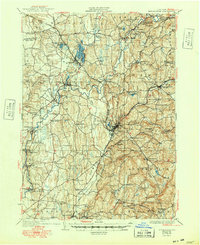 1949 Kinderhook1949 Print · USGSColumbia County’s landscape is captured here during the post-war era, showing a region shaped by both rail-borne industry and early American history. Genealogists and historians can trace the Boston and Albany tracks to landmarks like the Martin Van Buren Homestead and the Ichabod Crane Sch.
 - 1950 Map of Egremont
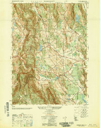 1950 Egremont1950 Print · USGSThe Berkshires of the mid-twentieth century are captured here along the New York border, showing the rural character of the Egremont hamlets. Researchers can trace historic property lines near Egremont Plain or locate old landmarks like the Great Barrington Airport and Prospect Lake.
 - 1953 Map of Chatham, 1955 Print
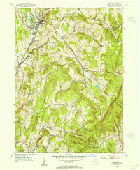 1953 Chatham1955 Print · USGSColumbia County in the early fifties shows a transition from rail-dependent industry to a quiet rural landscape. Genealogists can locate family landmarks like Arnolds Mill, Moorhouse Corner, and the German Cem near Harlemville.5 unique versions available
 - 1953 Map of Hillsdale, 1955 Print
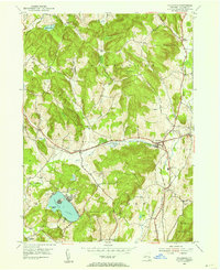 1953 Hillsdale1955 Print · USGSColumbia County at the mid-century reveals a landscape of high ridges and railroad-centered hamlets like Craryville and Hillsdale. Genealogists and local historians can trace the New York Central line and find rural landmarks like Drum Church and Williams Cem.3 unique versions available
Showing maps 1-25 of 63
Top cities near Hillsdale
- Pittsfield historical maps
- Kinderhook historical maps
- Great Barrington historical maps
- Claverack historical maps
- Ghent historical maps
- Lenox historical maps
See more
Top neighborhoods of Hillsdale
- Harlemville historical maps
- East Hillsdale historical maps
- Green River historical maps
- North Hillsdale historical maps
Frequently asked questions
- What are the different types of historical maps available for Hillsdale?
- What is the oldest map of Hillsdale?
- Where can I purchase historical maps of Hillsdale for my home or office?
- Where can I download high-res historical maps of Hillsdale?
- Are there historical topographic maps available for Hillsdale?
- Is there historical aerial imagery available for Hillsdale?
- Where are historical maps of Hillsdale sourced from?