Old Maps of Niverville, New York for Academic Research
Study the evolution of Niverville with 22 high-resolution historic maps. Whether you're teaching, researching, or modeling changes in land use, these maps provide essential visual documentation of urban, environmental, and geographic change.
- Analyze long-term change: Track patterns in development, transportation, and natural features.
- Ideal for environmental or urban studies: Support academic projects with primary historical map data.
- Use in the classroom or lab: Educators and researchers rely on these maps to bring historical context to life.
These maps are a powerful tool for teaching, research, and visualizing how Niverville has changed over the decades.
Niverville, NY maps
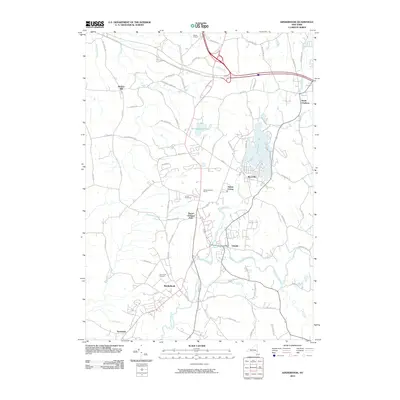
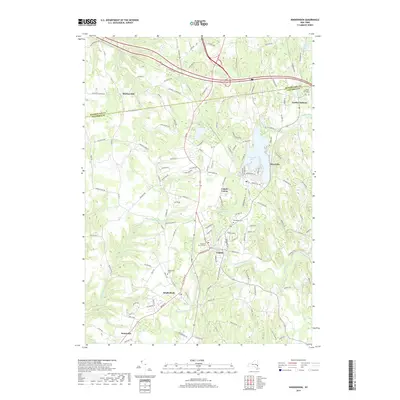
(22)- 1903 Map of Kinderhook
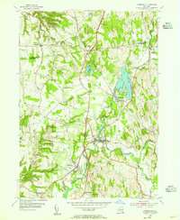
 1903 Kinderhook1903 Print · USGSColumbia County at the turn of the century shows a landscape defined by the intersection of water power and rail. Trace the industrial heritage of Stuyvesant Falls and White Mills or locate ancestral homes in Old Chatham and Valatie.6 unique versions available
 - 1933 Map of Kinderhook
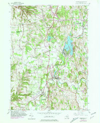
 1933 Kinderhook1933 Print · USGSColumbia County in the early thirties is a landscape of thriving mill towns and rail junctions. Genealogists and historians can locate family-named schoolhouses like Woltermire Sch or trace the grounds of the Martin Van Buren Homestead.3 unique versions available
 - 1948 Map of Albany, 1951 Print
 1948 Albany1951 Print · USGSThe Hudson and Connecticut River valleys are captured here in the late 1940s, showing the vital rail and water corridors of the Northeast. You can trace the Boston and Maine tracks past Mt Greylock or locate early settlements like Great Barrington and Bennington.
 - 1949 Map of Kinderhook
 1949 Kinderhook1949 Print · USGSColumbia County’s landscape is captured here during the post-war era, showing a region shaped by both rail-borne industry and early American history. Genealogists and historians can trace the Boston and Albany tracks to landmarks like the Martin Van Buren Homestead and the Ichabod Crane Sch.
 - 1953 Map of Kinderhook, 1955 Print
 1953 Kinderhook1955 Print · USGSColumbia County in the early fifties shows a landscape of established villages and working waterways at the height of the rail era. Genealogists can trace family footprints near the House of History, Kinderhook Lake, and Muitzes Kill.2 unique versions available
 - 1953 Map of East Chatham, 1955 Print
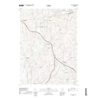
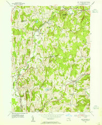 1953 East Chatham1955 Print · USGSColumbia County’s rural landscape is preserved in this mid-century survey as the New York Central railroad still wound through the valley. Researchers can trace ancestral roots at The Maples Cem or locate the Shaker Museum and Riders Mills Sch in their original settings.3 unique versions available
 - 1956 Map of Albany, 1968 Print
 1956 Albany1968 Print · USGSThe industrial heart of the Northeast is revealed in the mid-1950s, from the Hudson Valley to the Connecticut River. Researchers can trace the legacy of the Quabbin Reservoir, locate Westover Air Force Base, or follow the Rutland RR through the Green Mountains.2 unique versions available
 - 1957 Map of Albany
 1957 Albany1957 Print · USGSThe Tri-State region and Connecticut River Valley are captured here during a period of significant postwar growth and infrastructure expansion. Genealogists and historians can trace the rail-and-river economy through landmarks like the Boston and Maine railroad, Quabbin Reservoir, and Westover Air Force Base.
 - 1959 Map of Albany
 1959 Albany1959 Print · USGSThe Hudson and Connecticut River valleys are captured here during the late fifties, showing the region's dense rail networks and massive water projects. Researchers can trace the New York State Thruway or locate local landmarks like Mt Greylock and the Quabbin Reservoir.
 - 1962 Map of Albany
 1962 Albany1962 Print · USGSThe Hudson and Connecticut River valleys meet the Green Mountains and Berkshires in this mid-century overview of the Northeast. Genealogists and historians can trace the industrial hearts of Albany and Springfield or locate features like Quabbin Reservoir and Westover Air Force Base.
 - 1980 Map of Kinderhook, 1981 Print
 1980 Kinderhook1981 Print · USGSColumbia County in the early eighties retains its storied village character even as modern parkways and rail lines intersect the landscape. Genealogists can trace family footprints near Kinderhook at the House of History or locate early settlements along the Valatie Kill.
 - 1986 Map of Pittsfield
 1986 Pittsfield1986 Print · USGSThe Berkshires and the Hudson Valley meet in the mid-1980s, documenting a cross-border landscape of mountain forests and river towns. Genealogists and historians can trace the paths of Conrail and the Taconic State Parkway as they pass through Stockbridge, Great Barrington, and Kinderhook.2 unique versions available
 - 2010 Map of East Chatham, 2010 Print
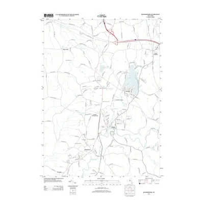
 2010 East Chatham2010 Print · USGSCovers Niverville, including Schodack, Nassau, and other nearby areas
 - 2010 Map of Kinderhook, 2010 Print
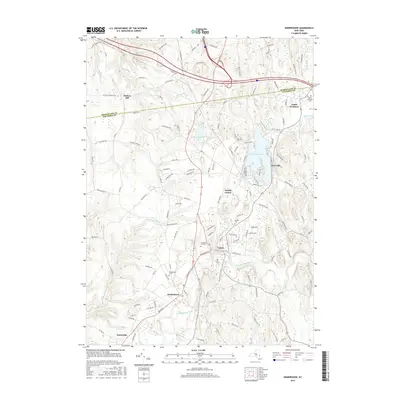
 2010 Kinderhook2010 Print · USGSCovers Niverville, including Schodack, Kinderhook, and other nearby areas
 - 2013 Map of East Chatham, 2013 Print
 2013 East Chatham2013 Print · USGSCovers Niverville, including Schodack, Nassau, and other nearby areas
 - 2013 Map of Kinderhook, 2013 Print
 2013 Kinderhook2013 Print · USGSCovers Niverville, including Schodack, Kinderhook, and other nearby areas
 - 2016 Map of East Chatham, 2016 Print
 2016 East Chatham2016 Print · USGSCovers Niverville, including Schodack, Nassau, and other nearby areas
 - 2016 Map of Kinderhook, 2016 Print
 2016 Kinderhook2016 Print · USGSCovers Niverville, including Schodack, Kinderhook, and other nearby areas
 - 2019 Map of East Chatham, 2019 Print
 2019 East Chatham2019 Print · USGSCovers Niverville, including Schodack, Nassau, and other nearby areas
 - 2019 Map of Kinderhook, 2019 Print
 2019 Kinderhook2019 Print · USGSCovers Niverville, including Schodack, Kinderhook, and other nearby areas
 - 2023 Map of Kinderhook, 2023 Print
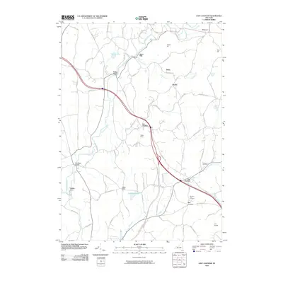
 2023 Kinderhook2023 Print · USGSUpper Columbia County settlements and winding waterways define this region south of the Rensselaer line. Researchers can trace the layout of Kinderhook and Valatie, while locating family history at North Chatham Cem and Woodlawn Cem.
 - 2023 Map of East Chatham, 2023 Print
 2023 East Chatham2023 Print · USGSThis part of eastern New York shows a landscape of historic hamlets and valley streams as they appeared in 2023. Researchers can trace the lineage of the region through sites like East Chatham, the Cem of the Maples, and Riders Mills.
End of results
Showing maps 1-22 of 22
Top cities near Niverville
- Albany historical maps
- Guilderland historical maps
- Bethlehem historical maps
- East Greenbush historical maps
- North Greenbush historical maps
- Schodack historical maps
See more
Frequently asked questions
- What are the different types of historical maps available for Niverville?
- What is the oldest map of Niverville?
- Where can I purchase historical maps of Niverville for my home or office?
- Where can I download high-res historical maps of Niverville?
- Are there historical topographic maps available for Niverville?
- Is there historical aerial imagery available for Niverville?
- Where are historical maps of Niverville sourced from?