Old Maps of Freetown, New York
Explore 45 old maps of Freetown, spanning from 1903 to today. These high-resolution historic maps reveal how streets, neighborhoods, landmarks, and natural features evolved over time — perfect for genealogy, metal detecting, research, and local history exploration.
What you can do with these maps:
- See how Freetown changed over time: Compare historical maps to modern-day views to trace roads, homesites, rail lines & more.
- View detailed metadata: Each map includes creators, publishers, year, scale, and archive source.
- Overlay maps with satellite & LiDAR: Visualize the past alongside modern tools to explore terrain & human change.
- Trusted historical sources: Maps sourced from the USGS, Library of Congress, and other archives.
- Access maps your way: View online, download high-res files, or order prints for personal or research use.
Start exploring old maps of Freetown to uncover forgotten places, hidden landmarks, and the deep history beneath your feet.
Freetown, NY maps
(45)- 1903 Map of Cortland
 1903 Cortland1903 Print · USGSCortland County at the turn of the century was a bustling hub of rail activity and river-valley industry. Researchers can trace the early layout of Cortland and Homer, or locate vanished operations at Crains Mills and Blodgett Mills.7 unique versions available
 - 1903 Map of Harford
 1903 Harford1903 Print · USGSThe Southern Tier of New York at the turn of the century reveals a landscape defined by deep valleys and the competing paths of the Lehigh Valley and Lackawanna railroads. Genealogists can trace early homesteads and hamlets like Harford Mills, Nanticoke, and Hunts Corners.5 unique versions available
 - 1904 Map of Greene
 1904 Greene1904 Print · USGSThe river valleys of Chenango and Broome counties come alive in this turn-of-the-century survey. You can trace the path of the Delaware Lackawanna and Western RR through Whitney Point or locate the early structures in Greene and Smithville Flats.6 unique versions available
 - 1904 Map of Pitcher
 1904 Pitcher1904 Print · USGSThe rural highlands of Central New York are documented here at the turn of the century, showing a landscape of upland hamlets and river-valley rail lines. Genealogists can trace early homesteads near Pitcher, Cincinnatus, and the remote heights of Taylor Center.5 unique versions available
 - 1906 Map of Catatonk
 1906 Catatonk1906 Print · USGSThe Southern Tier and Finger Lakes foothills are shown here at the peak of the rail era, before the expansion of modern highways. Genealogists can locate family lands near Slaterville Springs, trace the Lehigh Valley RR, or find early sites like White Church.
 - 1943 Map of Cincinnatus, 1960 Print
 1943 Cincinnatus1960 Print · USGSCortland County during the mid-1940s remained a landscape of tight-knit valley settlements and upland district schools. Genealogists can trace family roots through sites like Hawley Cem or follow the path of the Delaware Lackawanna and Western railroad.3 unique versions available
 - 1944 Map of Mc Graw
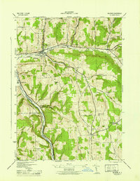 1944 Mc Graw1944 Print · USGSCortland County upland farms and valley villages are captured here during the mid-forties, showing the area's transition between agricultural and rail-based commerce. Researchers can locate many district schoolhouses like Old Stone Sch and cemeteries such as Atwood Cem.
 - 1944 Map of Cincinnatus
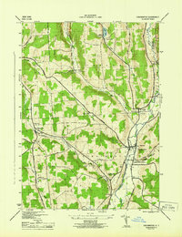 1944 Cincinnatus1944 Print · USGSCortland County dairy country and the Otselic River valley are captured here just as the war era reached its peak. Researchers can trace the Delaware Lackawanna and Western Railroad corridor and locate vanished rural schoolhouses like Mudge Sch and Minard Sch.
 - 1948 Map of Binghamton, 1980 Print
 1948 Binghamton1980 Print · USGSCentral New York and the Southern Tier thrive in the late 1940s as a hub of rail traffic and mountain industry. Researchers can trace historic transit lines like the Erie Railroad through Binghamton or find old valley settlements near Oneonta and Delhi.
 - 1949 Map of Willet, 1970 Print
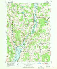 1949 Willet1970 Print · USGSThe Otselic River valley in the late 1940s reveals a landscape of dispersed hamlets and family-named hilltops. Genealogists and historians can trace old community centers like Upper Lisle and Texas Valley or locate local burials at Green Cem.
 - 1950 Map of Elmira
 1950 Elmira1950 Print · USGSThe Finger Lakes region thrived in the late 1940s as a hub of industry and transport. Trace family roots and vanished landmarks near Seneca Lake or explore the rail lines of the Erie RR and the sprawling Seneca Ordnance Depot.2 unique versions available
 - 1950 Map of Binghamton
 1950 Binghamton1950 Print · USGSBinghamton and the surrounding Southern Tier are shown in the mid-century era, highlighting the intricate rail and river networks that drove local industry. Researchers can trace the path of the Erie Railroad and locate landmarks from Otsego Lake to Sidney Mountain.2 unique versions available
 - 1950 Map of Marathon, 1952 Print
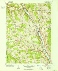 1950 Marathon1952 Print · USGSMid-century Cortland County comes to life along the river and rail lines of the Tioughnioga valley. Researchers can trace family roots through upland landmarks like Lapeer Church, Hunts Corners, and the tracks of the Delaware Lackawanna and Western.5 unique versions available
 - 1951 Map of Willet
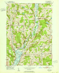 1951 Willet1951 Print · USGSThe Otselic River valley in Cortland and Broome counties comes alive in this mid-century survey. Genealogists and local historians can trace the foundations of Upper Lisle and Texas Valley or locate family plots at Green Cem.
 - 1955 Map of Mc Graw, 1956 Print
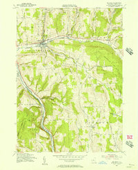 1955 Mc Graw1956 Print · USGSMid-state New York hill country comes into focus in the mid-fifties, showing the intersection of rail transport and rural township life. Genealogists and historians can trace family plots at McGrawville Rural Cem or locate old mill sites like Maybury Mills and Blodgett Mills.4 unique versions available
 - 1958 Map of Binghamton
 1958 Binghamton1958 Print · USGSCentral New York in the late fifties was a network of manufacturing cities and river valleys connected by vital rail lines. Genealogists and historians can trace family roots in Oneonta, Norwich, and Cooperstown or locate long-standing farms along Schoharie Creek.
 - 1958 Map of Elmira
 1958 Elmira1958 Print · USGSThe New York Finger Lakes during the late fifties reveal a complex landscape of glacial geology and industrial growth. Researchers can trace historic transport corridors like the Erie Canal and Erie RR, or locate institutional landmarks like Cornell University.2 unique versions available
 - 1962 Map of Elmira, 1969 Print
 1962 Elmira1969 Print · USGSThe Finger Lakes region and Southern Tier are captured here during a period of industrial maturity and highway expansion. Researchers can trace the path of the Erie Canal, the footprint of the Seneca Army Depot, and legacy rail lines through Elmira and Ithaca.4 unique versions available
 - 1963 Map of Binghamton
 1963 Binghamton1963 Print · USGSThe Southern Tier and Catskill peaks are shown in the early sixties as new reservoirs reshaped the valleys. Trace historic rail corridors like the Erie Lackawanna RR and explore lakeside settlements such as Cooperstown and Oneonta.
 - 1965 Map of Elmira
 1965 Elmira1965 Print · USGSThe Finger Lakes and Southern Tier regions are captured in the mid-sixties, showcasing a landscape of deep glacial valleys and heavy rail infrastructure. Trace old railroad corridors like the Pennsylvania RR or visit landmarks like Letchworth State Park and the Seneca Army Depot.
 - 1985 Map of Binghamton, 1986 Print
 1985 Binghamton1986 Print · USGSThe Southern Tier during the mid-1980s shows a landscape of river-valley industry and expanding university campuses. Genealogists and local historians can trace family roots through riverside towns like Bainbridge, Sidney, and the Calvary Cem in the Binghamton area.2 unique versions available
 - 1986 Map of Norwich
 1986 Norwich1986 Print · USGSCentral New York in the mid-eighties was a landscape of deep river valleys and university towns connected by historic rail corridors and state highways. Researchers can trace the rural infrastructure of Norwich and Hamilton, finding landmarks like Colgate University and the Seventh Day Hollow Church.2 unique versions available
 - 1986 Map of Elmira
 1986 Elmira1986 Print · USGSThe Southern Tier and Finger Lakes regions meet in this mid-eighties survey of the river valleys and high ridges. Genealogists can trace family names at Forest Lawn Memorial Park or locate homesteads near Breesport and Newark Valley.
 - 1986 Map of Auburn
 1986 Auburn1986 Print · USGSThe Finger Lakes region in the mid-eighties shows a landscape of deep glacial waters and significant military sites. Trace the layout of the Seneca Army Depot, find the campus of Wells College, and follow the historic Lehigh Valley RR lines.2 unique versions available
 - 1992 Map of Elmira, 1993 Print
 1992 Elmira1993 Print · USGSThe Finger Lakes and Southern Tier regions are captured in the early nineties as industrial hubs like Elmira and Endicott thrived alongside university life in Ithaca. Genealogists and researchers can trace the CONRAIL rail corridors, family hilltops such as Hornby Hill, and the extensive Newtown Battlefield Reservation.
Showing maps 1-25 of 45
Top cities near Freetown
- Cortland historical maps
- Cortlandville historical maps
- Homer historical maps
- Greene historical maps
- Candor historical maps
- Caroline historical maps
See more
Top neighborhoods of Freetown
Frequently asked questions
- What are the different types of historical maps available for Freetown?
- What is the oldest map of Freetown?
- Where can I purchase historical maps of Freetown for my home or office?
- Where can I download high-res historical maps of Freetown?
- Are there historical topographic maps available for Freetown?
- Is there historical aerial imagery available for Freetown?
- Where are historical maps of Freetown sourced from?