Old Maps of Preble, New York
Explore 37 old maps of Preble, spanning from 1900 to today. These high-resolution historic maps reveal how streets, neighborhoods, landmarks, and natural features evolved over time — perfect for genealogy, metal detecting, research, and local history exploration.
What you can do with these maps:
- See how Preble changed over time: Compare historical maps to modern-day views to trace roads, homesites, rail lines & more.
- View detailed metadata: Each map includes creators, publishers, year, scale, and archive source.
- Overlay maps with satellite & LiDAR: Visualize the past alongside modern tools to explore terrain & human change.
- Trusted historical sources: Maps sourced from the USGS, Library of Congress, and other archives.
- Access maps your way: View online, download high-res files, or order prints for personal or research use.
Start exploring old maps of Preble to uncover forgotten places, hidden landmarks, and the deep history beneath your feet.
Preble, NY maps
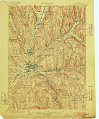
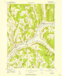
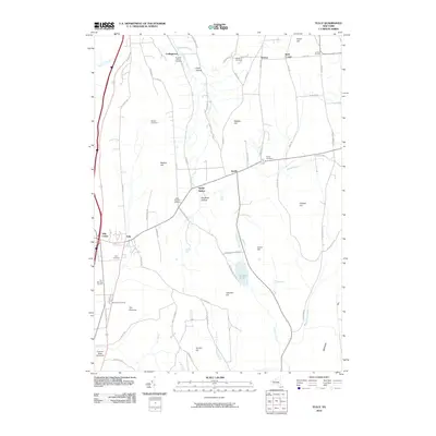
(37)- 1900 Map of Tully
 1900 Tully1900 Print · USGSIn the hills south of Syracuse during the late 1890s, this area supported a network of dairy farms and rail-dependent hamlets. Genealogists can locate long-lost rural communities like Maple Grove (Case P.O.), the Onondaga Indian Reservation, and the resort grounds at Assembly Park.9 unique versions available
 - 1903 Map of Cortland
 1903 Cortland1903 Print · USGSCortland County at the turn of the century was a bustling hub of rail activity and river-valley industry. Researchers can trace the early layout of Cortland and Homer, or locate vanished operations at Crains Mills and Blodgett Mills.7 unique versions available
 - 1943 Map of Otisco Valley
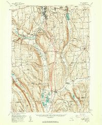
 1943 Otisco Valley1943 Print · USGSCentral New York's glacial lake country is captured here during the early 1940s, showing the rural communities of the Tully and Otisco valleys. Genealogists can locate family burial grounds like St Patricks Cem and tracing old school districts and Salt Wells.
 - 1943 Map of Tully, 1953 Print
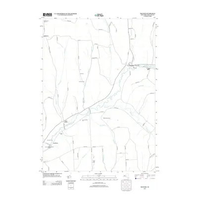
 1943 Tully1953 Print · USGSThe Onondaga and Cortland County borderlands are seen here in the early 1940s, showing a landscape of upland ridges and rail-connected valley towns. Trace local ancestry through the STATE COLLEGE EXPERIMENTAL STATION, numerous rural schools, and sites like St Leos Cem and Apulia Station.
 - 1944 Map of Homer
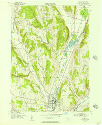
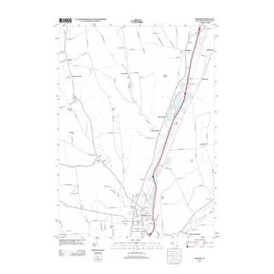
 1944 Homer1944 Print · USGSThe Tioughnioga River valleys in the 1940s were centers of agriculture and rail transport. Genealogists can trace family footprints at Atwater Cem or locate old schoolhouses like School No 10 and the former County Farm.
 - 1944 Map of Truxton
 1944 Truxton1944 Print · USGSCortland County agriculture and rail transit are captured in the mid-1940s as the river valleys supported thriving rural hamlets. Researchers can trace the Lehigh Valley tracks past Crains Mills and find several district schoolhouses like Log Sch.
 - 1950 Map of Elmira
 1950 Elmira1950 Print · USGSThe Finger Lakes region thrived in the late 1940s as a hub of industry and transport. Trace family roots and vanished landmarks near Seneca Lake or explore the rail lines of the Erie RR and the sprawling Seneca Ordnance Depot.2 unique versions available
 - 1955 Map of Homer, 1956 Print
 1955 Homer1956 Print · USGSCortland County during the mid-fifties reveals a busy landscape of river-valley rail towns and upland dairy country. Researchers can trace family sites near Homer and Slab City, or locate specific rural institutions like Central High Sch and Glenwood Cem.2 unique versions available
 - 1955 Map of Otisco Valley, 1956 Print
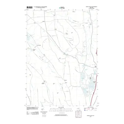
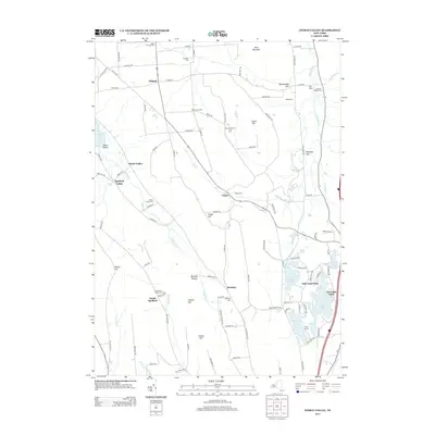
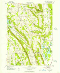 1955 Otisco Valley1956 Print · USGSOnondaga and Cortland Counties appear here in the mid-fifties, showing a landscape of glacial lakes and upland farms. You can trace family roots at The West Cem and Hillsdale Cem, or locate mid-century landmarks like Camp Hoover and Assembly Park.4 unique versions available
 - 1955 Map of Tully, 1956 Print
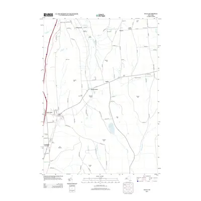
 1955 Tully1956 Print · USGSIn the mid-fifties, the Tully Valley was a blend of concentrated village life and sprawling state forestry lands. Genealogists and historians can trace the Delaware Lackawanna and Western tracks through Apulia Station or find local landmarks like St Leo Ch and Meeker Cem.4 unique versions available
 - 1955 Map of Truxton, 1956 Print
 1955 Truxton1956 Print · USGSMid-century Cortland County comes alive in this survey of the Tioughnioga Valley's rail and reforestation corridor. Genealogists and local historians can trace the Lehigh Valley line through old settlements like Crains Mills and East River.4 unique versions available
 - 1955 Map of Tully, 1961 Print
 1955 Tully1961 Print · USGSCentral New York at the dawn of the interstate era reveals a landscape of glacial lakes and historic upland hamlets. Genealogists can trace family sites at Pioneer Cem or St Patrick Cem, while identifying rail stops like Apulia Station.2 unique versions available
 - 1958 Map of Elmira
 1958 Elmira1958 Print · USGSThe New York Finger Lakes during the late fifties reveal a complex landscape of glacial geology and industrial growth. Researchers can trace historic transport corridors like the Erie Canal and Erie RR, or locate institutional landmarks like Cornell University.2 unique versions available
 - 1962 Map of Elmira, 1969 Print
 1962 Elmira1969 Print · USGSThe Finger Lakes region and Southern Tier are captured here during a period of industrial maturity and highway expansion. Researchers can trace the path of the Erie Canal, the footprint of the Seneca Army Depot, and legacy rail lines through Elmira and Ithaca.4 unique versions available
 - 1965 Map of Elmira
 1965 Elmira1965 Print · USGSThe Finger Lakes and Southern Tier regions are captured in the mid-sixties, showcasing a landscape of deep glacial valleys and heavy rail infrastructure. Trace old railroad corridors like the Pennsylvania RR or visit landmarks like Letchworth State Park and the Seneca Army Depot.
 - 1978 Map of Homer, 1979 Print
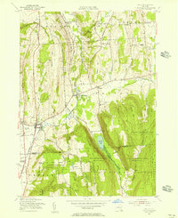
 1978 Homer1979 Print · USGSCortland County in the late seventies reveals a landscape of valley settlements and upland reforestation areas. Researchers can trace family history at Atwater Cem or explore the rural character of Slab City and Little York.
 - 1986 Map of Auburn
 1986 Auburn1986 Print · USGSThe Finger Lakes region in the mid-eighties shows a landscape of deep glacial waters and significant military sites. Trace the layout of the Seneca Army Depot, find the campus of Wells College, and follow the historic Lehigh Valley RR lines.2 unique versions available
 - 2010 Map of Truxton, 2010 Print
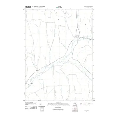 2010 Truxton2010 Print · USGSCovers Preble, including Cortlandville, Homer, and other nearby areas
 - 2010 Map of Homer, 2010 Print
 2010 Homer2010 Print · USGSCovers Preble, including Cortlandville, Homer, and other nearby areas
 - 2010 Map of Tully, 2010 Print
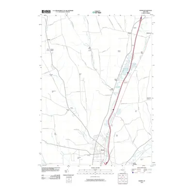
 2010 Tully2010 Print · USGSCovers Preble, including Pompey, LaFayette, and other nearby areas
 - 2010 Map of Otisco Valley, 2010 Print
 2010 Otisco Valley2010 Print · USGSCovers Preble, including LaFayette, Tully, and other nearby areas
 - 2013 Map of Homer, 2013 Print
 2013 Homer2013 Print · USGSCovers Preble, including Cortlandville, Homer, and other nearby areas
 - 2013 Map of Tully, 2013 Print
 2013 Tully2013 Print · USGSCovers Preble, including Pompey, LaFayette, and other nearby areas
 - 2013 Map of Truxton, 2013 Print
 2013 Truxton2013 Print · USGSCovers Preble, including Cortlandville, Homer, and other nearby areas
 - 2013 Map of Otisco Valley, 2013 Print
 2013 Otisco Valley2013 Print · USGSCovers Preble, including LaFayette, Tully, and other nearby areas
Showing maps 1-25 of 37
Top cities near Preble
- Onondaga historical maps
- Cortland historical maps
- Dryden historical maps
- Cortlandville historical maps
- Skaneateles historical maps
- Pompey historical maps
See more
Top neighborhoods of Preble
Frequently asked questions
- What are the different types of historical maps available for Preble?
- What is the oldest map of Preble?
- Where can I purchase historical maps of Preble for my home or office?
- Where can I download high-res historical maps of Preble?
- Are there historical topographic maps available for Preble?
- Is there historical aerial imagery available for Preble?
- Where are historical maps of Preble sourced from?