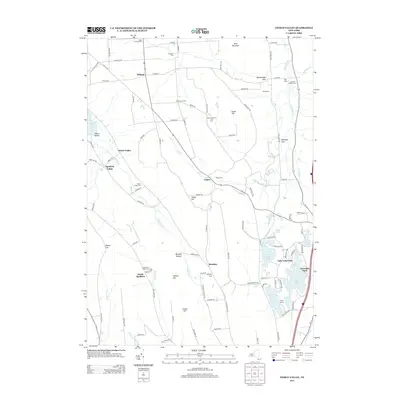
2013 Map of Otisco Valley
USGS Topo · Published 2013About this map
Otisco Lake defines the western edge of this central New York landscape, where deep glacial valleys and steep hillsides dictate the patterns of settlement. The community of Otisco Valley and the hamlet of Vesper anchor a rural interior marked by family-named landmarks like Mary Christmas Tree Farm and numerous burial grounds, including Saint Patricks Cem and the Tully Valley Christian Hollow Cem. The southeastern corner of the quadrangle reveals a concentrated cluster of water bodies such as Song Lake, Tully Lake, and Crooked Lake, supporting local recreation at Tully Lake Park and Camp Hoover. This 2013 survey illustrates the enduring agricultural and residential character of Onondaga County, showing how modern roads like Otisco Rd follow the natural contours of Bare Mountain and Dutch Hill.
Find a feature on this map
106 named features on this map. Tap any name to fly to it.
Don’t see what you’re looking for? This feature index may not catch every label — zoom into the map to look around manually.
Map Details
Editions of this 2013 Otisco Valley Map
This is the sole edition of this map. No revisions or reprints were ever made.
Other maps of this area

1898 · Moravia
USGS Topo · 1:62,500

1899 · Skaneateles
USGS Topo · 1:62,500

1900 · Tully
USGS Topo · 1:62,500

1902 · Skaneateles
USGS Topo · 1:62,500

1902 · Moravia
USGS Topo · 1:62,500

1903 · Cortland
USGS Topo · 1:62,500

1943 · South Onondaga
USGS Topo · 1:31,680

1943 · Spafford
USGS Topo · 1:31,680

1943 · Jamesville
USGS Topo · 1:31,680

1943 · Otisco Valley
USGS Topo · 1:31,680