Old Maps of Harford, New York for Metal Detecting
Plan your next treasure hunt with 25 historic maps of Harford. Find old homesites, ghost towns, trails, and gathering spots that may be lost to time — perfect for identifying promising metal detecting locations.
- Locate forgotten sites: Uncover places like long-lost settlements, abandoned rail lines, or gathering spots.
- Plan better hunts: Use map overlays combined with LiDAR or satellite views to narrow in on historically rich areas.
- Made for detectorists: Thousands of hobbyists use these maps to discover relics, coins, and hidden history.
Use these historic maps to boost your research and find new opportunities beneath the surface of Harford.
Harford, NY maps
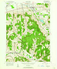
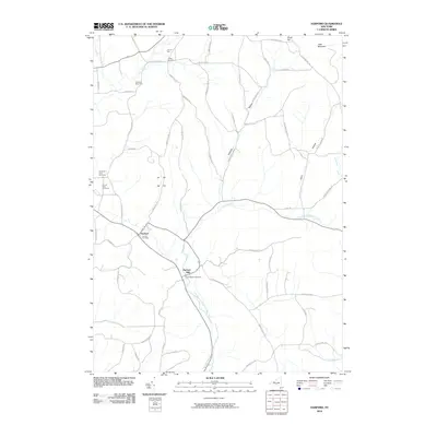
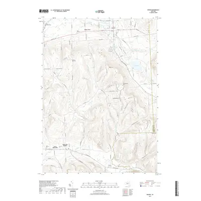
(25)- 1900 Map of Dryden
 1900 Dryden1900 Print · USGSThe Finger Lakes region comes to life in the late nineteenth century as the rail networks of the Lehigh Valley RR and the CAYUGA DIVISION expand through the valleys. Genealogists can trace family roots through the hill settlements of Caroline Center, South Danby, and the early grounds of Cornell University.9 unique versions available
 - 1903 Map of Harford
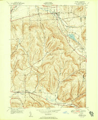
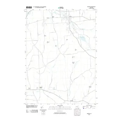
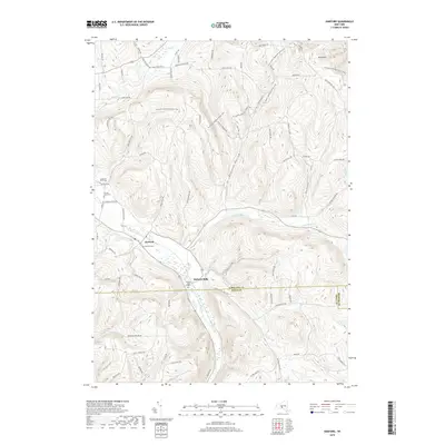
 1903 Harford1903 Print · USGSThe Southern Tier of New York at the turn of the century reveals a landscape defined by deep valleys and the competing paths of the Lehigh Valley and Lackawanna railroads. Genealogists can trace early homesteads and hamlets like Harford Mills, Nanticoke, and Hunts Corners.5 unique versions available
 - 1906 Map of Catatonk
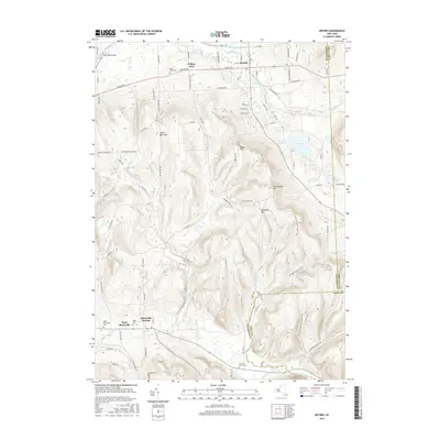
 1906 Catatonk1906 Print · USGSThe Southern Tier and Finger Lakes foothills are shown here at the peak of the rail era, before the expansion of modern highways. Genealogists can locate family lands near Slaterville Springs, trace the Lehigh Valley RR, or find early sites like White Church.
 - 1949 Map of Dryden, 1962 Print
 1949 Dryden1962 Print · USGSTompkins County villages and highland farms are captured here in the late 1940s just as post-war changes began. Researchers can trace the Lehigh Valley Railroad through Dryden or locate family plots at Willow Glen Cem and Mulks Cem.
 - 1949 Map of Harford, 1967 Print
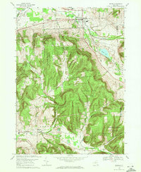
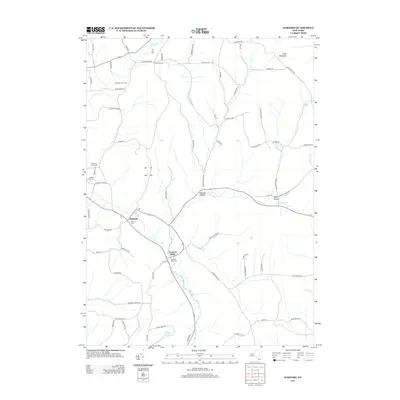
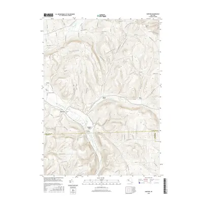
 1949 Harford1967 Print · USGSCortland County at the close of the 1940s is a landscape of deep hollows and dairy country centered on the Lehigh Valley rail line. Genealogists can locate the Birthplace of John D Rockefeller and trace rural family homesteads near Harford and Franks Corners.
 - 1950 Map of Elmira
 1950 Elmira1950 Print · USGSThe Finger Lakes region thrived in the late 1940s as a hub of industry and transport. Trace family roots and vanished landmarks near Seneca Lake or explore the rail lines of the Erie RR and the sprawling Seneca Ordnance Depot.2 unique versions available
 - 1951 Map of Harford
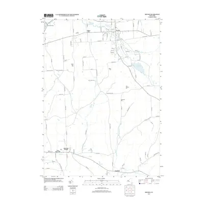
 1951 Harford1951 Print · USGSCortland County's southern hills and railroad hamlets are captured here at mid-century, just as the local rural economy was shifting. Genealogists and historians can locate the Birthplace of John D Rockefeller and trace the Lehigh Valley rail line through Harford Mills.
 - 1951 Map of Dryden
 1951 Dryden1951 Print · USGSTompkins County hills and valleys are captured here in the early fifties, showing the area as a vital rail and road junction. Researchers can trace family roots through the Dutch Reformed Cem and follow the old Catskill Turnpike through Slaterville Springs.2 unique versions available
 - 1958 Map of Elmira
 1958 Elmira1958 Print · USGSThe New York Finger Lakes during the late fifties reveal a complex landscape of glacial geology and industrial growth. Researchers can trace historic transport corridors like the Erie Canal and Erie RR, or locate institutional landmarks like Cornell University.2 unique versions available
 - 1962 Map of Elmira, 1969 Print
 1962 Elmira1969 Print · USGSThe Finger Lakes region and Southern Tier are captured here during a period of industrial maturity and highway expansion. Researchers can trace the path of the Erie Canal, the footprint of the Seneca Army Depot, and legacy rail lines through Elmira and Ithaca.4 unique versions available
 - 1965 Map of Elmira
 1965 Elmira1965 Print · USGSThe Finger Lakes and Southern Tier regions are captured in the mid-sixties, showcasing a landscape of deep glacial valleys and heavy rail infrastructure. Trace old railroad corridors like the Pennsylvania RR or visit landmarks like Letchworth State Park and the Seneca Army Depot.
 - 1969 Map of Dryden, 1971 Print
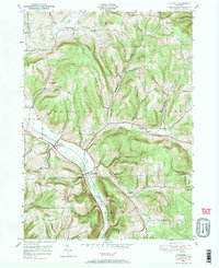
 1969 Dryden1971 Print · USGSDryden and the southern hills of Tompkins County are seen here in the late sixties, a landscape where valley railroads met sprawling state forests. Genealogists and local historians can locate several historic burial sites like Mulks Cem and old schools including the Caroline Sch and Central Sch.3 unique versions available
 - 1976 Map of Harford, 1984 Print
 1976 Harford1984 Print · USGSCortland and Tioga Counties are shown here during the mid-to-late twentieth century, preserving a landscape of steep hollows and valley settlements. Genealogists can locate family landmarks like the Birthplace of John D Rockefeller and the old Harford Mills station.2 unique versions available
 - 1986 Map of Elmira
 1986 Elmira1986 Print · USGSThe Southern Tier and Finger Lakes regions meet in this mid-eighties survey of the river valleys and high ridges. Genealogists can trace family names at Forest Lawn Memorial Park or locate homesteads near Breesport and Newark Valley.
 - 1992 Map of Elmira, 1993 Print
 1992 Elmira1993 Print · USGSThe Finger Lakes and Southern Tier regions are captured in the early nineties as industrial hubs like Elmira and Endicott thrived alongside university life in Ithaca. Genealogists and researchers can trace the CONRAIL rail corridors, family hilltops such as Hornby Hill, and the extensive Newtown Battlefield Reservation.
 - 2010 Map of Harford, 2010 Print
 2010 Harford2010 Print · USGSCovers Harford, including Lisle, Virgil, and other nearby areas
 - 2010 Map of Dryden, 2010 Print
 2010 Dryden2010 Print · USGSCovers Harford, including Dryden, Caroline, and other nearby areas
 - 2013 Map of Harford, 2013 Print
 2013 Harford2013 Print · USGSCovers Harford, including Lisle, Virgil, and other nearby areas
 - 2013 Map of Dryden, 2013 Print
 2013 Dryden2013 Print · USGSCovers Harford, including Dryden, Caroline, and other nearby areas
 - 2016 Map of Harford, 2016 Print
 2016 Harford2016 Print · USGSCovers Harford, including Lisle, Virgil, and other nearby areas
 - 2016 Map of Dryden, 2016 Print
 2016 Dryden2016 Print · USGSCovers Harford, including Dryden, Caroline, and other nearby areas
 - 2019 Map of Dryden, 2019 Print
 2019 Dryden2019 Print · USGSCovers Harford, including Dryden, Caroline, and other nearby areas
 - 2019 Map of Harford, 2019 Print
 2019 Harford2019 Print · USGSCovers Harford, including Lisle, Virgil, and other nearby areas
 - 2023 Map of Harford, 2023 Print
 2023 Harford2023 Print · USGSCentral New York hill country comes into focus in this recent survey of the rural landscape between Cortland and Tioga counties. Genealogists and hikers can trace paths to Harford Mills, the Larie Cem, and the North Country National Scenic Trl.
 - 2023 Map of Dryden, 2023 Print
 2023 Dryden2023 Print · USGSModern-day Tompkins County retains its historic village structure among the high ridges east of Ithaca. Researchers can locate family burial grounds like Caroline Grove Cem or trace the early settlement footprints of Slaterville Springs and Willow Glen.
End of results
Showing maps 1-25 of 25
Top cities near Harford
- Cortland historical maps
- Dryden historical maps
- Cortlandville historical maps
- Homer historical maps
- Groton historical maps
- Maine historical maps
See more
Top neighborhoods of Harford
Frequently asked questions
- What are the different types of historical maps available for Harford?
- What is the oldest map of Harford?
- Where can I purchase historical maps of Harford for my home or office?
- Where can I download high-res historical maps of Harford?
- Are there historical topographic maps available for Harford?
- Is there historical aerial imagery available for Harford?
- Where are historical maps of Harford sourced from?