Old Maps of Meredith, New York for Hiking & Exploration
Hike through history with 50 historic maps of Meredith. Explore old trails, ghost towns, and forgotten backroads — perfect for outdoor adventurers and local explorers.
- Rediscover forgotten places: Map out old mining camps, roads, and footpaths that no longer exist on modern maps.
- Layer with modern tools: Combine with LiDAR or satellite views to plan hikes through historical terrain.
- Made for exploration: Popular among hikers, overlanders, and local history lovers.
Use these maps to find adventure and explore the hidden past of Meredith.
Meredith, NY maps
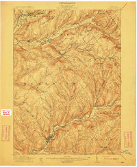
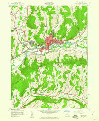
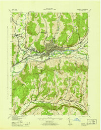
(50)- 1909 Map of Delhi, 1963 Print
 1909 Delhi1963 Print · USGSDelaware County at the turn of the century is a landscape of valley railroads and high ridgeline farms. Genealogists and researchers can trace family lands near Elk Creek Church, follow the old Ulster and Delaware RR line, or locate early sites in Delhi and Meridale.
 - 1911 Map of Delhi
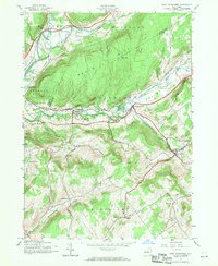
 1911 Delhi1911 Print · USGSDelaware County during the first decade of the twentieth century shows a landscape of rail-driven river towns and high hill farms. You can trace the historic routes of the Ulster and Delaware RR and locate local landmarks like the Elk Creek Church and Wakaqua Falls.5 unique versions available
 - 1915 Map of Oneonta
 1915 Oneonta1915 Print · USGSOtsego and Delaware counties thrived at this moment in the early twentieth century as a busy corridor for the Ulster and Delaware railroad. Genealogists and local historians can trace family-named schoolhouses and the agricultural economy at Arctic Creamery or the rural Franklin Depot.
 - 1918 Map of Oneonta
 1918 Oneonta1918 Print · USGSOneonta and the Susquehanna valley are captured here at a peak of rail-driven commerce during the early twentieth century. Genealogists and historians can locate scores of numbered country schools and rural landmarks like the Arctic Creamery, Wells Bridge, and Franklin Depot.3 unique versions available
 - 1943 Map of Delhi, 1953 Print
 1943 Delhi1953 Print · USGSMid-century Delaware County comes to life as a network of river valleys and upland turnpikes during the height of the steam-to-diesel rail transition. Genealogists can locate family sites near Woodland Cem, the County Home, and numerous numbered schoolhouses like School No 5.3 unique versions available
 - 1943 Map of Bloomville, 1953 Print
 1943 Bloomville1953 Print · USGSDelaware County dairy country appears at a mid-century peak, centered on the West Branch Delaware River valley. Genealogists and local historians can trace family roots through numerous upland sites like Pink St Sch and the Riverside Cem.3 unique versions available
 - 1943 Map of Oneonta, 1960 Print
 1943 Oneonta1960 Print · USGSOneonta and the Susquehanna River valley are captured in the 1940s when the city flourished as a regional education and railroad center. Genealogists can trace family names and local landmarks through several rural sites including Ouleout Ch, Plains Cem, and Homer Folks State Hospital.6 unique versions available
 - 1943 Map of West Davenport, 1960 Print
 1943 West Davenport1960 Print · USGSDelaware County and Otsego County are captured here during the wartime years, showing a landscape defined by valley railroads and rural school districts. Genealogists can locate family landmarks like McMinn Cem, the Prosser Hollow Sch, and the rail junction at Colliersville.3 unique versions available
 - 1943 Map of Davenport, 1960 Print
 1943 Davenport1960 Print · USGSDelaware County during the 1940s is defined by its rural valley settlements and the essential New York Central rail corridor. Genealogists can trace family roots through upland landmarks like Kortright Center, Fergusonville, and the Covenanter Cem.3 unique versions available
 - 1943 Map of Treadwell, 1960 Print
 1943 Treadwell1960 Print · USGSDelaware County upland communities are captured in the early 1940s as the rural schoolhouse era remained in full swing. Genealogists can locate family sites near Croton Union Cem or trace ancestor routes through Poverty Hollow and West Delhi.3 unique versions available
 - 1945 Map of West Davenport
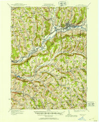
 1945 West Davenport1945 Print · USGSThe Susquehanna and Charlotte Creek valleys are captured here at a mid-century peak of rail and rural development. Genealogists can trace family names at Newell Cem and Charlotte Valley Cem or locate the many one-room schoolhouses like Coe Hill School.
 - 1945 Map of Oneonta
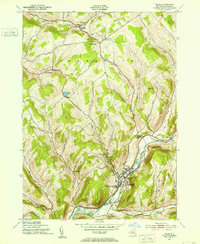
 1945 Oneonta1945 Print · USGSOneonta and the Susquehanna River valley are shown here in the mid-1940s as a bustling junction of rail lines and higher education. Genealogists and local researchers can trace the early layouts of Hartwick College, St Marys Cem, and rural outposts like Ouleout.
 - 1945 Map of Treadwell
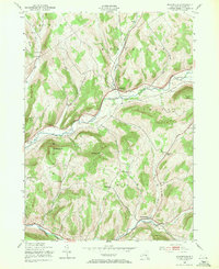
 1945 Treadwell1945 Print · USGSMid-century Delaware County is captured here at a time when small schoolhouses still anchored every rural hollow. Genealogists and historians can trace the foundations of local life at Treadwell, Croton Union Cem, and the Freer Hollow School.
 - 1945 Map of Davenport
 1945 Davenport1945 Print · USGSMid-century Delaware County is captured here in the hills of Davenport and Kortright just as the dairy economy and rail lines defined rural life. Genealogists can trace family footprints at Kortright Station, Hoseaville, or the old Covenanter Cem.
 - 1948 Map of Binghamton, 1980 Print
 1948 Binghamton1980 Print · USGSCentral New York and the Southern Tier thrive in the late 1940s as a hub of rail traffic and mountain industry. Researchers can trace historic transit lines like the Erie Railroad through Binghamton or find old valley settlements near Oneonta and Delhi.
 - 1950 Map of Binghamton
 1950 Binghamton1950 Print · USGSBinghamton and the surrounding Southern Tier are shown in the mid-century era, highlighting the intricate rail and river networks that drove local industry. Researchers can trace the path of the Erie Railroad and locate landmarks from Otsego Lake to Sidney Mountain.2 unique versions available
 - 1958 Map of Binghamton
 1958 Binghamton1958 Print · USGSCentral New York in the late fifties was a network of manufacturing cities and river valleys connected by vital rail lines. Genealogists and historians can trace family roots in Oneonta, Norwich, and Cooperstown or locate long-standing farms along Schoharie Creek.
 - 1963 Map of Binghamton
 1963 Binghamton1963 Print · USGSThe Southern Tier and Catskill peaks are shown in the early sixties as new reservoirs reshaped the valleys. Trace historic rail corridors like the Erie Lackawanna RR and explore lakeside settlements such as Cooperstown and Oneonta.
 - 1985 Map of Binghamton, 1986 Print
 1985 Binghamton1986 Print · USGSThe Southern Tier during the mid-1980s shows a landscape of river-valley industry and expanding university campuses. Genealogists and local historians can trace family roots through riverside towns like Bainbridge, Sidney, and the Calvary Cem in the Binghamton area.2 unique versions available
 - 1986 Map of Pepacton Reservoir
 1986 Pepacton Reservoir1986 Print · USGSThe Catskills in the mid-eighties show a landscape shaped by the Pepacton Reservoir and protected wilderness. Local historians can trace mountain rail corridors like the Delaware & Ulster RR and locate high-elevation landmarks from Slide Mountain to Hunter Mountain.2 unique versions available
 - 2010 Map of Davenport, 2010 Print
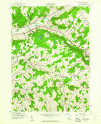
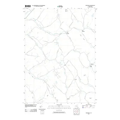
 2010 Davenport2010 Print · USGSCovers Meredith, including Davenport, Maryland, and other nearby areas
 - 2010 Map of West Davenport, 2010 Print
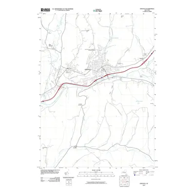
 2010 West Davenport2010 Print · USGSCovers Meredith, including Oneonta, Davenport, and other nearby areas
 - 2010 Map of Treadwell, 2010 Print
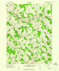
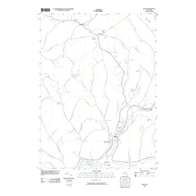
 2010 Treadwell2010 Print · USGSCovers Meredith, including Walton, Delhi, and other nearby areas
 - 2010 Map of Oneonta, 2010 Print
 2010 Oneonta2010 Print · USGSCovers Meredith, including Oneonta, Oneonta, and other nearby areas
 - 2010 Map of Delhi, 2010 Print
 2010 Delhi2010 Print · USGSCovers Meredith, including Delhi, Delhi, and other nearby areas
Showing maps 1-25 of 50
Top cities near Meredith
- Oneonta historical maps
- Walton historical maps
- Oneonta historical maps
- Delhi historical maps
- Middletown historical maps
- Davenport historical maps
See more
Top neighborhoods of Meredith
- Meridale historical maps
- Shackport historical maps
- East Meredith historical maps
- West Meredith historical maps
Frequently asked questions
- What are the different types of historical maps available for Meredith?
- What is the oldest map of Meredith?
- Where can I purchase historical maps of Meredith for my home or office?
- Where can I download high-res historical maps of Meredith?
- Are there historical topographic maps available for Meredith?
- Is there historical aerial imagery available for Meredith?
- Where are historical maps of Meredith sourced from?