Old Maps of Deposit, New York for Genealogy
Trace your family roots with 14 historic maps of Deposit. These high-res maps reveal old neighborhoods, homesites, landmarks, and streets — helping you uncover where your ancestors lived and how the area evolved over time.
- Explore historic neighborhoods: Identify where your relatives may have lived in the 1800s or 1900s.
- Compare maps over time: Trace the changes in streets, buildings, and landmarks for multi-generational research.
- Perfect for genealogy & ancestry research: Used by family historians and researchers to map out lineage and migration.
These maps are an incredible resource for exploring your personal connection to Deposit's past.
Deposit, NY maps
(14)- 1924 Map of Deposit, 1957 Print
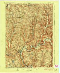
 1924 Deposit1957 Print · USGSDelaware and Broome Counties are shown here in the mid-twenties, centered on the river-and-rail corridor near Deposit. Researchers can trace the original locations of communities like Cannonsville and Rock Royal, or find ancestral schoolhouses like Slow and Easy School.
 - 1926 Map of Deposit
 1926 Deposit1926 Print · USGSThe West Branch of the Delaware River winds through these hills in the mid-twenties, passing through the villages of Deposit and Cannonsville. Genealogists can trace dozens of rural school districts, including the Slow and Easy School, and find old homesteads near McClure Settlement.4 unique versions available
 - 1944 Map of Deposit
 1944 Deposit1944 Print · USGSDelaware and Broome Counties come alive in the mid-1940s, showing the river-valley communities before later reservoir projects transformed the landscape. Trace genealogical roots through dozens of rural landmarks like McClure Settlement, Rock Royal, and Hale Eddy.
 - 1948 Map of Binghamton, 1980 Print
 1948 Binghamton1980 Print · USGSCentral New York and the Southern Tier thrive in the late 1940s as a hub of rail traffic and mountain industry. Researchers can trace historic transit lines like the Erie Railroad through Binghamton or find old valley settlements near Oneonta and Delhi.
 - 1950 Map of Binghamton
 1950 Binghamton1950 Print · USGSBinghamton and the surrounding Southern Tier are shown in the mid-century era, highlighting the intricate rail and river networks that drove local industry. Researchers can trace the path of the Erie Railroad and locate landmarks from Otsego Lake to Sidney Mountain.2 unique versions available
 - 1958 Map of Binghamton
 1958 Binghamton1958 Print · USGSCentral New York in the late fifties was a network of manufacturing cities and river valleys connected by vital rail lines. Genealogists and historians can trace family roots in Oneonta, Norwich, and Cooperstown or locate long-standing farms along Schoharie Creek.
 - 1963 Map of Binghamton
 1963 Binghamton1963 Print · USGSThe Southern Tier and Catskill peaks are shown in the early sixties as new reservoirs reshaped the valleys. Trace historic rail corridors like the Erie Lackawanna RR and explore lakeside settlements such as Cooperstown and Oneonta.
 - 1965 Map of Deposit, 1967 Print
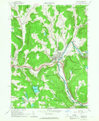 1965 Deposit1967 Print · USGSThe village of Deposit and its surrounding river valleys are captured here in the mid-sixties, shortly after the completion of the Cannonsville Dam. Genealogists and historians can trace the Erie Lackawanna Railroad and find local landmarks like Pine Grove Cem and Oquaga Lake.2 unique versions available
 - 1985 Map of Binghamton, 1986 Print
 1985 Binghamton1986 Print · USGSThe Southern Tier during the mid-1980s shows a landscape of river-valley industry and expanding university campuses. Genealogists and local historians can trace family roots through riverside towns like Bainbridge, Sidney, and the Calvary Cem in the Binghamton area.2 unique versions available
 - 2010 Map of Deposit, 2010 Print
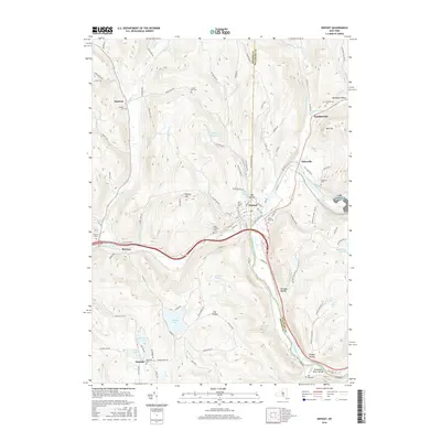
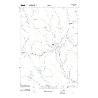 2010 Deposit2010 Print · USGSCovers Deposit, including Sanford, Stilesville, and other nearby areas
 - 2013 Map of Deposit, 2013 Print
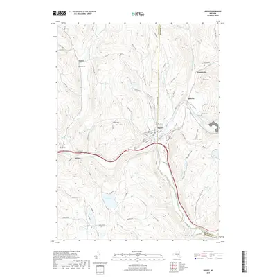
 2013 Deposit2013 Print · USGSCovers Deposit, including Sanford, Stilesville, and other nearby areas
 - 2016 Map of Deposit, 2016 Print
 2016 Deposit2016 Print · USGSCovers Deposit, including Sanford, Stilesville, and other nearby areas
 - 2019 Map of Deposit, 2019 Print
 2019 Deposit2019 Print · USGSCovers Deposit, including Sanford, Stilesville, and other nearby areas
 - 2023 Map of Deposit, 2023 Print
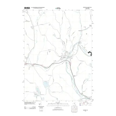
 2023 Deposit2023 Print · USGSThe river valley at the Broome and Delaware county border is shown here in detail, centered on the historic village of Deposit. Genealogists can trace family sites across nearly ten local burial grounds, including McClure Cem, Oakwood Cem, and Danville Cem.
End of results
Showing maps 1-14 of 14
Top cities near Deposit
- Windsor historical maps
- Sidney historical maps
- Walton historical maps
- Colesville historical maps
- Bainbridge historical maps
- Afton historical maps
See more
Frequently asked questions
- What are the different types of historical maps available for Deposit?
- What is the oldest map of Deposit?
- Where can I purchase historical maps of Deposit for my home or office?
- Where can I download high-res historical maps of Deposit?
- Are there historical topographic maps available for Deposit?
- Is there historical aerial imagery available for Deposit?
- Where are historical maps of Deposit sourced from?