Old Maps of Sardinia, New York for Genealogy
Trace your family roots with 35 historic maps of Sardinia. These high-res maps reveal old neighborhoods, homesites, landmarks, and streets — helping you uncover where your ancestors lived and how the area evolved over time.
- Explore historic neighborhoods: Identify where your relatives may have lived in the 1800s or 1900s.
- Compare maps over time: Trace the changes in streets, buildings, and landmarks for multi-generational research.
- Perfect for genealogy & ancestry research: Used by family historians and researchers to map out lineage and migration.
These maps are an incredible resource for exploring your personal connection to Sardinia's past.
Sardinia, NY maps
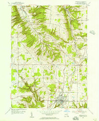
(35)- 1923 Map of Arcade, 1957 Print
 1923 Arcade1957 Print · USGSWyoming County is captured in the early 1920s, showing a landscape defined by dairy farming and the vital rail connections of the Arcade and Attica. Genealogists can trace family names at Hicks Corners and Toziers Corners, or locate rural landmarks like Klein School and Java Lake.2 unique versions available
 - 1924 Map of Ellicottville
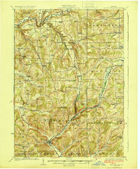 1924 Ellicottville1924 Print · USGSCattaraugus County’s steep valleys and rural schools are preserved here in the mid-1920s, showing the region's transition into the early automotive age. Trace family roots and vanished landmarks like Cascade Park, the Dutch Hill Church, and the Buffalo Rochester and Pittsburgh Railroad corridor.3 unique versions available
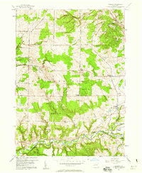
 - 1925 Map of Springville
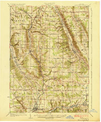 1925 Springville1925 Print · USGSSouthern Erie County in the mid-twenties shows a landscape of deep valleys and rail-connected villages before the expansion of modern highways. Genealogists can trace family footprints through dozens of district schools like Wheeler Hollow School and rural centers such as Sardinia and Griffins Mills.5 unique versions available
 - 1925 Map of Arcade
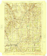 1925 Arcade1925 Print · USGSWestern New York’s rural landscape is captured here in the mid-1920s, a time when one-room schoolhouses and family-named crossroads still defined the countryside. Genealogists can trace property vicinities near Java Village, locate the elusive Cheery Tavern, or follow the path of the Arcade and Attica railroad.4 unique versions available
 - 1941 Map of Ellicottville
 1941 Ellicottville1941 Print · USGSCattaraugus County in the early 1940s is shown here as a landscape of rural school districts and rail-side villages. Researchers can trace the Baltimore and Ohio tracks through Riceville Sta or locate family sites near Dutch Hill Church and Fancy Tract.
 - 1954 Map of Springville, 1955 Print
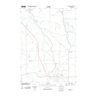
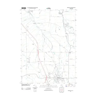
 1954 Springville1955 Print · USGSSouthern Erie County in the mid-fifties is defined by the thriving village of Springville and the winding course of the Baltimore and Ohio railroad. Local historians can trace early schools and healthcare sites like Griffith Institute and Chaffee Hosp, or locate family plots at Maplewood Cem and Sibley Cem.2 unique versions available
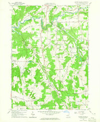
 - 1957 Map of Sardinia, 1958 Print
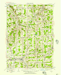
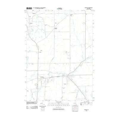
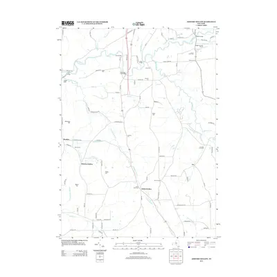
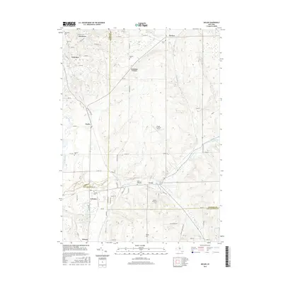
 1957 Sardinia1958 Print · USGSSoutheastern Erie County in the late fifties was a landscape of high ridges and rural family crossroads. Genealogists and researchers can trace the old rail lines of the Pennsylvania Railroad and locate vanished landmarks like Tru-Blue Ch and Sillimans Corners.3 unique versions available
 - 1960 Map of Buffalo
 1960 Buffalo1960 Print · USGSWestern New York and the Niagara Peninsula thrive during the mid-twentieth century industrial peak. Genealogists and historians can trace family-named points and early settlements from Dunkirk Light to the Allegany Indian Reservation.
 - 1962 Map of Buffalo, 1980 Print
 1962 Buffalo1980 Print · USGSThe Niagara Frontier and Western New York are captured here in the early sixties, showing the vital industrial and maritime nexus between the U.S. and Canada. Researchers can trace the path of the Welland Canal, locate the Allegany Indian Reservation, or find family sites near Chautauqua Lake.2 unique versions available
 - 1964 Map of Ashford Hollow, 1965 Print
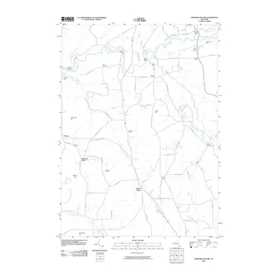
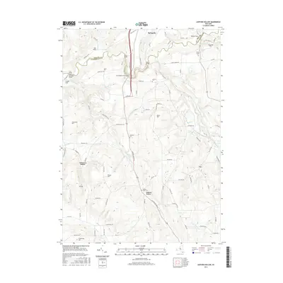
 1964 Ashford Hollow1965 Print · USGSCattaraugus County in the mid-1960s reveals a rural landscape adapting to new industrial footprints like the Western New York Nuclear Service Center. Researchers can trace old family burial grounds at Weber Cem and Thomas Corners Cem or locate vanished rail stops at Riceville Station.4 unique versions available
 - 1966 Map of Arcade, 1968 Print
 1966 Arcade1968 Print · USGSThe Arcade region of New York is shown here in the mid-1960s, a period when rural crossroads and small hamlets still anchored the landscape. Genealogists and local historians can trace the foundations of Arcade, Yorkshire, and Delevan while identifying rural landmarks like the Punkshire Cem and Camp Merrie Mill.2 unique versions available
 - 1967 Map of Buffalo
 1967 Buffalo1967 Print · USGSWestern New York and the Lake Erie shoreline are shown here during the mid-1960s industrial peak. Researchers can trace the massive rail networks of the Erie Railroad, locate the Cattaraugus Indian Reservation, or find historic sites like Fort Erie.
 - 1973 Map of Buffalo
 1973 Buffalo1973 Print · USGSWestern New York and Ontario's Golden Horseshoe meet in the early seventies, spanning from the industrial waterfronts of Buffalo to the hills of Allegany State Park. Trace the paths of the Welland Canal and Erie Lackawanna railroad through the lakefront towns of Dunkirk and Port Colborne.
 - 1984 Map of Buffalo, 1985 Print
 1984 Buffalo1985 Print · USGSWestern New York's industrial and transport hubs are in full view during the mid-eighties, from the Lake Erie waterfront to the Genesee Valley. Researchers can trace the legacy of the Erie Canal, find ancestral sites like Mount Calvary Cem, or locate the Attica Correctional Facility.2 unique versions available
 - 1986 Map of Olean
 1986 Olean1986 Print · USGSThe Southern Tier and northern Pennsylvania border are captured here in the mid-1980s as the regional rail and river economy evolved. Genealogists and local historians can trace family-named sites across the Allegany Indian Reservation, identify old Oil Field tracts, or locate landmarks like St Bonaventure University and the Tannery.2 unique versions available
 - 2010 Map of Arcade, 2010 Print
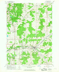
 2010 Arcade2010 Print · USGSCovers Sardinia, including Arcade, Yorkshire, and other nearby areas
 - 2010 Map of Springville, 2010 Print
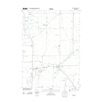
 2010 Springville2010 Print · USGSCovers Sardinia, including Concord, Boston, and other nearby areas
 - 2010 Map of Sardinia, 2010 Print
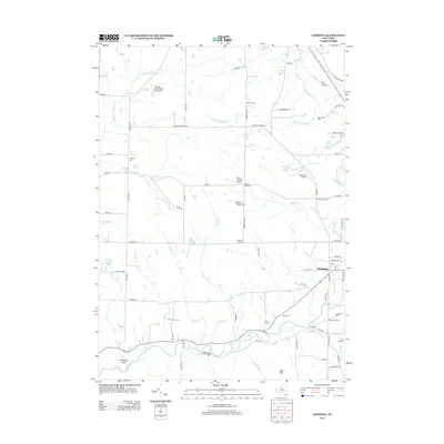
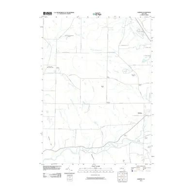 2010 Sardinia2010 Print · USGSCovers Sardinia, including Yorkshire, Holland, and other nearby areas
 - 2010 Map of Ashford Hollow, 2010 Print
 2010 Ashford Hollow2010 Print · USGSCovers Sardinia, including Concord, Springville, and other nearby areas
 - 2013 Map of Ashford Hollow, 2013 Print
 2013 Ashford Hollow2013 Print · USGSCovers Sardinia, including Concord, Springville, and other nearby areas
 - 2013 Map of Springville, 2013 Print
 2013 Springville2013 Print · USGSCovers Sardinia, including Concord, Boston, and other nearby areas
 - 2013 Map of Sardinia, 2013 Print
 2013 Sardinia2013 Print · USGSCovers Sardinia, including Yorkshire, Holland, and other nearby areas
 - 2013 Map of Arcade, 2013 Print
 2013 Arcade2013 Print · USGSCovers Sardinia, including Arcade, Yorkshire, and other nearby areas
 - 2016 Map of Arcade, 2016 Print
 2016 Arcade2016 Print · USGSCovers Sardinia, including Arcade, Yorkshire, and other nearby areas
 - 2016 Map of Ashford Hollow, 2016 Print
 2016 Ashford Hollow2016 Print · USGSCovers Sardinia, including Concord, Springville, and other nearby areas
Showing maps 1-25 of 35
Top cities near Sardinia
- Orchard Park historical maps
- Aurora historical maps
- Concord historical maps
- Boston historical maps
- East Aurora historical maps
- Springville historical maps
See more
Top neighborhoods of Sardinia
Frequently asked questions
- What are the different types of historical maps available for Sardinia?
- What is the oldest map of Sardinia?
- Where can I purchase historical maps of Sardinia for my home or office?
- Where can I download high-res historical maps of Sardinia?
- Are there historical topographic maps available for Sardinia?
- Is there historical aerial imagery available for Sardinia?
- Where are historical maps of Sardinia sourced from?