Old Maps of South Wales, Wales
Explore 13 old maps of South Wales, spanning from 1925 to today. These high-resolution historic maps reveal how streets, neighborhoods, landmarks, and natural features evolved over time — perfect for genealogy, metal detecting, research, and local history exploration.
What you can do with these maps:
- See how South Wales changed over time: Compare historical maps to modern-day views to trace roads, homesites, rail lines & more.
- View detailed metadata: Each map includes creators, publishers, year, scale, and archive source.
- Overlay maps with satellite & LiDAR: Visualize the past alongside modern tools to explore terrain & human change.
- Trusted historical sources: Maps sourced from the USGS, Library of Congress, and other archives.
- Access maps your way: View online, download high-res files, or order prints for personal or research use.
Start exploring old maps of South Wales to uncover forgotten places, hidden landmarks, and the deep history beneath your feet.
South Wales, Wales maps
(13)- 1925 Map of Springville
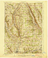 1925 Springville1925 Print · USGSSouthern Erie County in the mid-twenties shows a landscape of deep valleys and rail-connected villages before the expansion of modern highways. Genealogists can trace family footprints through dozens of district schools like Wheeler Hollow School and rural centers such as Sardinia and Griffins Mills.5 unique versions available
 - 1955 Map of Holland, 1957 Print
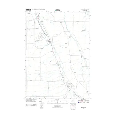
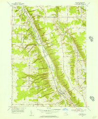 1955 Holland1957 Print · USGSErie County's southern valleys and highlands are caught mid-century, before modern development bypassed these rural hamlets. Genealogists can trace family names at Humphrey Cem and Hunter Creek Ch, or locate the old Gow Sch near South Wales.2 unique versions available
 - 1960 Map of Buffalo
 1960 Buffalo1960 Print · USGSWestern New York and the Niagara Peninsula thrive during the mid-twentieth century industrial peak. Genealogists and historians can trace family-named points and early settlements from Dunkirk Light to the Allegany Indian Reservation.
 - 1962 Map of Buffalo, 1980 Print
 1962 Buffalo1980 Print · USGSThe Niagara Frontier and Western New York are captured here in the early sixties, showing the vital industrial and maritime nexus between the U.S. and Canada. Researchers can trace the path of the Welland Canal, locate the Allegany Indian Reservation, or find family sites near Chautauqua Lake.2 unique versions available
 - 1967 Map of Buffalo
 1967 Buffalo1967 Print · USGSWestern New York and the Lake Erie shoreline are shown here during the mid-1960s industrial peak. Researchers can trace the massive rail networks of the Erie Railroad, locate the Cattaraugus Indian Reservation, or find historic sites like Fort Erie.
 - 1973 Map of Buffalo
 1973 Buffalo1973 Print · USGSWestern New York and Ontario's Golden Horseshoe meet in the early seventies, spanning from the industrial waterfronts of Buffalo to the hills of Allegany State Park. Trace the paths of the Welland Canal and Erie Lackawanna railroad through the lakefront towns of Dunkirk and Port Colborne.
 - 1979 Map of Holland
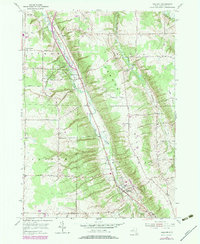 1979 Holland1979 Print · USGSErie County's rural character is on full display in the late 1970s as agricultural valleys and wooded ridges meet along the East Branch Cazenovia Creek. Family historians can trace numerous burial sites like Humphrey Cem and local landmarks such as the Gow Sch and Emery Park.
 - 1984 Map of Buffalo, 1985 Print
 1984 Buffalo1985 Print · USGSWestern New York's industrial and transport hubs are in full view during the mid-eighties, from the Lake Erie waterfront to the Genesee Valley. Researchers can trace the legacy of the Erie Canal, find ancestral sites like Mount Calvary Cem, or locate the Attica Correctional Facility.2 unique versions available
 - 2010 Map of Holland, 2010 Print
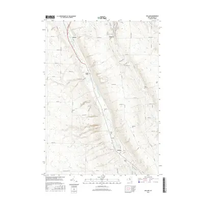
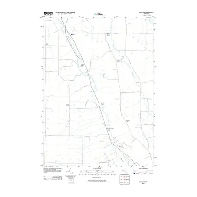 2010 Holland2010 Print · USGSCovers South Wales, including Aurora, Holland, and other nearby areas
 - 2013 Map of Holland, 2013 Print
 2013 Holland2013 Print · USGSCovers South Wales, including Aurora, Holland, and other nearby areas
 - 2016 Map of Holland, 2016 Print
 2016 Holland2016 Print · USGSCovers South Wales, including Aurora, Holland, and other nearby areas
 - 2019 Map of Holland, 2019 Print
 2019 Holland2019 Print · USGSCovers South Wales, including Aurora, Holland, and other nearby areas
 - 2023 Map of Holland, 2023 Print
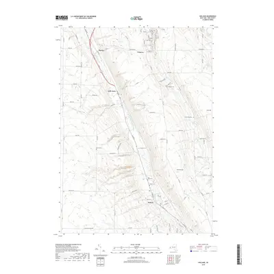
 2023 Holland2023 Print · USGSErie County's rural townships are documented in detail here during the early twenty-first century, showing the enduring valley settlements of South Wales and Holland. Family history researchers can trace several burial sites including Humphrey Cem and Holmes Hill Cem along the ridges.
End of results
Showing maps 1-13 of 13
Top cities near South Wales
- Buffalo historical maps
- Cheektowaga historical maps
- Hamburg historical maps
- West Seneca historical maps
- Lancaster historical maps
- Orchard Park historical maps
See more
Frequently asked questions
- What are the different types of historical maps available for South Wales?
- What is the oldest map of South Wales?
- Where can I purchase historical maps of South Wales for my home or office?
- Where can I download high-res historical maps of South Wales?
- Are there historical topographic maps available for South Wales?
- Is there historical aerial imagery available for South Wales?
- Where are historical maps of South Wales sourced from?