Old Maps of Fulton County, New York
Explore 84 old maps of Fulton County, spanning from 1895 to today. These high-resolution historic maps reveal how streets, neighborhoods, landmarks, and natural features evolved over time — perfect for genealogy, metal detecting, research, and local history exploration.
What you can do with these maps:
- See how Fulton County changed over time: Compare historical maps to modern-day views to trace roads, homesites, rail lines & more.
- View detailed metadata: Each map includes creators, publishers, year, scale, and archive source.
- Overlay maps with satellite & LiDAR: Visualize the past alongside modern tools to explore terrain & human change.
- Trusted historical sources: Maps sourced from the USGS, Library of Congress, and other archives.
- Access maps your way: View online, download high-res files, or order prints for personal or research use.
Start exploring old maps of Fulton County to uncover forgotten places, hidden landmarks, and the deep history beneath your feet.
Fulton County, NY maps
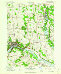
(84)- 1895 Map of Amsterdam
 1895 Amsterdam1895 Print · USGSCovers Fulton County, including Guilderland, Rotterdam, and other nearby areas7 unique versions available
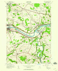
 - 1896 Map of Fonda
 1896 Fonda1896 Print · USGSCovers Fulton County, including Johnstown, Johnstown, and other nearby areas
 - 1898 Map of Fonda
 1898 Fonda1898 Print · USGSCovers Fulton County, including Johnstown, Johnstown, and other nearby areas
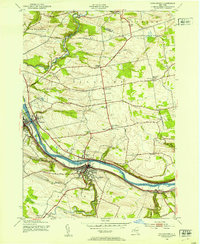
 - 1898 Map of Canajoharie, 1954 Print
 1898 Canajoharie1954 Print · USGSCovers Fulton County, including Minden, Canajoharie, and other nearby areas
 - 1899 Map of Broadalbin, 1954 Print
 1899 Broadalbin1954 Print · USGSCovers Fulton County, including Mayfield, Broadalbin, and other nearby areas
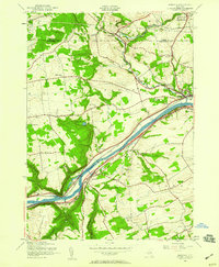
 - 1900 Map of Little Falls
 1900 Little Falls1900 Print · USGSCovers Fulton County, including German Flatts, Herkimer, and other nearby areas
 - 1900 Map of Canajoharie
 1900 Canajoharie1900 Print · USGSCovers Fulton County, including Minden, Canajoharie, and other nearby areas
 - 1901 Map of Lassellsville, 1959 Print
 1901 Lassellsville1959 Print · USGSCovers Fulton County, including Johnstown, Palatine, and other nearby areas
 - 1902 Map of Broadalbin
 1902 Broadalbin1902 Print · USGSCovers Fulton County, including Mayfield, Broadalbin, and other nearby areas9 unique versions available
 - 1902 Map of Canajoharie
 1902 Canajoharie1902 Print · USGSCovers Fulton County, including Minden, Canajoharie, and other nearby areas6 unique versions available
 - 1902 Map of Fonda
 1902 Fonda1902 Print · USGSCovers Fulton County, including Johnstown, Johnstown, and other nearby areas8 unique versions available
 - 1903 Map of Gloversville
 1903 Gloversville1903 Print · USGSCovers Fulton County, including Gloversville, Johnstown, and other nearby areas8 unique versions available
 - 1903 Map of Lassellsville
 1903 Lassellsville1903 Print · USGSCovers Fulton County, including Johnstown, Palatine, and other nearby areas6 unique versions available
 - 1903 Map of Little Falls
 1903 Little Falls1903 Print · USGSCovers Fulton County, including German Flatts, Herkimer, and other nearby areas6 unique versions available
 - 1904 Map of Piseco Lake
 1904 Piseco Lake1904 Print · USGSCovers Fulton County, including Salisbury, Stratford, and other nearby areas
 - 1906 Map of Piseco Lake
 1906 Piseco Lake1906 Print · USGSCovers Fulton County, including Salisbury, Stratford, and other nearby areas7 unique versions available
 - 1908 Map of Piseco Lake, 1918 Print
 1908 Piseco Lake1918 Print · USGSCovers Fulton County, including Salisbury, Stratford, and other nearby areas
 - 1910 Map of Stony Creek
 1910 Stony Creek1910 Print · USGSCovers Fulton County, including Northampton, Edinburg, and other nearby areas7 unique versions available
 - 1931 Map of Amsterdam
 1931 Amsterdam1931 Print · USGSCovers Fulton County, including Guilderland, Rotterdam, and other nearby areas3 unique versions available
 - 1939 Map of Little Falls
 1939 Little Falls1939 Print · USGSCovers Fulton County, including German Flatts, Herkimer, and other nearby areas
 - 1943 Map of Gloversville
 1943 Gloversville1943 Print · USGSCovers Fulton County, including Gloversville, Johnstown, and other nearby areas
 - 1943 Map of Little Falls, 1960 Print
 1943 Little Falls1960 Print · USGSCovers Fulton County, including Little Falls, Manheim, and other nearby areas2 unique versions available
 - 1944 Map of Canajoharie, 1953 Print
 1944 Canajoharie1953 Print · USGSCovers Fulton County, including Minden, Canajoharie, and other nearby areas2 unique versions available
 - 1944 Map of Tribes Hill, 1959 Print
 1944 Tribes Hill1959 Print · USGSCovers Fulton County, including Johnstown, Johnstown, and other nearby areas2 unique versions available
 - 1944 Map of Randall, 1959 Print
 1944 Randall1959 Print · USGSCovers Fulton County, including Johnstown, Johnstown, and other nearby areas3 unique versions available
Showing maps 1-25 of 84
Top cities of Fulton County
- Gloversville historical maps
- Johnstown historical maps
- Johnstown historical maps
- Mayfield historical maps
- Broadalbin historical maps
- Perth historical maps
See more
Frequently asked questions
- What are the different types of historical maps available for Fulton County?
- What is the oldest map of Fulton County?
- Where can I purchase historical maps of Fulton County for my home or office?
- Where can I download high-res historical maps of Fulton County?
- Are there historical topographic maps available for Fulton County?
- Is there historical aerial imagery available for Fulton County?
- Where are historical maps of Fulton County sourced from?