Old Maps of Stafford, New York for Metal Detecting
Plan your next treasure hunt with 41 historic maps of Stafford. Find old homesites, ghost towns, trails, and gathering spots that may be lost to time — perfect for identifying promising metal detecting locations.
- Locate forgotten sites: Uncover places like long-lost settlements, abandoned rail lines, or gathering spots.
- Plan better hunts: Use map overlays combined with LiDAR or satellite views to narrow in on historically rich areas.
- Made for detectorists: Thousands of hobbyists use these maps to discover relics, coins, and hidden history.
Use these historic maps to boost your research and find new opportunities beneath the surface of Stafford.
Stafford, NY maps
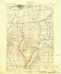
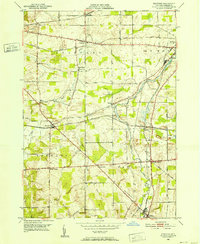
(41)- 1897 Map of Albion
 1897 Albion1897 Print · USGSWestern New York at the close of the nineteenth century is defined by its busy transit corridors and rural crossroads. Researchers can trace ancestral farmsteads and old trade routes near the Erie Canal, Oak Orchard Swamp, and Rich's Corners.7 unique versions available
 - 1904 Map of Batavia
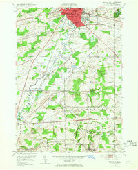
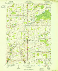
 1904 Batavia1904 Print · USGSWestern New York at the turn of the century shows a landscape dominated by competing railroad interests and agricultural hamlets. Genealogists can trace family connections between Pearl Creek, Attica Center, and Stafford while following the routes of the Lehigh Valley and Erie R. R. through the valleys.7 unique versions available
 - 1944 Map of Byron
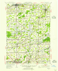
 1944 Byron1944 Print · USGSGenesee County's rural landscape at the height of the Second World War was a thriving network of rail-side hamlets and small school districts. Genealogists and local historians can trace family roots through labeled sites like School No 2, the village of South Byron, and the Bergen Swamp Wild-Life Sanctuary.
 - 1944 Map of Stafford
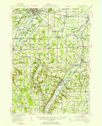
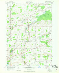
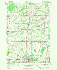
 1944 Stafford1944 Print · USGSWestern New York’s rural landscape is captured here during the mid-1940s, showcasing the intersection of heavy rail and local farming life. Genealogists can locate family-named roads and several rural schoolhouses like School No 8 and School No 11.
 - 1950 Map of Batavia
 1950 Batavia1950 Print · USGSWestern New York at the mid-century shows a bustling landscape of rail hubs and rural crossroads. Researchers can trace the heritage of Batavia and Wyoming while locating local landmarks like the Pioneer Salt Well, Bethany Ch, and the Fairgrounds.
 - 1950 Map of Stafford, 1952 Print
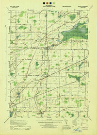
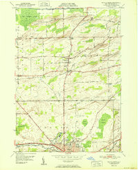
 1950 Stafford1952 Print · USGSGenesee County at the mid-century was a bustling hub of New York rail traffic and small-town commerce. Researchers can trace family history through the Stafford Cem or locate vanished local landmarks like the Bel-air Ranch Health Camp and Suicide Corners.3 unique versions available
 - 1950 Map of Batavia South, 1952 Print
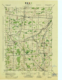
 1950 Batavia South1952 Print · USGSThe Genesee County countryside south of Batavia in the early fifties was a busy junction of four major railroads. Genealogists and local historians can trace the paths between rural hamlets like Linden, Brookville, and Bethany Center, or locate landmarks such as Jackson Sch and the County Home.3 unique versions available
 - 1950 Map of Albion, 1956 Print
 1950 Albion1956 Print · USGSOrleans and Genesee counties sit at a fascinating crossroads in the early fifties as new highway systems began to parallel the historic water and rail routes. Researchers can trace the heritage of local hamlets like South Barre and North Bergen, or locate landmarks like the State Training School for Girls and Mt Albion Cem.2 unique versions available
 - 1950 Map of Byron, 1969 Print
 1950 Byron1969 Print · USGSMid-century Genesee County comes alive through this 1950 survey, showcasing the vital rail corridors and rural hamlets of the Byron region. Family historians can locate several burial grounds, including Sodom Cem and Walkers Cem, while tracing the paths of the New York Central Railroad and Lehigh Valley Railroad.3 unique versions available
 - 1950 Map of Batavia North, 1970 Print
 1950 Batavia North1970 Print · USGSGenesee County at mid-century centers on the industrial and institutional expansion of Batavia. Researchers can trace the legacy of local landmarks like the State School for the Blind, the Batavia Downs track, and rural hamlets such as East Elba and Langton Corners.2 unique versions available
 - 1951 Map of Batavia North
 1951 Batavia North1951 Print · USGSGenesee County's northern corridor is captured here in the early fifties as Batavia's urban reach meets the surrounding swamplands and muck farms. Genealogists and local historians can trace family roots through Gardner Cem, the Veterans Hospital, and small hamlets like East Elba and Daws.
 - 1952 Map of Byron
 1952 Byron1952 Print · USGSThe rural landscape of Genesee County in the early fifties shows a thriving rail-and-road network connecting local settlements. Genealogists and historians can locate numerous family-named landmarks and burial grounds, such as Sodom Cem, Morganville, and the Airway Beacon near the railroad tracks.
 - 1952 Map of Toronto, 1954 Print
 1952 Toronto1954 Print · USGSLake Ontario and the international border define this mid-century landscape of rapid industrial and suburban growth. Researchers can trace the vital shipping and rail corridors of the era, from the Welland Canal to the New York Central Railroad.
 - 1960 Map of Buffalo
 1960 Buffalo1960 Print · USGSWestern New York and the Niagara Peninsula thrive during the mid-twentieth century industrial peak. Genealogists and historians can trace family-named points and early settlements from Dunkirk Light to the Allegany Indian Reservation.
 - 1962 Map of Buffalo, 1980 Print
 1962 Buffalo1980 Print · USGSThe Niagara Frontier and Western New York are captured here in the early sixties, showing the vital industrial and maritime nexus between the U.S. and Canada. Researchers can trace the path of the Welland Canal, locate the Allegany Indian Reservation, or find family sites near Chautauqua Lake.2 unique versions available
 - 1962 Map of Toronto, 1982 Print
 1962 Toronto1982 Print · USGSThe Golden Horseshoe and the Niagara Frontier meet in this early 1960s study of a growing international border region. Trace the path of the Welland Canal and locate land marks like the Scarborough Bluffs and Tuscarora Indian Reservation.
 - 1965 Map of Toronto
 1965 Toronto1965 Print · USGSThe Golden Horseshoe and Niagara Frontier are shown in detail during the early sixties, highlighting the international shipping and transit networks. Trace the path of the Erie Canal, the Welland Canal, and rail lines connecting Toronto and Niagara Falls.2 unique versions available
 - 1967 Map of Buffalo
 1967 Buffalo1967 Print · USGSWestern New York and the Lake Erie shoreline are shown here during the mid-1960s industrial peak. Researchers can trace the massive rail networks of the Erie Railroad, locate the Cattaraugus Indian Reservation, or find historic sites like Fort Erie.
 - 1973 Map of Buffalo
 1973 Buffalo1973 Print · USGSWestern New York and Ontario's Golden Horseshoe meet in the early seventies, spanning from the industrial waterfronts of Buffalo to the hills of Allegany State Park. Trace the paths of the Welland Canal and Erie Lackawanna railroad through the lakefront towns of Dunkirk and Port Colborne.
 - 1984 Map of Buffalo, 1985 Print
 1984 Buffalo1985 Print · USGSWestern New York's industrial and transport hubs are in full view during the mid-eighties, from the Lake Erie waterfront to the Genesee Valley. Researchers can trace the legacy of the Erie Canal, find ancestral sites like Mount Calvary Cem, or locate the Attica Correctional Facility.2 unique versions available
 - 1984 Map of Lockport, 1985 Print
 1984 Lockport1985 Print · USGSWestern New York in the 1980s shows a landscape of lakefront parks, industrial rail corridors, and vast protected wetlands. Genealogists and historians can trace the legacy of local families through sites like Acacia Park Cem or the Tuscarora Indian Reservation.2 unique versions available
 - 2010 Map of Batavia South, 2010 Print
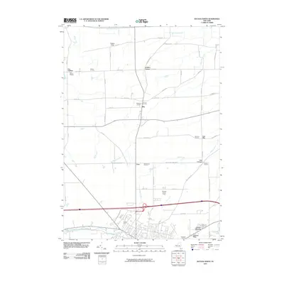
 2010 Batavia South2010 Print · USGSCovers Stafford, including Batavia, Batavia, and other nearby areas
 - 2010 Map of Stafford, 2010 Print
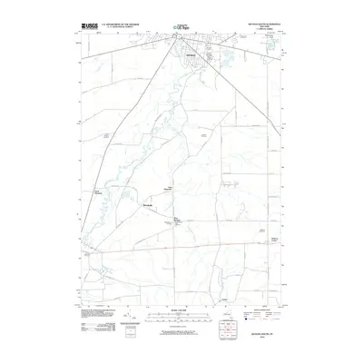
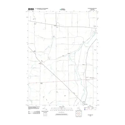 2010 Stafford2010 Print · USGSCovers Stafford, including LeRoy, LeRoy, and other nearby areas
 - 2010 Map of Batavia North, 2010 Print
 2010 Batavia North2010 Print · USGSCovers Stafford, including Batavia, Batavia, and other nearby areas
 - 2010 Map of Byron, 2010 Print
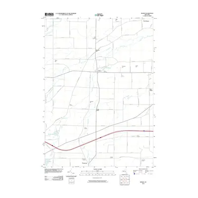 2010 Byron2010 Print · USGSCovers Stafford, including LeRoy, Bergen, and other nearby areas
Showing maps 1-25 of 41
Top cities near Stafford
- Ogden historical maps
- Parma historical maps
- Batavia historical maps
- Sweden historical maps
- LeRoy historical maps
- Albion historical maps
See more
Top neighborhoods of Stafford
Frequently asked questions
- What are the different types of historical maps available for Stafford?
- What is the oldest map of Stafford?
- Where can I purchase historical maps of Stafford for my home or office?
- Where can I download high-res historical maps of Stafford?
- Are there historical topographic maps available for Stafford?
- Is there historical aerial imagery available for Stafford?
- Where are historical maps of Stafford sourced from?