Old Maps of Salisbury, New York
Explore 71 old maps of Salisbury, spanning from 1900 to today. These high-resolution historic maps reveal how streets, neighborhoods, landmarks, and natural features evolved over time — perfect for genealogy, metal detecting, research, and local history exploration.
What you can do with these maps:
- See how Salisbury changed over time: Compare historical maps to modern-day views to trace roads, homesites, rail lines & more.
- View detailed metadata: Each map includes creators, publishers, year, scale, and archive source.
- Overlay maps with satellite & LiDAR: Visualize the past alongside modern tools to explore terrain & human change.
- Trusted historical sources: Maps sourced from the USGS, Library of Congress, and other archives.
- Access maps your way: View online, download high-res files, or order prints for personal or research use.
Start exploring old maps of Salisbury to uncover forgotten places, hidden landmarks, and the deep history beneath your feet.
Salisbury, NY maps
(71)- 1900 Map of Little Falls
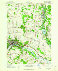
 1900 Little Falls1900 Print · USGSThe Mohawk River valley serves as a bustling industrial artery at the turn of the century, dominated by canal and rail traffic. Genealogists can trace the early footprints of Little Falls, find the County House, or locate vanished stops like Ingham Mills Sta.
 - 1900 Map of Wilmurt
 1900 Wilmurt1900 Print · USGSThe Adirondack foothills of Herkimer and Hamilton counties appear here at the turn of the century, showing a landscape of isolated hamlets and timber-rich woods. Genealogists can trace family roots in Wilmurt, Nobleboro, and Morehouseville or locate landmarks like Twin Lakes Reservoir and Hinckley Lake.
 - 1901 Map of Lassellsville, 1959 Print
 1901 Lassellsville1959 Print · USGSFulton and Montgomery Counties come alive in this turn-of-the-century survey of the Mohawk Valley and southern Adirondacks. Genealogists and researchers can pinpoint family holdings near Irish Settlement, the industry of Newkirk Mills, and the rails of the N. Y. C. and H. R. R. R.
 - 1902 Map of Wilmurt
 1902 Wilmurt1902 Print · USGSThe Adirondack foothills are captured here in the late nineteenth century, showing a landscape defined by logging-era headwaters and remote hamlets. Genealogists and researchers can trace early roads and river landings through Wilmurt, Nobleboro, and Morehouseville.8 unique versions available
 - 1903 Map of Lassellsville
 1903 Lassellsville1903 Print · USGSFulton County at the start of the century shows a landscape of upland mill sites and busy valley railroads. Genealogists can trace family names at Irish Settlement, Fical Corners, and the mill sites at Newkirk Mills.6 unique versions available
 - 1903 Map of Little Falls
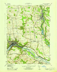
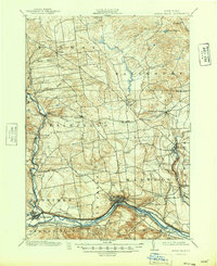
 1903 Little Falls1903 Print · USGSThe Mohawk Valley was a bustling corridor of industry and transit at the turn of the century, where the river met a network of canals and railroads. Genealogists and historians can trace the foundations of Little Falls, find the historic site of Fort Herkimer, and locate rural landmarks like the County House.6 unique versions available
 - 1904 Map of Piseco Lake
 1904 Piseco Lake1904 Print · USGSThe central Adirondacks in the early 1900s centered on the waters of Piseco Lake and the winding West Canada Creek. Local historians can trace early outposts and settlements like Hoffmeister, Rudeston, and the isolated Mountain House.
 - 1906 Map of Piseco Lake
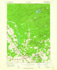
 1906 Piseco Lake1906 Print · USGSThe Adirondack wilderness of the early twentieth century comes into focus through this survey of the high-country lake district. Researchers can find logging-era outposts and early resorts like Mountain House, Rudeston, and the remote Powley Place.7 unique versions available
 - 1908 Map of Piseco Lake, 1918 Print
 1908 Piseco Lake1918 Print · USGSThe southern Adirondacks at the turn of the century appear as a network of isolated homesteads and family camps. Trace early settlements like Piseco and Hoffmeister or find remote landmarks such as Mountain House, Powley Place, and Clockmill Corners.
 - 1939 Map of Little Falls
 1939 Little Falls1939 Print · USGSThe Mohawk Valley was a bustling corridor of rail and water transport just before the mid-century, centered on the narrow gorge at Little Falls. Genealogists and historians can trace the paths of the Adirondack Division railroad and historic sites like Fort Herkimer and Indian Castle.
 - 1943 Map of Little Falls, 1960 Print
 1943 Little Falls1960 Print · USGSThe Mohawk Valley at the height of the Second World War shows a landscape defined by the Barge Canal and industrial hubs like Little Falls. Trace family roots at the Fink-Van Valkenburg Cem or locate rural landmarks like Yellow Ch.2 unique versions available
 - 1943 Map of Middleville, 1960 Print
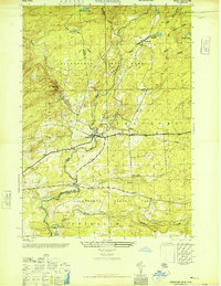
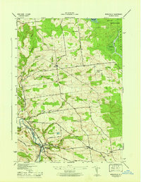
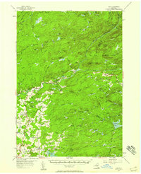
 1943 Middleville1960 Print · USGSHerkimer County's rural highlands and the West Canada Creek valley are captured here during the Second World War. Researchers can trace old schoolhouse sites like Dairy Hill Sch and find quiet burying grounds including Sweet Cem and Hardscrabble Cem.3 unique versions available
 - 1945 Map of Stratford, 1946 Print
 1945 Stratford1946 Print · USGSThe southern Adirondack foothills come alive in this mid-forties survey of the Herkimer and Fulton county line. Researchers can trace the rural layout of Stratford and Emmonsburg or locate family sites near Roundtop Cem and School No 16.4 unique versions available
 - 1945 Map of Salisbury, 1960 Print
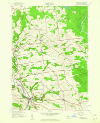
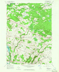
 1945 Salisbury1960 Print · USGSHerkimer County's transition into the Adirondack wilderness is captured here in the mid-1940s. Genealogists and local historians can trace family roots through numerous sites like St Bridget Cem, the Kelly Sch, and the old settlement at Irondale.3 unique versions available
 - 1945 Map of Lassellsville, 1964 Print
 1945 Lassellsville1964 Print · USGSFulton County and the southern Adirondack fringe are captured here just after the turn of the century, showing a landscape of small mill towns and isolated highland settlements. Researchers can trace family-named crossroads like Fical Corners and vanished industrial sites at Glasgow Mills or Newkirk Mills.
 - 1945 Map of Oppenheim, 1966 Print
 1945 Oppenheim1966 Print · USGSThe Mohawk Valley and the Adirondack foothills meet in this mid-century survey of Fulton and Montgomery Counties. You can trace early schoolhouse locations like School No 9 and explore rural hamlets including Lotville and Kringsbush.2 unique versions available
 - 1946 Map of Salisbury
 1946 Salisbury1946 Print · USGSHerkimer County's southern Adirondack foothills appear here in the mid-1940s, balancing timber clearings with settled valley hamlets. Researchers can trace family history through sites like St Bridget Cem, the Pine Crest Sanatorium, and old junctions like Paper Mill Corners.
 - 1946 Map of Little Falls
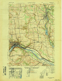
 1946 Little Falls1946 Print · USGSHerkimer County at mid-century reveals a landscape defined by the Mohawk River and the busy Barge Canal. Researchers can trace the heritage of local hamlets like Ingham Mills and Dolgeville or locate ancestral sites at Yellow Ch and St Marys Cem.
 - 1946 Map of Middleville
 1946 Middleville1946 Print · USGSHerkimer County's dairy country and river valleys are shown in detail during the mid-1940s, highlighting a landscape of upland farms and rural hamlets. Researchers can locate vanished landmarks like Dairy Hill Sch, the high Lookout Tower, and family burial grounds at Hardscrabble Cem.
 - 1949 Map of Little Falls
 1949 Little Falls1949 Print · USGSThe Mohawk River valley during the late 1940s reveals a bustling landscape of rail and water transport. Trace family roots at St Marys Cem or locate old rural landmarks like Ingham Mills, Indian Castle Ch, and Five Mile Dam.
 - 1949 Map of Little Falls
 1949 Little Falls1949 Print · USGSHerkimer County's industrial heartland is captured here at mid-century, showcasing the vital Mohawk Valley transit corridor. Researchers can trace the path of the Erie Canal, the Barge Canal, and early rail stops like Ingham Mills Sta. and Dolgeville.
 - 1950 Map of Utica, 1951 Print
 1950 Utica1951 Print · USGSCentral New York in the post-war era showcases the industrial Mohawk Valley and the pristine Adirondack interior. Researchers can trace transportation networks like the New York Central Railroad and find early Cold War sites such as Griffiss Air Force Base.
 - 1954 Map of Ohio
 1954 Ohio1954 Print · USGSThe southwestern Adirondacks in the mid-1950s reveal a landscape of remote mountain peaks and small timber-era settlements. Researchers can locate vanished landmarks like Wilmurt Sch, the War Memorial Monument, and rural cemeteries like McIntosh Cem.4 unique versions available
 - 1954 Map of Piseco Lake, 1957 Print
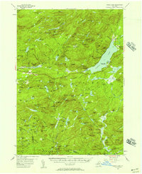 1954 Piseco Lake1957 Print · USGSMid-century Hamilton County is captured here in detail, showcasing the high-elevation settlements and lakes of the southern Adirondacks. Genealogists and historians can trace family locations and remote sites like Morehouseville, Shaker Place, and the Spruce Hill Cem.5 unique versions available
 - 1957 Map of Utica
 1957 Utica1957 Print · USGSCentral New York and the Adirondack foothills are captured here in the mid-fifties, showing a landscape defined by the Mohawk River corridor and the growing highway system. Genealogists and researchers can trace the rail lines of the New York Central and locate communities from Lowville to Gloversville.
Showing maps 1-25 of 71
Top cities near Salisbury
- German Flatts historical maps
- Herkimer historical maps
- Herkimer historical maps
- Little Falls historical maps
- Palatine historical maps
- Manheim historical maps
See more
Top neighborhoods of Salisbury
- Paper Mill Corners historical maps
- Ives Hollow historical maps
- Curtis historical maps
- Irondale historical maps
- Stratford historical maps
- Salisbury Center historical maps
Frequently asked questions
- What are the different types of historical maps available for Salisbury?
- What is the oldest map of Salisbury?
- Where can I purchase historical maps of Salisbury for my home or office?
- Where can I download high-res historical maps of Salisbury?
- Are there historical topographic maps available for Salisbury?
- Is there historical aerial imagery available for Salisbury?
- Where are historical maps of Salisbury sourced from?