Old Maps of Champion, New York for Academic Research
Study the evolution of Champion with 46 high-resolution historic maps. Whether you're teaching, researching, or modeling changes in land use, these maps provide essential visual documentation of urban, environmental, and geographic change.
- Analyze long-term change: Track patterns in development, transportation, and natural features.
- Ideal for environmental or urban studies: Support academic projects with primary historical map data.
- Use in the classroom or lab: Educators and researchers rely on these maps to bring historical context to life.
These maps are a powerful tool for teaching, research, and visualizing how Champion has changed over the decades.
Champion, NY maps
(46)- 1895 Map of Watertown
 1895 Watertown1895 Print · USGSJefferson County in the 1890s centered on the industrial energy of the Black River and a complex web of iron rails. Genealogists and local researchers can trace historic crossroads such as Fields Settlement, Whitford Corner, and Burrs Mills.
 - 1898 Map of Watertown
 1898 Watertown1898 Print · USGSJefferson County at the close of the nineteenth century centers on the growing hub of Watertown and its intricate rail network. Researchers can trace the nineteenth-century landscape of rural hamlets, mills, and family landmarks like Burrs Mills, Honeyville, and Fields Settlement.2 unique versions available
 - 1902 Map of Carthage
 1902 Carthage1902 Print · USGSUpper New York at the turn of the century shows a landscape of river-powered industry and sprawling hill farms. Genealogists can trace family names and old crossroads from Champion Huddle to Gardners Corners, while rail historians can follow the R. W. and O. Div. through the Black River valley.
 - 1904 Map of Carthage
 1904 Carthage1904 Print · USGSJefferson and Lewis Counties at the turn of the century show a landscape defined by the Black River valley and its busy rail lines. Genealogists can trace early homesteads in rural outposts like Champion Huddle, Windecker, and Gardners Corners.6 unique versions available
 - 1908 Map of Watertown, 1955 Print
 1908 Watertown1955 Print · USGSWatertown and the rural uplands of the Tug Hill region are captured here in the early twentieth century as the railroad era peaked. Genealogists can trace early post offices like Klondike and Whitesville, or locate family sites near Brookside Cemetery.
 - 1909 Map of Watertown
 1909 Watertown1909 Print · USGSJefferson County was at its industrial and agrarian height in the early twentieth century, centered on the vital rail hub of Watertown. Local historians can trace family roots through the Middle Road Church or locate vanished post offices like Klondike Worth and Tylerville South Rutland.6 unique versions available
 - 1911 Map of Antwerp
 1911 Antwerp1911 Print · USGSJefferson County was a landscape of bustling river towns and intersecting rail lines just after the turn of the century. Trace the early footprints of Antwerp and Sterlingville, or locate family landmarks like Bishops Corners and Woods Mill.6 unique versions available
 - 1942 Map of Copenhagen, 1960 Print
 1942 Copenhagen1960 Print · USGSUpper New York state is mapped here during the early war years, showing a landscape of small river towns and upland dairy farms. Genealogists can trace family names at Hillside Cem and locate numerous one-room schoolhouses like School No 10.2 unique versions available
 - 1943 Map of Copenhagen
 1943 Copenhagen1943 Print · USGSThe rural uplands of Lewis and Jefferson Counties come into focus during the early 1940s as agricultural life centered around the Deer River. Researchers can locate numerous numbered schoolhouses, the village of Copenhagen, and local landmarks like Pleasant Lake and High Falls.
 - 1943 Map of Carthage
 1943 Carthage1943 Print · USGSIn the early 1940s, the industrial hub of Carthage and the surrounding river townships relied heavily on the Black River and the New York Central rail line. Researchers can trace rural school districts and family cemeteries like Swinburne Cem and Sunny Side Cem.4 unique versions available
 - 1943 Map of South Rutland, 1954 Print
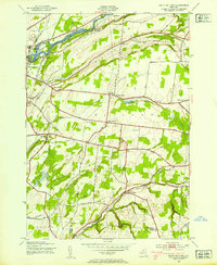 1943 South Rutland1954 Print · USGSJefferson County farming communities and the Black River valley are captured here in the 1940s. Genealogists can trace family footprints at Middle Road Ch, Maple Hill Cem, and numerous schoolhouses from Burrs Mills to South Rutland.2 unique versions available
 - 1948 Map of Ogdensburg, 1973 Print
 1948 Ogdensburg1973 Print · USGSThe international border along the St Lawrence River comes to life in the late 1940s, showing the vital rail and water connections between New York and Ontario. Researchers can trace the grounds of St Lawrence University, the massive Camp Drum military reservation, and the historic Rideau River and Canal.2 unique versions available
 - 1949 Map of Antwerp, 1953 Print
 1949 Antwerp1953 Print · USGSNorthern Jefferson County during the late 1940s is defined here by the massive footprint of the Pine Camp Military Reservation. You can trace rural life and ancestry through dozens of schoolhouses and family landmarks like Bishops Corners and Woods Mill.2 unique versions available
 - 1949 Map of Deferiet, 1967 Print
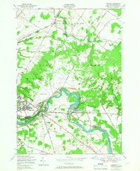 1949 Deferiet1967 Print · USGSJefferson County’s river towns and military installations are captured here in the late 1940s as the regional economy shifted. Researchers can locate family landmarks like the F W Woolworth Memorial Cemetery, early schoolhouses, and the rail-side community of Deferiet.2 unique versions available
 - 1950 Map of Deferiet
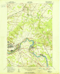 1950 Deferiet1950 Print · USGSJefferson County at the mid-century is defined here by the confluence of industrial river towns and the growing Pine Camp Military Reservation. Trace family roots and local history through School No 14, Sterlingville, and the F. W. Woolworth Memorial Cemetery.
 - 1950 Map of Utica, 1951 Print
 1950 Utica1951 Print · USGSCentral New York in the post-war era showcases the industrial Mohawk Valley and the pristine Adirondack interior. Researchers can trace transportation networks like the New York Central Railroad and find early Cold War sites such as Griffiss Air Force Base.
 - 1951 Map of Ogdensburg
 1951 Ogdensburg1951 Print · USGSThe St. Lawrence frontier and the North Country are captured here during the post-war era, from the river ports to the high Adirondacks. Genealogists and historians can trace the rail-and-river economy through Ogdensburg, the Rutland rail lines, and Potsdam.
 - 1953 Map of Ogdensburg
 1953 Ogdensburg1953 Print · USGSThe North Country and St. Lawrence Valley are shown here in the early fifties, just as the region’s rail-and-river economy remained in full swing. Genealogists and historians can trace family-named corners and rural hubs along the Rutland railroad or locate heritage sites near Ogdensburg, Potsdam, and the St Regis Indian Reservation.
 - 1957 Map of Utica
 1957 Utica1957 Print · USGSCentral New York and the Adirondack foothills are captured here in the mid-fifties, showing a landscape defined by the Mohawk River corridor and the growing highway system. Genealogists and researchers can trace the rail lines of the New York Central and locate communities from Lowville to Gloversville.
 - 1959 Map of Rutland Center, 1960 Print
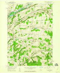 1959 Rutland Center1960 Print · USGSJefferson County dairy lands and upland hollows are captured here in the late fifties, as rural life centered on crossroads like Tylersville and Burrs Mills. Researchers can locate family homesteads near Maple Hill Cem or trace the old New York Central line along the Black River.2 unique versions available
 - 1961 Map of Ogdensburg
 1961 Ogdensburg1961 Print · USGSThe St. Lawrence valley and the Adirondack high country meet in this early sixties survey during a peak era for rail and river commerce. Genealogists and historians can trace the paths of the New York Central railroad through remote settlements like Wanakena, Conifer, and Piercefield.
 - 1962 Map of Utica
 1962 Utica1962 Print · USGSCentral New York and the Adirondack wilderness are captured here during the mid-century era of highway and industrial expansion. Genealogists and historians can trace the development of the New York State Thruway and local rail lines connecting Utica, Rome, and Gloversville.3 unique versions available
 - 1964 Map of Utica
 1964 Utica1964 Print · USGSCentral New York and the high wilderness of the Adirondacks are captured here during the post-war era of infrastructure expansion. Researchers can trace the development of the New York State Thruway alongside historic corridors like the Oneida Lake (Barge Canal Route) and the N. Y. Central railroad.
 - 1967 Map of Utica
 1967 Utica1967 Print · USGSCentral New York's industrial Mohawk Valley meets the Adirondack wilderness in the 1960s, showing the region's transition from manufacturing hubs to state-managed parklands. Trace historic settlements and sites like Griffiss Air Force Base, Colgate University, and the Lyons Falls Paper Mill.
 - 1985 Map of Gouverneur
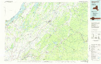 1985 Gouverneur1985 Print · USGSSt. Lawrence and Jefferson Counties are shown in the mid-eighties as a landscape of river-driven industry and expanding military grounds. Genealogists and historians can trace rail lines through Carthage, find local landmarks like Noble Hospital, and locate the boundaries of the Fort Drum Military Reservation.2 unique versions available
Showing maps 1-25 of 46
Top cities near Champion
- Le Ray historical maps
- Watertown historical maps
- Watertown historical maps
- Wilna historical maps
- Lowville historical maps
- Calcium historical maps
See more
Top neighborhoods of Champion
Frequently asked questions
- What are the different types of historical maps available for Champion?
- What is the oldest map of Champion?
- Where can I purchase historical maps of Champion for my home or office?
- Where can I download high-res historical maps of Champion?
- Are there historical topographic maps available for Champion?
- Is there historical aerial imagery available for Champion?
- Where are historical maps of Champion sourced from?