Old Maps of Hungerford Corners, Henderson for Metal Detecting
Plan your next treasure hunt with 13 historic maps of Hungerford Corners. Find old homesites, ghost towns, trails, and gathering spots that may be lost to time — perfect for identifying promising metal detecting locations.
- Locate forgotten sites: Uncover places like long-lost settlements, abandoned rail lines, or gathering spots.
- Plan better hunts: Use map overlays combined with LiDAR or satellite views to narrow in on historically rich areas.
- Made for detectorists: Thousands of hobbyists use these maps to discover relics, coins, and hidden history.
Use these historic maps to boost your research and find new opportunities beneath the surface of Hungerford Corners.
Hungerford Corners, Henderson maps
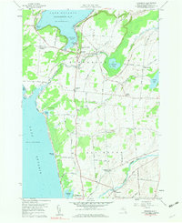
(13)- 1893 Map of Sackets Harbor, 1963 Print
 1893 Sackets Harbor1963 Print · USGSJefferson County’s shoreline at the close of the 19th century reveals a landscape of vital military outposts and thriving rail-side villages. Genealogists can trace family roots through Greens Settlement and Thomas Settlement or locate ancestors at Madison Barracks and Adams Center.
 - 1895 Map of Sacketts Harbor
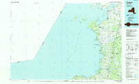
 1895 Sacketts Harbor1895 Print · USGSJefferson County’s lakefront and military outposts are frozen in time during the late nineteenth century. Genealogists and historians can trace family land near Greens Settlement, locate the old Madison Barracks, or follow the Ogdensburg and Watertown R. R. through the hills.8 unique versions available
 - 1943 Map of Henderson
 1943 Henderson1943 Print · USGSJefferson County’s eastern Lake Ontario shoreline is shown here during the war years, capturing the rural community before modern coastal development. Genealogists can trace family names across a landscape dotted with sites like Carpenter Cem, Bishop Street, and Henderson Harbor.
 - 1959 Map of Henderson, 1961 Print
 1959 Henderson1961 Print · USGSJefferson County’s lakefront and agricultural interior are captured here in the late fifties, showing the region before modern development. Genealogists can trace family footprints at Carpenter Cem or Rural Hill, while exploring maritime sites like Henderson Harbor and Whites Bay.3 unique versions available
 - 1960 Map of Rochester
 1960 Rochester1960 Print · USGSThe Lake Ontario shoreline in the late fifties was a bustling corridor of rail and water commerce. Genealogists and historians can trace the path of the New York Central through canal towns like Newark or explore the coastal landmarks around Sackets Harbor.2 unique versions available
 - 1961 Map of Rochester, 1973 Print
 1961 Rochester1973 Print · USGSThe Lake Ontario shoreline and Finger Lakes frontier are shown here at the height of the mid-century infrastructure boom. Genealogists and historians can trace the rail-and-road evolution from Sackets Harbor down to the New York State Thruway, passing through centers like Pulaski and Adams Center.3 unique versions available
 - 1965 Map of Rochester
 1965 Rochester1965 Print · USGSUpstate New York's industrial heartland is captured here during a period of significant growth between the Great Lakes and the Finger Lakes. Genealogists and historians can trace the evolution of canal towns and rail hubs from Rochester to Syracuse, noting features like the Erie Canal and the New York State Thruway.
 - 1985 Map of Pulaski
 1985 Pulaski1985 Print · USGSThe eastern shores of Lake Ontario in the mid-1980s showcase a landscape of protected wetlands and historic harbor towns. Trace the paths of the CONRAIL railroad and explore the coastal heritage of Sackets Harbor, Port Ontario, and Selkirk Shores State Park.2 unique versions available
 - 2010 Map of Henderson, 2010 Print
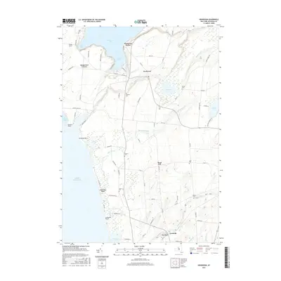
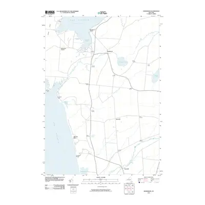 2010 Henderson2010 Print · USGSCovers Hungerford Corners, including Ellisburg, Henderson, and other nearby areas
 - 2013 Map of Henderson, 2013 Print
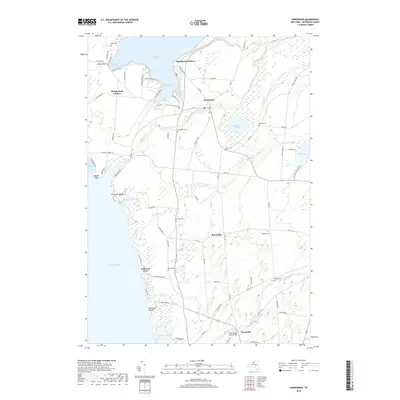
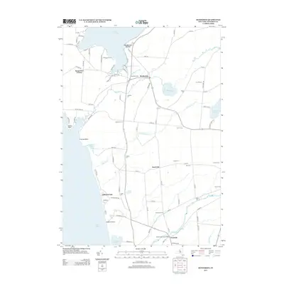 2013 Henderson2013 Print · USGSCovers Hungerford Corners, including Ellisburg, Henderson, and other nearby areas
 - 2016 Map of Henderson, 2016 Print
 2016 Henderson2016 Print · USGSCovers Hungerford Corners, including Ellisburg, Henderson, and other nearby areas
 - 2019 Map of Henderson, 2019 Print
 2019 Henderson2019 Print · USGSCovers Hungerford Corners, including Ellisburg, Henderson, and other nearby areas
 - 2023 Map of Henderson, 2023 Print
 2023 Henderson2023 Print · USGSCoastal Jefferson County comes into focus on this recent survey of the Lake Ontario shoreline and its inland hamlets. Local historians can trace family burial sites like Stowles Cem and Gallea Cem or explore the water network of Graham Creek Canal and Stony Creek.
End of results
Showing maps 1-13 of 13
Top cities near Hungerford Corners
- Brownville historical maps
- Adams historical maps
- Sandy Creek historical maps
- Ellisburg historical maps
- Hounsfield historical maps
- Cape Vincent historical maps
See more
Frequently asked questions
- What are the different types of historical maps available for Hungerford Corners?
- What is the oldest map of Hungerford Corners?
- Where can I purchase historical maps of Hungerford Corners for my home or office?
- Where can I download high-res historical maps of Hungerford Corners?
- Are there historical topographic maps available for Hungerford Corners?
- Is there historical aerial imagery available for Hungerford Corners?
- Where are historical maps of Hungerford Corners sourced from?