1940s Maps of Lyme, New York
Explore 9 historic maps of Lyme from the 1940s. These maps offer a rare glimpse into what life looked like during the 1940s — showing old roads, neighborhoods, homes, and landmarks that have changed or disappeared over time.
Whether you're researching your family's past, planning a metal detecting trip, or studying how Lyme's landscape evolved across the 1940s, these high-resolution maps are a powerful tool for exploring the history of this region.
- Focus on a specific era: All maps on this page are from the 1940s, giving you a focused view of this time period.
- See what’s changed: Compare century-old streets, trails, and buildings to today's modern landscape using overlays and satellite layers.
- Research with precision: Use these maps for genealogy, historical research, land use analysis, or educational projects.
- View, download, or print: Maps are fully viewable online in high resolution, and can be downloaded or printed for your own records.
Start exploring Lyme's history through authentic maps from the 1940s. This is your window into the past.
Lyme, NY maps
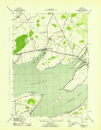
(9)- 1942 Map of Henderson Bay
 1942 Henderson Bay1942 Print · USGSJefferson County’s shoreline comes alive in the early 1940s, highlighting the military presence at the historic Madison Barracks. Researchers can trace old lakeside schoolhouses and family cemeteries like Stone Cem or explore the waterfront detail near Sackets Harbor.
 - 1942 Map of Chaumont
 1942 Chaumont1942 Print · USGSLake Ontario's northern shores are captured in the early 1940s, showing the vital rail-and-water connections of Jefferson County. Genealogists and local historians can trace family sites like Harris Cem, local landmarks such as Wells School, and the villages of Three Mile Bay and Chaumont.
 - 1942 Map of Sawmill Bay
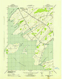
 1942 Sawmill Bay1942 Print · USGSThe Thousand Islands region along the New York-Ontario border is captured here during the early 1940s. Researchers can trace the rural landscape of Jefferson County through sites like Sand Bay Cem, the Wolfe Island L H, and local schoolhouses like School No 19.
 - 1942 Map of Cape Vincent South
 1942 Cape Vincent South1942 Print · USGSCoastal Jefferson County comes alive in this wartime survey of the waterfront where the St. Lawrence meets Lake Ontario. Genealogists can trace rural family life through a dozen numbered schoolhouses and explore landforms like Grenadier Island and the Long Carrying Place.2 unique versions available
 - 1942 Map of Point Peninsula
 1942 Point Peninsula1942 Print · USGSJefferson County shorelines were a landscape of military readiness and isolated lake outposts during the Second World War. Researchers can trace the boundaries of the U S Military Res, find family landmarks like Cooper, and locate the Stony Point Rifle Range.
 - 1942 Map of Clayton, 1957 Print
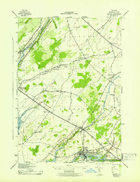
 1942 Clayton1957 Print · USGSThe Thousand Islands region appears at a mid-century peak in this survey of the riverfront and agricultural interior. Local historians can trace the foundations of the community through its many numbered rural schools and family burial sites like Corbin Cem and Dutch Cem.
 - 1943 Map of Dexter
 1943 Dexter1943 Print · USGSJefferson County life in the early 1940s is centered on the riverfront industry and rail connections of the lake plain. Genealogists can locate family burial grounds like Freeman Cem and identify numerous rural schoolhouses including School No 16 and School No 8.
 - 1943 Map of Clayton
 1943 Clayton1943 Print · USGSThe Thousand Islands region and the St. Lawrence riverfront are captured here in the early 1940s. Genealogists and local historians can trace the rural school system and family burial grounds, including School No 2, Dutch Cem, and the village of Depauville.
 - 1944 Map of Cape Vincent
 1944 Cape Vincent1944 Print · USGSThe Thousand Islands region thrived as a maritime and rail hub during the mid-twentieth century. Researchers can trace the international boundary line and locate historic landmarks like Tibbetts Pt. L.H. or the Marysville settlement on Wolfe Island.
End of results
Showing maps 1-9 of 9
Top cities near Lyme
- Watertown historical maps
- Brownville historical maps
- Adams historical maps
- Clayton historical maps
- Hounsfield historical maps
- Orleans historical maps
See more
Top neighborhoods of Lyme
- Herrick Grove historical maps
- Bayview historical maps
- Point Peninsula historical maps
- Chaumont historical maps
- Three Mile Bay historical maps
Frequently asked questions
- What are the different types of historical maps available for Lyme?
- What is the oldest map of Lyme?
- Where can I purchase historical maps of Lyme for my home or office?
- Where can I download high-res historical maps of Lyme?
- Are there historical topographic maps available for Lyme?
- Is there historical aerial imagery available for Lyme?
- Where are historical maps of Lyme sourced from?