Old Maps of Lyme, New York for Hiking & Exploration
Hike through history with 64 historic maps of Lyme. Explore old trails, ghost towns, and forgotten backroads — perfect for outdoor adventurers and local explorers.
- Rediscover forgotten places: Map out old mining camps, roads, and footpaths that no longer exist on modern maps.
- Layer with modern tools: Combine with LiDAR or satellite views to plan hikes through historical terrain.
- Made for exploration: Popular among hikers, overlanders, and local history lovers.
Use these maps to find adventure and explore the hidden past of Lyme.
Lyme, NY maps
(64)- 1893 Map of Sackets Harbor, 1963 Print
 1893 Sackets Harbor1963 Print · USGSJefferson County’s shoreline at the close of the 19th century reveals a landscape of vital military outposts and thriving rail-side villages. Genealogists can trace family roots through Greens Settlement and Thomas Settlement or locate ancestors at Madison Barracks and Adams Center.
 - 1895 Map of Sacketts Harbor
 1895 Sacketts Harbor1895 Print · USGSJefferson County’s lakefront and military outposts are frozen in time during the late nineteenth century. Genealogists and historians can trace family land near Greens Settlement, locate the old Madison Barracks, or follow the Ogdensburg and Watertown R. R. through the hills.8 unique versions available
 - 1895 Map of Stony Island
 1895 Stony Island1895 Print · USGSLake Ontario's eastern islands and Jefferson County shoreline are documented in the 1890s as critical navigation points. Maritimers and local historians can trace the positions of the Galloup Id. L.H. and Stony Point L.H. among islands like Stony Island.6 unique versions available
 - 1895 Map of Cape Vincent
 1895 Cape Vincent1895 Print · USGSUpper New York and the Canadian border meet at the head of the St. Lawrence River during the peak of the steamboat era. Genealogists and historians can trace the Cape Vincent Branch railroad and locate early shoreline landmarks like Tibbetts Pt. L.H. and the village of Marysville.6 unique versions available
 - 1900 Map of Clayton, 1957 Print
 1900 Clayton1957 Print · USGSThe Thousand Islands region and the St. Lawrence riverfront are captured here at the turn of the century, showing a landscape defined by steam and rail. Genealogists can trace family roots in CLAYTON, Chaumont, and Depauville, or follow the path of the Electric R.R. near Dexter.
 - 1903 Map of Clayton
 1903 Clayton1903 Print · USGSJefferson County's Thousand Islands region and Lake Ontario shoreline are documented here just after the turn of the century. Genealogists and historians can trace the rail lines connecting Clayton and Chaumont, or locate old post offices in Depauville and Rosiere.6 unique versions available
 - 1942 Map of Henderson Bay
 1942 Henderson Bay1942 Print · USGSJefferson County’s shoreline comes alive in the early 1940s, highlighting the military presence at the historic Madison Barracks. Researchers can trace old lakeside schoolhouses and family cemeteries like Stone Cem or explore the waterfront detail near Sackets Harbor.
 - 1942 Map of Chaumont
 1942 Chaumont1942 Print · USGSLake Ontario's northern shores are captured in the early 1940s, showing the vital rail-and-water connections of Jefferson County. Genealogists and local historians can trace family sites like Harris Cem, local landmarks such as Wells School, and the villages of Three Mile Bay and Chaumont.
 - 1942 Map of Sawmill Bay
 1942 Sawmill Bay1942 Print · USGSThe Thousand Islands region along the New York-Ontario border is captured here during the early 1940s. Researchers can trace the rural landscape of Jefferson County through sites like Sand Bay Cem, the Wolfe Island L H, and local schoolhouses like School No 19.
 - 1942 Map of Cape Vincent South
 1942 Cape Vincent South1942 Print · USGSCoastal Jefferson County comes alive in this wartime survey of the waterfront where the St. Lawrence meets Lake Ontario. Genealogists can trace rural family life through a dozen numbered schoolhouses and explore landforms like Grenadier Island and the Long Carrying Place.2 unique versions available
 - 1942 Map of Point Peninsula
 1942 Point Peninsula1942 Print · USGSJefferson County shorelines were a landscape of military readiness and isolated lake outposts during the Second World War. Researchers can trace the boundaries of the U S Military Res, find family landmarks like Cooper, and locate the Stony Point Rifle Range.
 - 1942 Map of Clayton, 1957 Print
 1942 Clayton1957 Print · USGSThe Thousand Islands region appears at a mid-century peak in this survey of the riverfront and agricultural interior. Local historians can trace the foundations of the community through its many numbered rural schools and family burial sites like Corbin Cem and Dutch Cem.
 - 1943 Map of Dexter
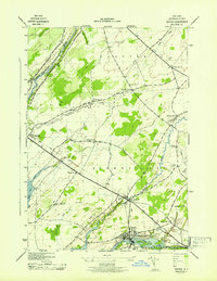 1943 Dexter1943 Print · USGSJefferson County life in the early 1940s is centered on the riverfront industry and rail connections of the lake plain. Genealogists can locate family burial grounds like Freeman Cem and identify numerous rural schoolhouses including School No 16 and School No 8.
 - 1943 Map of Clayton
 1943 Clayton1943 Print · USGSThe Thousand Islands region and the St. Lawrence riverfront are captured here in the early 1940s. Genealogists and local historians can trace the rural school system and family burial grounds, including School No 2, Dutch Cem, and the village of Depauville.
 - 1944 Map of Cape Vincent
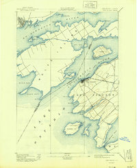 1944 Cape Vincent1944 Print · USGSThe Thousand Islands region thrived as a maritime and rail hub during the mid-twentieth century. Researchers can trace the international boundary line and locate historic landmarks like Tibbetts Pt. L.H. or the Marysville settlement on Wolfe Island.
 - 1954 Map of Kingston
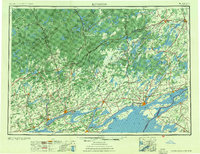 1954 Kingston1954 Print · USGSThe international border at the head of the St. Lawrence comes alive in the mid-fifties, showing the interconnected rail and river systems of Ontario and New York. Trace historical routes like the Canadian National RR or find local landmarks such as Thousand Island Park and Tyendinaga Ind. Res.4 unique versions available
 - 1958 Map of Chaumont
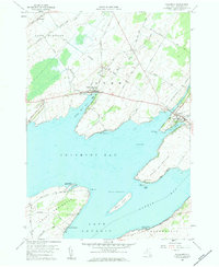 1958 Chaumont1958 Print · USGSThe eastern shores of Lake Ontario come into focus during the late fifties, showing a landscape of maritime peninsulas and sheltered harbors. Local historians can trace family names at Haider Cem or explore the waterfront layouts of Three Mile Bay and Chaumont.2 unique versions available
 - 1958 Map of Clayton, 1960 Print
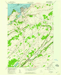 1958 Clayton1960 Print · USGSJefferson County’s riverfront and agricultural interior are captured here in the late fifties, showcasing the transition from the St Lawrence River docks to rural townships. Genealogists and local historians can trace the New York Central Railroad line or locate the Weaver Cem and Corbin Cem.2 unique versions available
 - 1958 Map of Dexter, 1960 Print
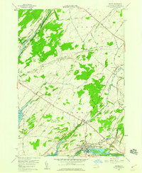 1958 Dexter1960 Print · USGSThe Lake Ontario shoreline near the mouth of the Black River is captured here in the late fifties. Genealogists and local historians can trace the Old Railroad Grade and locate ancestral sites like Freeman Cem and the General Brown High Sch.3 unique versions available
 - 1958 Map of Point Peninsula, 1960 Print
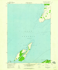 1958 Point Peninsula1960 Print · USGSLake Ontario's eastern shore in the late fifties shows a landscape of isolated islands and maritime outposts. Genealogists and historians can trace local landmarks like the Cem on Stony Island or the rural roads through Cooper and Gleason.2 unique versions available
 - 1958 Map of Cape Vincent South, 1960 Print
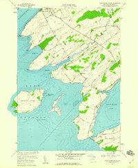 1958 Cape Vincent South1960 Print · USGSThe Jefferson County shoreline at the end of the fifties reveals a complex network of bays and islands where the Great Lakes meet the river. Genealogists and researchers can trace local family landmarks from St Vincent de Paul Cem to the Tibbetts Point Lighthouse and the Old Railroad Grade.2 unique versions available
 - 1958 Map of Saint Lawrence, 1961 Print
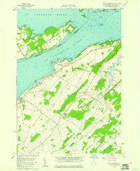 1958 Saint Lawrence1961 Print · USGSThe Thousand Islands region and the international border appear here in the late fifties as a landscape of river navigation and quiet upland farming. Genealogists can trace family names at the Saint Lawrence Cem or locate old homesteads near Warren and Kents.2 unique versions available
 - 1959 Map of Henderson Bay, 1960 Print
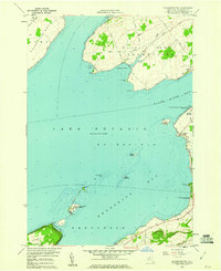 1959 Henderson Bay1960 Print · USGSThe Jefferson County shoreline in the late fifties is defined by its deep maritime history and expanding recreation areas. Researchers can trace the layout of Sackets Harbor and locate family landmarks such as Sherwin Bay Cem or Boultons Beach.
 - 1960 Map of Rochester
 1960 Rochester1960 Print · USGSThe Lake Ontario shoreline in the late fifties was a bustling corridor of rail and water commerce. Genealogists and historians can trace the path of the New York Central through canal towns like Newark or explore the coastal landmarks around Sackets Harbor.2 unique versions available
 - 1961 Map of Rochester, 1973 Print
 1961 Rochester1973 Print · USGSThe Lake Ontario shoreline and Finger Lakes frontier are shown here at the height of the mid-century infrastructure boom. Genealogists and historians can trace the rail-and-road evolution from Sackets Harbor down to the New York State Thruway, passing through centers like Pulaski and Adams Center.3 unique versions available
Showing maps 1-25 of 64
Top cities near Lyme
- Watertown historical maps
- Brownville historical maps
- Adams historical maps
- Clayton historical maps
- Hounsfield historical maps
- Orleans historical maps
See more
Top neighborhoods of Lyme
- Herrick Grove historical maps
- Bayview historical maps
- Point Peninsula historical maps
- Chaumont historical maps
- Three Mile Bay historical maps
Frequently asked questions
- What are the different types of historical maps available for Lyme?
- What is the oldest map of Lyme?
- Where can I purchase historical maps of Lyme for my home or office?
- Where can I download high-res historical maps of Lyme?
- Are there historical topographic maps available for Lyme?
- Is there historical aerial imagery available for Lyme?
- Where are historical maps of Lyme sourced from?