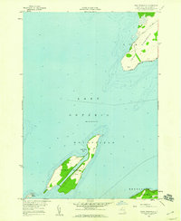
1958 Map of Point Peninsula
USGS Topo · Published 1960About this map
Stony Island dominates the southeastern waters of Lake Ontario in this late-1950s survey of the Jefferson County shoreline. The island's geography reveals a mix of maritime utility and rural isolation, featuring a small Airstrip and a local Cem situated near the shores of Dutch John Bay. On the mainland, the hook-shaped Point Peninsula shows a sparse settlement pattern connected by Middle Road and South Shore Road, with small hubs like Cooper and Gleason serving the local farming and fishing community.
Find a feature on this map
15 named features on this map. Tap any name to fly to it.
Don’t see what you’re looking for? This feature index may not catch every label — zoom into the map to look around manually.
Map Details
Editions of this 1958 Point Peninsula Map
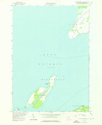
2 editions found
Other maps of this area

1893 · Sackets Harbor
USGS Topo · 1:62,500

1895 · Sacketts Harbor
USGS Topo · 1:62,500

1895 · Stony Island
USGS Topo · 1:62,500

1895 · Cape Vincent
USGS Topo · 1:62,500

1900 · Clayton
USGS Topo · 1:62,500

1903 · Clayton
USGS Topo · 1:62,500

1942 · Stony Point
USGS Topo · 1:31,680

1942 · Henderson Bay
USGS Topo · 1:31,680

1942 · Chaumont
USGS Topo · 1:31,680

1942 · Galloo Island
USGS Topo · 1:31,680